Cairo, West Virginia
| Cairo, West Virginia | |
|---|---|
| Town | |
|
The North Fork of the Hughes River at Cairo | |
 Location of Cairo, West Virginia | |
| Coordinates: 39°12′30″N 81°9′24″W / 39.20833°N 81.15667°WCoordinates: 39°12′30″N 81°9′24″W / 39.20833°N 81.15667°W | |
| Country | United States |
| State | West Virginia |
| County | Ritchie |
| Area[1] | |
| • Total | 0.48 sq mi (1.24 km2) |
| • Land | 0.47 sq mi (1.22 km2) |
| • Water | 0.01 sq mi (0.03 km2) |
| Elevation | 653 ft (199 m) |
| Population (2010)[2] | |
| • Total | 281 |
| • Estimate (2012[3]) | 276 |
| • Density | 597.9/sq mi (230.9/km2) |
| Time zone | Eastern (EST) (UTC-5) |
| • Summer (DST) | EDT (UTC-4) |
| ZIP code | 26337 |
| Area code(s) | 304 |
| FIPS code | 54-12124[4] |
| GNIS feature ID | 1536852[5] |

Cairo /ˈkɛəroʊ/ CARE-o is a town in Ritchie County, West Virginia, United States, along West Virginia Route 31, the North Fork of the Hughes River, and the North Bend Rail Trail.[6] The population was 281 at the 2010 census.
History
The town was named by its earliest settlers, who were Scots Presbyterians, for the city of Cairo, Egypt, owing to the presence of water and fertile land at the site.[7] Cairo was incorporated in 1895.[8] The North Bend Rail Trail passes through the town.
The former Bank of Cairo building, now Cairo Town Hall, was listed on the National Register of Historic Places in 1996.[9]
Geography
Cairo is located at 39°12′30″N 81°9′24″W / 39.20833°N 81.15667°W (39.208264, -81.156600).[10]
According to the United States Census Bureau, the town has a total area of 0.48 square miles (1.24 km2), of which, 0.47 square miles (1.22 km2) is land and 0.01 square miles (0.03 km2) is water.[1]
Demographics
| Historical population | |||
|---|---|---|---|
| Census | Pop. | %± | |
| 1880 | 75 | — | |
| 1900 | 653 | — | |
| 1910 | 668 | 2.3% | |
| 1920 | 662 | −0.9% | |
| 1930 | 607 | −8.3% | |
| 1940 | 532 | −12.4% | |
| 1950 | 500 | −6.0% | |
| 1960 | 418 | −16.4% | |
| 1970 | 412 | −1.4% | |
| 1980 | 428 | 3.9% | |
| 1990 | 290 | −32.2% | |
| 2000 | 263 | −9.3% | |
| 2010 | 281 | 6.8% | |
| Est. 2015 | 270 | [11] | −3.9% |
2010 census
As of the census[2] of 2010, there were 281 people, 118 households, and 71 families residing in the town. The population density was 597.9 inhabitants per square mile (230.9/km2). There were 151 housing units at an average density of 321.3 per square mile (124.1/km2). The racial makeup of the town was 100.0% White.
There were 118 households of which 28.8% had children under the age of 18 living with them, 49.2% were married couples living together, 6.8% had a female householder with no husband present, 4.2% had a male householder with no wife present, and 39.8% were non-families. 36.4% of all households were made up of individuals and 12.7% had someone living alone who was 65 years of age or older. The average household size was 2.38 and the average family size was 3.13.
The median age in the town was 40.6 years. 23.5% of residents were under the age of 18; 10.6% were between the ages of 18 and 24; 20.3% were from 25 to 44; 30.9% were from 45 to 64; and 14.6% were 65 years of age or older. The gender makeup of the town was 52.0% male and 48.0% female.
2000 census
As of the census[4] of 2000, there were 263 people, 112 households, and 73 families residing in the town. The population density was 536.2 inhabitants per square mile (207.2/km²). There were 140 housing units at an average density of 285.4 per square mile (110.3/km²). The racial makeup of the town was 100.00% White.
There were 112 households out of which 29.5% had children under the age of 18 living with them, 52.7% were married couples living together, 11.6% had a female householder with no husband present, and 34.8% were non-families. 30.4% of all households were made up of individuals and 10.7% had someone living alone who was 65 years of age or older. The average household size was 2.35 and the average family size was 3.00.
In the town the population was spread out with 25.1% under the age of 18, 6.8% from 18 to 24, 27.8% from 25 to 44, 27.0% from 45 to 64, and 13.3% who were 65 years of age or older. The median age was 41 years. For every 100 females there were 85.2 males. For every 100 females age 18 and over, there were 89.4 males.
The median income for a household in the town was $24,688, and the median income for a family was $29,792. Males had a median income of $20,833 versus $21,750 for females. The per capita income for the town was $14,958. About 9.5% of families and 14.0% of the population were below the poverty line, including 19.7% of those under the age of eighteen and 4.3% of those sixty five or over.
Climate
The climate in this area is characterized by hot, humid summers and generally mild to cool winters. According to the Köppen Climate Classification system, Cairo has a humid subtropical climate, abbreviated "Cfa" on climate maps.[13]
References
- 1 2 "US Gazetteer files 2010". United States Census Bureau. Archived from the original on 2012-07-14. Retrieved 2013-01-24.
- 1 2 "American FactFinder". United States Census Bureau. Retrieved 2013-01-24.
- ↑ "Population Estimates". United States Census Bureau. Archived from the original on 2013-06-17. Retrieved 2013-06-26.
- 1 2 "American FactFinder". United States Census Bureau. Archived from the original on 2013-09-11. Retrieved 2008-01-31.
- ↑ "US Board on Geographic Names". United States Geological Survey. 2007-10-25. Retrieved 2008-01-31.
- ↑ DeLorme (1997). West Virginia Atlas & Gazetteer. Yarmouth, Maine: DeLorme. ISBN 0-89933-246-3.
- ↑ Kenny, Hamill (1945). West Virginia Place Names: Their Origin and Meaning, Including the Nomenclature of the Streams and Mountains. Piedmont, WV: The Place Name Press. p. 147.
- ↑ West Virginia Blue Book. Published annually by the Clerk's Office of the West Virginia Senate.
- ↑ National Park Service (2009-03-13). "National Register Information System". National Register of Historic Places. National Park Service.
- ↑ "US Gazetteer files: 2010, 2000, and 1990". United States Census Bureau. 2011-02-12. Retrieved 2011-04-23.
- ↑ "Annual Estimates of the Resident Population for Incorporated Places: April 1, 2010 to July 1, 2015". Retrieved July 2, 2016.
- ↑ "Census of Population and Housing". Census.gov. Archived from the original on April 22, 2013. Retrieved June 4, 2015.
- ↑ Climate Summary for Cairo, West Virginia
Municipalities and communities of Ritchie County, West Virginia, United States | ||
|---|---|---|
| City | 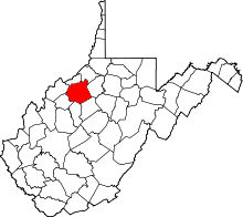 | |
| Towns | ||
| Unincorporated communities |
| |
| Ghost towns | ||
| Footnotes | ‡This populated place also has portions in an adjacent county or counties | |