Marmet, West Virginia
| City of Marmet | |
|---|---|
| City | |
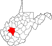
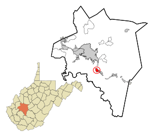 Location in Kanawha County and state of West Virginia. | |
| Coordinates: 38°14′43″N 81°34′3″W / 38.24528°N 81.56750°WCoordinates: 38°14′43″N 81°34′3″W / 38.24528°N 81.56750°W | |
| Country |
|
| State |
|
| County | Kanawha |
| Government | |
| • Mayor | David Fontalbert |
| Area[1] | |
| • Total | 1.41 sq mi (3.65 km2) |
| • Land | 1.27 sq mi (3.29 km2) |
| • Water | 0.14 sq mi (0.36 km2) |
| Elevation | 610 ft (186 m) |
| Population (2010)[2] | |
| • Total | 1,503 |
| • Estimate (2012[3]) | 1,492 |
| • Density | 1,183.5/sq mi (457.0/km2) |
| Time zone | Eastern (EST) (UTC-5) |
| • Summer (DST) | EDT (UTC-4) |
| ZIP codes | 25315, 25365 |
| Area code(s) | 304 |
| FIPS code | 54-51724[4] |
| GNIS feature ID | 1542771[5] |
Marmet (pronounced mar-MET) is a city in Kanawha County, West Virginia, USA, along the Kanawha River. The population was 1,503 at the 2010 census.
The community was named after the local Marmet Coal Company, which had the name of its proprietors Edwin and William Marmet.[6]
Geography
Marmet is located at 38°14′43″N 81°34′3″W / 38.24528°N 81.56750°W (38.245148, -81.567510).[7]
According to the United States Census Bureau, the city has a total area of 1.41 square miles (3.65 km2), of which, 1.27 square miles (3.29 km2) is land and 0.14 square miles (0.36 km2) is water.[1]
Demographics
| Historical population | |||
|---|---|---|---|
| Census | Pop. | %± | |
| 1930 | 1,200 | — | |
| 1940 | 1,814 | 51.2% | |
| 1950 | 2,515 | 38.6% | |
| 1960 | 2,500 | −0.6% | |
| 1970 | 2,339 | −6.4% | |
| 1980 | 2,196 | −6.1% | |
| 1990 | 1,879 | −14.4% | |
| 2000 | 1,693 | −9.9% | |
| 2010 | 1,503 | −11.2% | |
| Est. 2015 | 1,450 | [8] | −3.5% |
2010 census
As of the census[2] of 2010, there were 1,503 people, 616 households, and 397 families residing in the city. The population density was 1,183.5 inhabitants per square mile (457.0/km2). There were 700 housing units at an average density of 551.2 per square mile (212.8/km2). The racial makeup of the city was 96.5% White, 1.6% African American, 0.2% Native American, 0.2% Asian, and 1.5% from two or more races. Hispanic or Latino of any race were 0.3% of the population.
There were 616 households of which 26.3% had children under the age of 18 living with them, 42.2% were married couples living together, 15.7% had a female householder with no husband present, 6.5% had a male householder with no wife present, and 35.6% were non-families. 30.7% of all households were made up of individuals and 13.6% had someone living alone who was 65 years of age or older. The average household size was 2.29 and the average family size was 2.83.
The median age in the city was 46.2 years. 18.5% of residents were under the age of 18; 9.4% were between the ages of 18 and 24; 20.6% were from 25 to 44; 28.7% were from 45 to 64; and 23.1% were 65 years of age or older. The gender makeup of the city was 43.5% male and 56.5% female.
References
- 1 2 "US Gazetteer files 2010". United States Census Bureau. Retrieved 2013-01-24.
- 1 2 "American FactFinder". United States Census Bureau. Retrieved 2013-01-24.
- ↑ "Population Estimates". United States Census Bureau. Retrieved 2013-06-26.
- ↑ "American FactFinder". United States Census Bureau. Retrieved 2008-01-31.
- ↑ "US Board on Geographic Names". United States Geological Survey. 2007-10-25. Retrieved 2008-01-31.
- ↑ Kenny, Hamill (1945). West Virginia Place Names: Their Origin and Meaning, Including the Nomenclature of the Streams and Mountains. Piedmont, WV: The Place Name Press. p. 403.
- ↑ "US Gazetteer files: 2010, 2000, and 1990". United States Census Bureau. 2011-02-12. Retrieved 2011-04-23.
- ↑ "Annual Estimates of the Resident Population for Incorporated Places: April 1, 2010 to July 1, 2015". Retrieved July 2, 2016.
- ↑ "Census of Population and Housing". Census.gov. Retrieved June 4, 2015.