Terra Alta, West Virginia
| Terra Alta, West Virginia | |
|---|---|
| Town | |
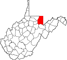
 Location in Preston County and the state of West Virginia. | |
| Coordinates: 39°26′40″N 79°32′38″W / 39.44444°N 79.54389°WCoordinates: 39°26′40″N 79°32′38″W / 39.44444°N 79.54389°W | |
| Country | United States |
| State | West Virginia |
| County | Preston |
| Government | |
| • Mayor | Mark Ball [1] |
| Area[2] | |
| • Total | 1.19 sq mi (3.08 km2) |
| • Land | 1.19 sq mi (3.08 km2) |
| • Water | 0 sq mi (0 km2) |
| Elevation | 2,582 ft (787 m) |
| Population (2010)[3] | |
| • Total | 1,477 |
| • Estimate (2012[4]) | 1,490 |
| • Density | 1,241.2/sq mi (479.2/km2) |
| Time zone | Eastern (EST) (UTC-5) |
| • Summer (DST) | EDT (UTC-4) |
| ZIP code | 26764 |
| Area code(s) | 304 |
| FIPS code | 54-79708[5] |
| GNIS feature ID | 1547983[6] |
Terra Alta is a town and former coal town in Preston County, West Virginia, United States. The population was 1,477 at the 2010 census.
History
Terra Alta was originally called Portland, and under the latter name had its start in the 1850s.[7] The present name Terra Alta is derived from Latin meaning "high land".[8]
The town is home to the James S. Lakin House and Terra Alta Bank, each listed on the National Register of Historic Places.[9]
Geography
Terra Alta is located at 39°26′40″N 79°32′38″W / 39.44444°N 79.54389°W (39.444343, -79.544002).[10]
According to the United States Census Bureau, the town has a total area of 1.19 square miles (3.08 km2), all of it land.[2]
Climate
The climate in this area has mild differences between highs and lows, and there is adequate rainfall year round. According to the Köppen Climate Classification system, Terra Alta has a marine west coast climate, abbreviated "Cfb" on climate maps.[11]
Demographics
| Historical population | |||
|---|---|---|---|
| Census | Pop. | %± | |
| 1890 | 443 | — | |
| 1900 | 616 | 39.1% | |
| 1910 | 1,126 | 82.8% | |
| 1920 | 1,261 | 12.0% | |
| 1930 | 1,474 | 16.9% | |
| 1940 | 1,471 | −0.2% | |
| 1950 | 1,649 | 12.1% | |
| 1960 | 1,504 | −8.8% | |
| 1970 | 1,474 | −2.0% | |
| 1980 | 1,946 | 32.0% | |
| 1990 | 1,713 | −12.0% | |
| 2000 | 1,456 | −15.0% | |
| 2010 | 1,477 | 1.4% | |
| Est. 2015 | 1,493 | [12] | 1.1% |
2010 census
As of the census[3] of 2010, there were 1,477 people, 610 households, and 394 families residing in the town. The population density was 1,241.2 inhabitants per square mile (479.2/km2). There were 700 housing units at an average density of 588.2 per square mile (227.1/km2). The racial makeup of the town was 98.0% White, 0.7% African American, 0.5% Native American, 0.1% Asian, 0.2% from other races, and 0.5% from two or more races. Hispanic or Latino of any race were 0.9% of the population.
There were 610 households of which 33.0% had children under the age of 18 living with them, 45.1% were married couples living together, 14.6% had a female householder with no husband present, 4.9% had a male householder with no wife present, and 35.4% were non-families. 28.7% of all households were made up of individuals and 10.6% had someone living alone who was 65 years of age or older. The average household size was 2.41 and the average family size was 2.92.
The median age in the town was 38.8 years. 24.4% of residents were under the age of 18; 8.4% were between the ages of 18 and 24; 26.1% were from 25 to 44; 27.2% were from 45 to 64; and 13.9% were 65 years of age or older. The gender makeup of the town was 47.2% male and 52.8% female.
2000 census
As of the census[5] of 2000, there were 1,456 people, 596 households, and 417 families residing in the town. The population density was 1,220.1 inhabitants per square mile (472.4/km²). There were 690 housing units at an average density of 578.2 per square mile (223.9/km²). The racial makeup of the town was 99.18% White, 0.14% African American, 0.07% Asian, 0.07% Pacific Islander, 0.07% from other races, and 0.48% from two or more races. Hispanic or Latino of any race were 0.34% of the population.
There were 596 households out of which 32.6% had children under the age of 18 living with them, 53.2% were married couples living together, 12.6% had a female householder with no husband present, and 30.0% were non-families. 26.2% of all households were made up of individuals and 12.2% had someone living alone who was 65 years of age or older. The average household size was 2.43 and the average family size was 2.90.
In the town the population was spread out with 24.5% under the age of 18, 8.2% from 18 to 24, 26.5% from 25 to 44, 26.0% from 45 to 64, and 14.9% who were 65 years of age or older. The median age was 38 years. For every 100 females there were 88.6 males. For every 100 females age 18 and over, there were 85.2 males.
The median income for a household in the town was $25,388, and the median income for a family was $32,692. Males had a median income of $23,750 versus $17,950 for females. The per capita income for the town was $12,040. About 15.6% of families and 18.9% of the population were below the poverty line, including 31.5% of those under age 18 and 8.9% of those age 65 or over.
References
- ↑ http://www.prestoncountywv.org/mayors.php
- 1 2 "US Gazetteer files 2010". United States Census Bureau. Retrieved 2013-01-24.
- 1 2 "American FactFinder". United States Census Bureau. Retrieved 2013-01-24.
- ↑ "Population Estimates". United States Census Bureau. Retrieved 2013-06-26.
- 1 2 "American FactFinder". United States Census Bureau. Retrieved 2008-01-31.
- ↑ "US Board on Geographic Names". United States Geological Survey. 2007-10-25. Retrieved 2008-01-31.
- ↑ Kenny, Hamill (1945). West Virginia Place Names: Their Origin and Meaning, Including the Nomenclature of the Streams and Mountains. Piedmont, WV: The Place Name Press. p. 622.
- ↑ Capace, Nancy (1999). Encyclopedia of West Virginia. North American Book Dist LLC. p. 193. ISBN 978-0-403-09843-9.
- ↑ National Park Service (2010-07-09). "National Register Information System". National Register of Historic Places. National Park Service.
- ↑ "US Gazetteer files: 2010, 2000, and 1990". United States Census Bureau. 2011-02-12. Retrieved 2011-04-23.
- ↑ Climate Summary for Terra Alta, West Virginia
- ↑ "Annual Estimates of the Resident Population for Incorporated Places: April 1, 2010 to July 1, 2015". Retrieved July 2, 2016.
- ↑ "Census of Population and Housing". Census.gov. Retrieved June 4, 2015.