Choctaw County, Alabama
| Choctaw County, Alabama | |
|---|---|
 Choctaw County Courthouse in Butler | |
 Location in the U.S. state of Alabama | |
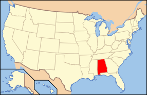 Alabama's location in the U.S. | |
| Founded | December 29, 1847 |
| Named for | Choctaw tribe |
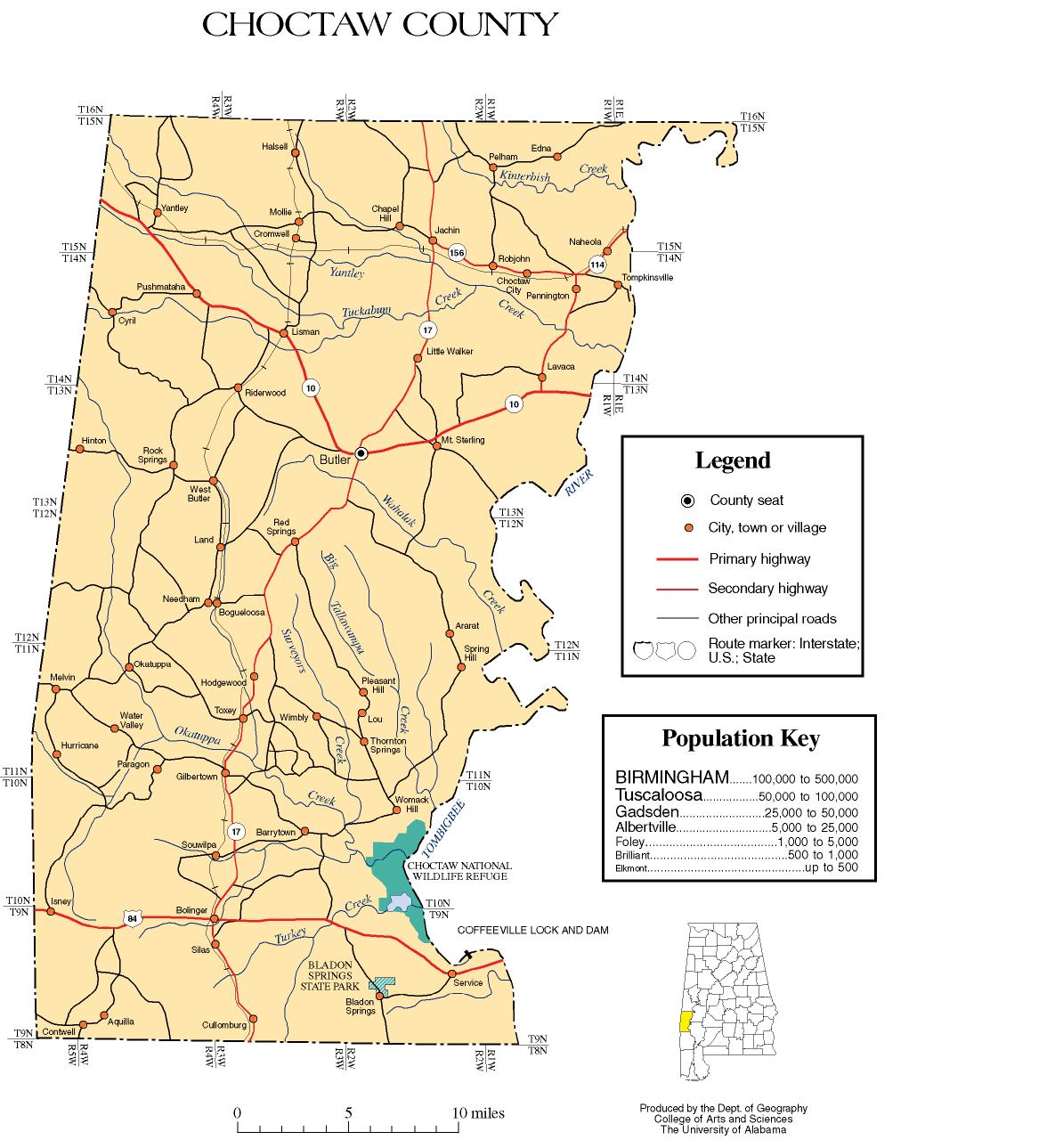
| Seat | Butler |
| Largest town | Butler |
| Area | |
| • Total | 921 sq mi (2,385 km2) |
| • Land | 914 sq mi (2,367 km2) |
| • Water | 7.4 sq mi (19 km2), 0.8% |
| Population (est.) | |
| • (2015) | 13,170 |
| • Density | 15/sq mi (6/km²) |
| Congressional district | 7th |
| Time zone | Central: UTC-6/-5 |
|
Footnotes:
| |
Choctaw County is a county of the U.S. state of Alabama. As of the 2010 census, the population was 13,859.[1] The county seat is Butler.[2] The county was established on December 29, 1847 and named for the Choctaw tribe of American Indians.[3]
History
Most of the early pioneers of Choctaw County were farmers from North and South Carolina. In 1912 the Alabama, Tennessee and Northern Railroad was completed through the county from north to south, connecting the area to the Port of Mobile and northern Alabama. It induced a population shift from areas near the Tombigbee River to the central part of the county.[4]
The county's population reached its peak in the 1920s, due in part from jobs created by a sawmill boom with companies as the E. E. Jackson Lumber Company and Choctaw Lumber Company. The sawmill industry collapsed during the Great Depression. The first successful oil well in Alabama was drilled at Gilbertown in 1944, with oil and gas becoming the county's most important industry. This industry waned by the 1970s as the wells lost profitability.[4]
An African-American family, the Thorntons of Mobile, was featured in the September 24, 1956, issue of Life Magazine. The article included an interview with the Thorntons' daughter, Allie Lee Causey, of Shady Grove in Choctaw County. In the article, Mrs. Causey, a schoolteacher, spoke openly about her family's life, stating that "integration is the only way in which Negroes will receive justice. We cannot get it as a separate people. If we can get justice on our jobs, and equal pay, then we'll be able to afford better homes and good education."[5] When the magazine was seen in Choctaw County, the Causeys were subjected to brutal economic retaliation by white residents, who tried to coerce Mrs. Causey into recanting her remarks. Their loans were called in, local stores refused to sell them food and gasoline, Willie Causey was cut off from his employment as a woodcutter, and Mrs. Causey was fired from her job as a teacher. The Causeys left Shady Grove and Alabama for good in October 1956.[6]
Apparel factories opened during the 1950s–60s in Silas, Toxey, and Butler, although the plants had largely closed by the 21st century. The 1950s also saw the building a paper mill at Naheola, now owned and operated by Georgia-Pacific.[4][7] The county was declared a disaster area in September 1979, due to damage from Hurricane Frederic. The 1980s saw the main railroad close and the tracks removed.[4]
Historic sites
Choctaw County has one site listed on the National Register of Historic Places, the Mount Sterling Methodist Church.[8][9] Additionally, five sites are listed on the Alabama Register of Landmarks and Heritage.[10]
Geography
According to the U.S. Census Bureau, the county has a total area of 921 square miles (2,390 km2), of which 914 square miles (2,370 km2) is land and 7.4 square miles (19 km2) (0.8%) is water.[11]
Major highways
Adjacent counties
- Sumter County (north)
- Marengo County (northeast)
- Clarke County (southeast)
- Washington County (south)
- Wayne County, Mississippi (southwest)
- Clarke County, Mississippi (west)
- Lauderdale County, Mississippi (northwest)
National protected area
Demographics
| Historical population | |||
|---|---|---|---|
| Census | Pop. | %± | |
| 1850 | 8,389 | — | |
| 1860 | 13,877 | 65.4% | |
| 1870 | 12,676 | −8.7% | |
| 1880 | 15,731 | 24.1% | |
| 1890 | 17,526 | 11.4% | |
| 1900 | 18,136 | 3.5% | |
| 1910 | 18,483 | 1.9% | |
| 1920 | 20,753 | 12.3% | |
| 1930 | 20,513 | −1.2% | |
| 1940 | 20,195 | −1.6% | |
| 1950 | 19,152 | −5.2% | |
| 1960 | 17,870 | −6.7% | |
| 1970 | 16,589 | −7.2% | |
| 1980 | 16,839 | 1.5% | |
| 1990 | 16,018 | −4.9% | |
| 2000 | 15,922 | −0.6% | |
| 2010 | 13,859 | −13.0% | |
| Est. 2015 | 13,170 | [12] | −5.0% |
| U.S. Decennial Census[13] 1790–1960[14] 1900–1990[15] 1990–2000[16] 2010–2015[1] | |||
As of the 2010 United States Census, there were 13,859 people residing in the county. 55.8% were White, 43.4% Black or African American, 0.1% Native American, 0.1% Asian, 0.2% of some other race and 0.4% of two or more races. 0.5% were Hispanic or Latino (of any race).
As of the census[17] of 2000, there were 15,922 people, 6,363 households, and 4,574 families residing in the county. The population density was 17 people per square mile (7/km2). There were 7,839 housing units at an average density of 9 per square mile (3/km2). The racial makeup of the county was 55.14% White, 44.13% Black or African American, 0.16% Native American, 0.04% Asian, 0.11% from other races, and 0.42% from two or more races. 0.67% of the population were Hispanic or Latino of any race.
There were 6,363 households out of which 32.50% had children under the age of 18 living with them, 52.00% were married couples living together, 16.00% had a female householder with no husband present, and 28.10% were non-families. 26.50% of all households were made up of individuals and 11.60% had someone living alone who was 65 years of age or older. The average household size was 2.48 and the average family size was 2.99.
In the county the population was spread out with 26.10% under the age of 18, 7.90% from 18 to 24, 26.20% from 25 to 44, 25.20% from 45 to 64, and 14.60% who were 65 years of age or older. The median age was 38 years. For every 100 females there were 88.80 males. For every 100 females age 18 and over, there were 85.40 males.
The median income for a household in the county was $24,749, and the median income for a family was $31,870. Males had a median income of $32,316 versus $18,760 for females. The per capita income for the county was $14,635. About 20.70% of families and 24.50% of the population were below the poverty line, including 34.80% of those under age 18 and 26.10% of those age 65 or over.
Government
| Year | GOP | DNC | Others |
|---|---|---|---|
| 2016 | 56.4% 4,102 | 42.7% 3,109 | 0.9% 70 |
| 2012 | 52.1% 4,150 | 47.5% 3,785 | 0.4% 30 |
| 2008 | 53.5% 4,223 | 46.1% 3,636 | 0.4% 35 |
| 2004 | 53.9% 3,897 | 45.7% 3,303 | 0.4% 27 |
| 2000 | 48.8% 3,600 | 50.3% 3,707 | 0.9% 67 |
Communities
Towns
- Butler (county seat)
- Gilbertown
- Lisman
- Needham
- Pennington
- Silas
- Toxey
Census-designated place
- Cullomburg (partly in Washington County)
Unincorporated communities
See also
- National Register of Historic Places listings in Choctaw County, Alabama
- Properties on the Alabama Register of Landmarks and Heritage in Choctaw County, Alabama
References
- 1 2 "State & County QuickFacts". United States Census Bureau. Retrieved May 15, 2014.
- ↑ "Find a County". National Association of Counties. Archived from the original on 2015-05-10. Retrieved 2011-06-07.
- ↑ "Alabama Counties: Choctaw County". Alabama Department of Archives and History. Retrieved June 21, 2011.
- 1 2 3 4 "County History". Choctaw County Genealogy Society. Retrieved June 21, 2011.
- ↑ Wallace, Robert; Parks, Gordon (24 September 1956). The Restraints: Open and Hidden; Both are Seen in the Study of One Negro Family. Life Magazine. pp. 98–109. ISSN 0024-3019. Retrieved 14 September 2011.
- ↑ Stolley, Richard (10 December 1956). A Sequel to Segregation. Life Magazine. pp. 77–90. ISSN 0024-3019. Retrieved 14 September 2011. Reprinted in Carson, Clayborne; Garrow, David J.; Kovach, Bill (2003). Reporting Civil Rights: American journalism, 1941-1963. Library of America. pp. 342–354. Retrieved 14 September 2011.
- ↑ "Southeastern Facilities and Wood Specifications". Georgia-Pacific. Retrieved June 21, 2011.
- ↑ Chiat, Marilyn Joyce Segal (1997). America's Religious Architecture: Sacred Places For Every Community. John Wiley and Sons. p. 279. ISBN 978-0-471-14502-8.
- ↑ National Park Service (2009-03-13). "National Register Information System". National Register of Historic Places. National Park Service.
- ↑ "The Alabama Register of Landmarks & Heritage". preserveala.org. Alabama Historical Commission. May 31, 2011. Archived from the original (PDF) on June 6, 2011. Retrieved 6 June 2011.
- ↑ "2010 Census Gazetteer Files". United States Census Bureau. August 22, 2012. Retrieved August 22, 2015.
- ↑ "County Totals Dataset: Population, Population Change and Estimated Components of Population Change: April 1, 2010 to July 1, 2015". Retrieved July 2, 2016.
- ↑ "U.S. Decennial Census". United States Census Bureau. Archived from the original on May 11, 2015. Retrieved August 22, 2015.
- ↑ "Historical Census Browser". University of Virginia Library. Retrieved August 22, 2015.
- ↑ Forstall, Richard L., ed. (March 24, 1995). "Population of Counties by Decennial Census: 1900 to 1990". United States Census Bureau. Retrieved August 22, 2015.
- ↑ "Census 2000 PHC-T-4. Ranking Tables for Counties: 1990 and 2000" (PDF). United States Census Bureau. April 2, 2001. Retrieved August 22, 2015.
- ↑ "American FactFinder". United States Census Bureau. Archived from the original on 2013-09-11. Retrieved 2011-05-14.
- ↑ "Dave Leip's Atlas of U.S. Presidential Elections". Retrieved November 16, 2016.
External links
- Choctaw County official website
- The Choctaw Sun-Advocate
- Coastal Gateway Regional Economic Development Alliance
- Choctaw County map of roads/towns (map © 2007 Univ. of Alabama).
- Choctaw County Tourism and Business Directory
 |
Lauderdale County, Mississippi | Sumter County | Marengo County | |
| Clarke County, Mississippi | |
|||
| ||||
| | ||||
| Wayne County, Mississippi | Washington County | Clarke County |
Municipalities and communities of Choctaw County, Alabama, United States | ||
|---|---|---|
| Towns | | |
| CDP | ||
| Unincorporated communities | ||
| Footnotes | ‡This populated place also has portions in an adjacent county or counties | |
Coordinates: 32°01′13″N 88°15′47″W / 32.02028°N 88.26306°W