Lauderdale County, Mississippi
| Lauderdale County, Mississippi | |
|---|---|
 Lauderdale County Courthouse | |
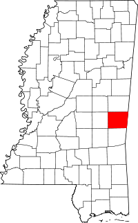 Location in the U.S. state of Mississippi | |
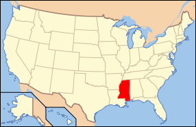 Mississippi's location in the U.S. | |
| Founded | 1833 |
| Named for | James Lauderdale |
| Seat | Meridian |
| Largest city | Meridian |
| Area | |
| • Total | 715 sq mi (1,852 km2) |
| • Land | 704 sq mi (1,823 km2) |
| • Water | 12 sq mi (31 km2), 1.6% |
| Population | |
| • (2010) | 80,261 |
| • Density | 114/sq mi (44/km²) |
| Congressional district | 3rd |
| Time zone | Central: UTC-6/-5 |
| Website |
www |
Lauderdale County is a county located in the U.S. state of Mississippi. As of the 2010 census, the population was 80,261.[1] The county seat is Meridian.[2] The county is named for Colonel James Lauderdale, who was killed at the Battle of New Orleans in the War of 1812.[3]
Lauderdale County is included in the Meridian, MS Micropolitan Statistical Area.
Geography
According to the U.S. Census Bureau, the county has a total area of 715 square miles (1,850 km2), of which 704 square miles (1,820 km2) is land and 12 square miles (31 km2) (1.6%) is water.[4]
Major highways
-
 Interstate 59
 -
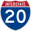 Interstate 20
 -
 U.S. Highway 11
 -
 U.S. Highway 45
 -
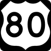 U.S. Highway 80
 -
 Mississippi Highway 19
 -
 Mississippi Highway 39
Adjacent counties
- Kemper County (north)
- Sumter County, Alabama (east)
- Choctaw County, Alabama (southeast)
- Clarke County (south)
- Newton County (west)
Demographics
| Historical population | |||
|---|---|---|---|
| Census | Pop. | %± | |
| 1840 | 5,358 | — | |
| 1850 | 8,717 | 62.7% | |
| 1860 | 13,313 | 52.7% | |
| 1870 | 13,462 | 1.1% | |
| 1880 | 21,501 | 59.7% | |
| 1890 | 29,661 | 38.0% | |
| 1900 | 38,150 | 28.6% | |
| 1910 | 46,919 | 23.0% | |
| 1920 | 45,897 | −2.2% | |
| 1930 | 52,748 | 14.9% | |
| 1940 | 58,247 | 10.4% | |
| 1950 | 64,171 | 10.2% | |
| 1960 | 67,119 | 4.6% | |
| 1970 | 67,087 | 0.0% | |
| 1980 | 77,285 | 15.2% | |
| 1990 | 75,555 | −2.2% | |
| 2000 | 78,161 | 3.4% | |
| 2010 | 80,261 | 2.7% | |
| Est. 2015 | 78,524 | [5] | −2.2% |
| U.S. Decennial Census[6] 1790-1960[7] 1900-1990[8] 1990-2000[9] 2010-2013[1] | |||
As of the census[10] of 2000, there were 78,161 people, 29,990 households, and 20,573 families residing in the county. The population density was 111 people per square mile (43/km²). There were 33,418 housing units at an average density of 48 per square mile (18/km²). The racial makeup of the county was 60.15% White, 38.18% Black or African American, 0.18% Native American, 0.50% Asian, 0.03% Pacific Islander, 0.34% from other races, and 0.63% from two or more races. 1.14% of the population were Hispanic or Latino of any race.
There were 29,990 households out of which 33.90% had children under the age of 18 living with them, 46.70% were married couples living together, 18.30% had a female householder with no husband present, and 31.40% were non-families. 28.00% of all households were made up of individuals and 11.70% had someone living alone who was 65 years of age or older. The average household size was 2.49 and the average family size was 3.06.
In the county the population was spread out with 26.60% under the age of 18, 9.80% from 18 to 24, 28.00% from 25 to 44, 21.40% from 45 to 64, and 14.20% who were 65 years of age or older. The median age was 35 years. For every 100 females there were 90.60 males. For every 100 females age 18 and over, there were 85.50 males.
The median income for a household in the county was $30,768, and the median income for a family was $37,581. Males had a median income of $31,069 versus $21,111 for females. The per capita income for the county was $16,026. About 17.10% of families and 20.80% of the population were below the poverty line, including 28.80% of those under age 18 and 18.80% of those age 65 or over.
Government and infrastructure
The East Mississippi Correctional Facility is located in an unincorporated area of the county, near Meridian. It is operated by the GEO Group on behalf of the Mississippi Department of Corrections.[11]
Education
Lauderdale County is within the service area of the East Mississippi Community College system.[12] The system offers classes in the Naval Air Station Meridian Extension in Meridian.[13] Other academic institutions are Meridian Community College, University of Southern Mississippi School of Nursing (located inside Reed Hall building of Meridian Community College, and Mississippi State University Meridian Campus.
Communities
Cities
- Meridian (county seat)
Towns
Census-designated places
Unincorporated communities
Notable people
- Samuel Dale (1772–1841), American frontiersman, known as the "Daniel Boone of Alabama" and a veteran of the Creek War of 1813-14. In 1836, Dale became Lauderdale County's first representative in the Mississippi Legislature.[14]
See also
References
- 1 2 "State & County QuickFacts". United States Census Bureau. Retrieved September 4, 2013.
- ↑ "Find a County". National Association of Counties. Retrieved 2011-06-07.
- ↑ Gannett, Henry (1905). The Origin of Certain Place Names in the United States. U.S. Government Printing Office. p. 182.
- ↑ "2010 Census Gazetteer Files". United States Census Bureau. August 22, 2012. Retrieved November 6, 2014.
- ↑ "County Totals Dataset: Population, Population Change and Estimated Components of Population Change: April 1, 2010 to July 1, 2015". Retrieved July 2, 2016.
- ↑ "U.S. Decennial Census". United States Census Bureau. Retrieved November 6, 2014.
- ↑ "Historical Census Browser". University of Virginia Library. Retrieved November 6, 2014.
- ↑ "Population of Counties by Decennial Census: 1900 to 1990". United States Census Bureau. Retrieved November 6, 2014.
- ↑ "Census 2000 PHC-T-4. Ranking Tables for Counties: 1990 and 2000" (PDF). United States Census Bureau. Retrieved November 6, 2014.
- ↑ "American FactFinder". United States Census Bureau. Retrieved 2008-01-31.
- ↑ "Private Prisons." Mississippi Department of Corrections. Retrieved on November 19, 2010.
- ↑ "CATALOG 2007-2009." East Mississippi Community College. 3 (3/147). Retrieved on March 1, 2011.
- ↑ "CATALOG 2007-2009." East Mississippi Community College. 10 (10/147). Retrieved on March 1, 2011.
- ↑ Lewis, Herbert J. "Jim" (July 25, 2012). "Samuel Dale". Encyclopedia of Alabama.
External links
- Lauderdale County, MS
- Meridian/Lauderdale County Tourism Bureau
- Laurerdale County Courthouse Pictures
 |
Kemper County | | ||
| Newton County | |
Sumter County, Alabama | ||
| ||||
| | ||||
| Clarke County | Choctaw County, Alabama |
Municipalities and communities of Lauderdale County, Mississippi, United States | ||
|---|---|---|
| Cities | | |
| Towns | ||
| CDPs | ||
| Other unincorporated communities |
| |
.svg.png)
Coordinates: 32°24′N 88°40′W / 32.40°N 88.66°W