Compreignac
| Compreignac | ||
|---|---|---|
|
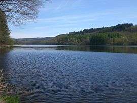
The Saint-Pardoux Lake, north of the village of Compreignac | ||
| ||
 Compreignac | ||
|
Location within Nouvelle-Aquitaine region  Compreignac | ||
| Coordinates: 45°59′34″N 1°16′32″E / 45.9928°N 1.2756°ECoordinates: 45°59′34″N 1°16′32″E / 45.9928°N 1.2756°E | ||
| Country | France | |
| Region | Nouvelle-Aquitaine | |
| Department | Haute-Vienne | |
| Arrondissement | Bellac | |
| Canton | Nantiat | |
| Intercommunality | Porte d'Occitanie | |
| Government | ||
| • Mayor (2001–2008) | Jacques Pleinevert | |
| Area1 | 47.62 km2 (18.39 sq mi) | |
| Population (2006)2 | 1,654 | |
| • Density | 35/km2 (90/sq mi) | |
| Time zone | CET (UTC+1) | |
| • Summer (DST) | CEST (UTC+2) | |
| INSEE/Postal code | 87047 / 87140 | |
| Elevation | 301–587 m (988–1,926 ft) | |
|
1 French Land Register data, which excludes lakes, ponds, glaciers > 1 km² (0.386 sq mi or 247 acres) and river estuaries. 2 Population without double counting: residents of multiple communes (e.g., students and military personnel) only counted once. | ||
.svg.png)
Compreignac (Occitan: Comprenhac) is a commune in the Haute-Vienne department in the Nouvelle-Aquitaine region in western France.
Geography
The commune covers 4,762 hectares. Compreignac is located 20 km (12 mi) to the north of the city of Limoges, approximately 10 minute travel along the Autoroute A20.
Inhabitants are known as Compreignacois.
See also
References
| Wikimedia Commons has media related to Compreignac. |
This article is issued from Wikipedia - version of the 11/11/2016. The text is available under the Creative Commons Attribution/Share Alike but additional terms may apply for the media files.