Saint-Hilaire-les-Places
| Saint-Hilaire-les-Places | |
|---|---|
|
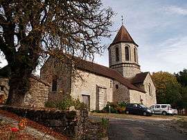
The church of Saint-Hilaire, in Saint-Hilaire-les-Places | |
 Saint-Hilaire-les-Places | |
|
Location within Nouvelle-Aquitaine region  Saint-Hilaire-les-Places | |
| Coordinates: 45°38′45″N 1°09′35″E / 45.6458°N 1.1597°ECoordinates: 45°38′45″N 1°09′35″E / 45.6458°N 1.1597°E | |
| Country | France |
| Region | Nouvelle-Aquitaine |
| Department | Haute-Vienne |
| Arrondissement | Limoges |
| Canton | Nexon |
| Intercommunality | Pays de Nexon |
| Government | |
| • Mayor (2008–2014) | Louis Puydenus |
| Area1 | 23.06 km2 (8.90 sq mi) |
| Population (2006)2 | 853 |
| • Density | 37/km2 (96/sq mi) |
| Time zone | CET (UTC+1) |
| • Summer (DST) | CEST (UTC+2) |
| INSEE/Postal code | 87150 / 87800 |
| Elevation | 320–492 m (1,050–1,614 ft) |
|
1 French Land Register data, which excludes lakes, ponds, glaciers > 1 km² (0.386 sq mi or 247 acres) and river estuaries. 2 Population without double counting: residents of multiple communes (e.g., students and military personnel) only counted once. | |
Saint-Hilaire-les-Places (Occitan: Sent Alari las Plaças) is a commune in the Haute-Vienne department in the Nouvelle-Aquitaine region in west-central France.
See also
References
| Wikimedia Commons has media related to Saint-Hilaire-les-Places. |
This article is issued from Wikipedia - version of the 11/11/2016. The text is available under the Creative Commons Attribution/Share Alike but additional terms may apply for the media files.