Cookeville, Tennessee
| Cookeville, Tennessee | |
|---|---|
| City | |
|
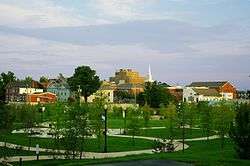
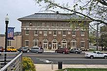
Downtown Cookeville, viewed from Dogwood Park | |
| Nickname(s): Hub of the Upper Cumberland | |
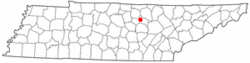 Location in Putnam County and the state of Tennessee. | |
| Coordinates: 36°9′51″N 85°30′15″W / 36.16417°N 85.50417°WCoordinates: 36°9′51″N 85°30′15″W / 36.16417°N 85.50417°W | |
| Country | United States |
| State | Tennessee |
| County | Putnam |
| Founded | 1854[1] |
| Incorporated | 1903[2] |
| Named for | Richard F. Cooke |
| Government | |
| • Type | City Council |
| • Mayor | Ricky Shelton |
| Area | |
| • Total | 22.0 sq mi (57.0 km2) |
| • Land | 21.9 sq mi (56.7 km2) |
| • Water | 0.2 sq mi (0.52 km2) |
| Elevation | 1,140 ft (350 m) |
| Population (2014) | |
| • Total | 31,335 (city proper) |
| Estimate | |
| Time zone | CST (UTC-6) |
| • Summer (DST) | CDT (UTC-5) |
| ZIP codes | 38501, 38502, 38503, 38505 (Tennessee Tech), 38506 |
| Area code(s) | 931 |
| FIPS code | 47-16920[3] |
| GNIS feature ID | 1647827[4] |
| Website | www.cookeville-tn.org |
Cookeville is a city in Putnam County, Tennessee, United States. Its population at the 2010 census was 30,435.[5] It is the county seat of Putnam County and home to Tennessee Technological University. It is recognized as one of the country's micropolitan areas, smaller cities which nevertheless function as significant economic hubs. Of the twenty micropolitan areas in Tennessee, Cookeville is the largest; the Cookeville micropolitan area's 2010 Census population was 106,042.[6]
Geography

Cookeville is located at 36°9′46″N 85°30′5″W / 36.16278°N 85.50139°W.[7] According to the United States Census Bureau, the city has a total area of 22.0 square miles (57 km2), of which 21.9 square miles (57 km2) is land and 0.2 square miles (0.52 km2) (0.77%) is water.
Located on the Highland Rim, Cookeville's elevation is a few hundred feet higher than either Nashville or Knoxville. As a result, temperatures and humidity levels are generally slightly lower in Cookeville than in either the Nashville Basin or in the Tennessee Valley.
Three man-made lakes maintained by the Corps of Engineers are located near Cookeville, created to help flood control in the narrow valleys of the Cumberland Plateau: Center Hill Lake, Cordell Hull Lake, and Dale Hollow Lake. Two smaller man-made lakes, City Lake and Burgess Falls Lake, lie along the Falling Water River, which flows through the southeastern part of the county. Cane Creek Lake, created by an earthen dam built by the Civilian Conservation Corps, lies in the western part of the city.
Climate
Cookeville has a humid subtropical climate (Köppen climate classification: Cfa) with relatively high temperatures and evently distributed precipitation through the year. Summers are typically hot and humid and winters are mild and cool.[8] The average annual temperature is 44.9 °F (7.2 °C), and the highest temperature recorded in Cookeville since 1896 is 105 °F (41 °C) on June 29, 2012, and the lowest temperature recorded is −22 °F (−30 °C) on January 21, 1985. Average annual precipitation is 56.1 in (1,420 mm), with the highest recorded precipitation at 6.06 in (154 mm) on September 29, 1964. Average annual snowfall is 8.0 in (200 mm) with the highest recorded snowfall at 15.2 in (39 cm) on November 3, 1966.[9]
| Climate data for Cookeville, Tennessee | |||||||||||||
|---|---|---|---|---|---|---|---|---|---|---|---|---|---|
| Month | Jan | Feb | Mar | Apr | May | Jun | Jul | Aug | Sep | Oct | Nov | Dec | Year |
| Record high °F (°C) | 76 (24) |
80 (27) |
85 (29) |
90 (32) |
93 (34) |
105 (41) |
104 (40) |
104 (40) |
99 (37) |
92 (33) |
85 (29) |
77 (25) |
105 (41) |
| Average high °F (°C) | 26 (−3) |
28 (−2) |
35 (2) |
43 (6) |
52 (11) |
61 (16) |
65 (18) |
64 (18) |
56 (13) |
44 (7) |
36 (2) |
29 (−2) |
44.9 (7.2) |
| Average low °F (°C) | 26 (−3) |
28 (−2) |
35 (2) |
43 (6) |
52 (11) |
61 (16) |
65 (18) |
64 (18) |
56 (13) |
44 (7) |
36 (2) |
29 (−2) |
44.9 (7.2) |
| Record low °F (°C) | −22 (−30) |
−13 (−25) |
−1 (−18) |
20 (−7) |
29 (−2) |
38 (3) |
46 (8) |
46 (8) |
34 (1) |
22 (−6) |
7 (−14) |
−13 (−25) |
−22 (−30) |
| Average precipitation inches (mm) | 5.1 (130) |
5.1 (130) |
4.8 (122) |
4.6 (117) |
5.5 (140) |
4.6 (117) |
5.0 (127) |
3.9 (99) |
3.9 (99) |
3.2 (81) |
4.7 (119) |
5.7 (145) |
56.1 (1,426) |
| Source: "Monthly Average/Record Temperatures and Precipitation at Cookeville Golf Club". Weather Channel. Weather Channel. Retrieved 6 February 2016. | |||||||||||||
Economy
- Known as the "Hub of the Upper Cumberlands," approximately 25,000 people travel to Cookeville daily to work, shop, or attend school.
- Cookeville's 2005 retail sales total of $1.16 billion was a 12.4% increase from the 2004 retail sales total. The state's increase was 7.86%.
- The December 2006 unemployment rate was 4.7%, down from a high of 6.8% in August 2006 after the closing of two large manufacturing facilities with 1300 employees combined.
- Manufacturing is the largest sector in Cookeville's economy with over 100 plants and 8,000 employees. In 2006 Oreck manufacturing moved their Long Beach, Mississippi plant to Cookeville after Hurricane Katrina. Oreck employs about 500 people and is a prominent business in the region.
- With 13% of the workforce, retail trade employs about 4,200 people and is the second largest sector in the Cookeville economy.
- Health care workers comprise about 12% of the work force with 3,840 employees.
- Education is another major sector with nearly 2,000 employees at Tennessee Technological University and the public school system.
- In June 2006 Cookeville banks had $1.215 billion in deposits, an increase of 10.2 percent over June 2005. In June 2006 there were 30 bank branches in Cookeville, an increase of three over June 2005.
- The trucking company Averitt Express is based in Cookeville.
Demographics
| Historical population | |||
|---|---|---|---|
| Census | Pop. | %± | |
| 1870 | 156 | — | |
| 1880 | 279 | 78.8% | |
| 1890 | 469 | 68.1% | |
| 1910 | 1,848 | — | |
| 1920 | 2,395 | 29.6% | |
| 1930 | 3,738 | 56.1% | |
| 1940 | 4,364 | 16.7% | |
| 1950 | 6,924 | 58.7% | |
| 1960 | 7,805 | 12.7% | |
| 1970 | 14,403 | 84.5% | |
| 1980 | 20,535 | 42.6% | |
| 1990 | 21,744 | 5.9% | |
| 2000 | 23,923 | 10.0% | |
| 2010 | 30,435 | 27.2% | |
| Est. 2015 | 32,113 | [10] | 5.5% |
| Sources:[11][12] | |||
As of the census[3] of 2010, there were 30,435 people, 12,471 households, and 6,669 families residing in the city. The population density was 1,094.5 people per square mile (422.5/km²). There were 13,706 housing units at an average density of 491.6 per square mile (189.8/km²). The racial makeup of the city was 87.9% White, 3.4% African American, 0.6% Native American, 2.0% Asian, 0.21% Pacific Islander, 4.0% from other races, and 2.1% from two or more races. Hispanic or Latino of any race were 7.0% of the population.
There were 12,471 households out of which 25.2% had children under the age of 18 living with them, 37% were married couples living together, 12% had a female householder with no husband present, and 46.5% were non-families. 33.9% of all households were made up of individuals and 10.9% had someone living alone who was 65 years of age or older. The average household size was 2.19 and the average family size was 2.83.
In the city the population was spread out with 18.6% under the age of 18, 25.2% from 18 to 24, 25.1% from 25 to 44, 18.0% from 45 to 64, and 13.7% who were 65 years of age or older. The median age was 29 years. For every 100 females there were 101.4 males. For every 100 females age 18 and over, there were 100.8 males.
The median income for a household in the city was $29,789, and the median income for a family was $39,623. Males had a median income of $28,013 versus $21,710 for females. The per capita income for the city was $19,297. About 13.1% of families and 23.2% of the population were below the poverty line, including 20.1% of those under age 18 and 18.7% of those age 65 or over.
Points of interest

- Cummins Falls State Park
- Gerald D. Coorts Memorial Arboretum
- Cookeville Depot Museum
- Cane Creek Park
- Burgess Falls State Park
- Cookeville Performing Arts Center
- Tennessee Tech University
- Arda E. Lee's Hidden Hollow
- White Plains
Museums
- Cookeville History Museum
- Cookeville Children's Museum
- Derryberry Art Gallery
- Cumberland Art Society and Gallery
- Appalachian Center for Craft Gallery
Performing arts
- Cookeville Community Band
- Cookeville Children's Theatre
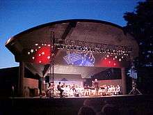
- Dogwood Outdoor Performance Pavilion
- Bryan Symphony Orchestra
- Bryan Fine Arts Center
- Mastersingers
- Cookeville Performing Arts Center
- Backdoor Playhouse
- Drama Center Backstage
- Wesley Arena Theatre
- Shakespeare in the Park
- Brown Bag Lunch Concerts
Media
The major daily newspaper in Cookeville is the Herald-Citizen, which publishes in print and online formats six days per week (except Saturdays). Cookeville is also the headquarters of the Upper Cumberland Business Journal, a quarterly business newspaper serving the 14-county Upper Cumberland region. Cookeville is also home one broadcast television station, WCTE TV 22 (PBS). Charter Communications provides cable television service, and Dish Network provides satellite television. Using cable or satellite, television stations and network affiliates from the Nashville media market can be received. Local Internet service providers include Charter Communications and Frontier Communications.
Cookeville is also served by nine FM and three AM radio stations. Tennessee Tech University's campus radio station operates at WTTU 88.5 FM, and National Public Radio (NPR) broadcasts at WHRS 91.7 FM (simulcast with WPLN, Nashville). Rock and roll and Top 40 stations include WBXE 93.7 FM and WKSW 98.5 Kiss FM, and country music can be found at WGSQ 94.7 FM Country Giant and WKXD-FM 106.9 Kicks FM. There is also one easy listening station at WLQK 95.9 FM and two Christian music stations: WAYM 90.5 FM Christian Hit Radio and WWOG 90.9 FM. There are three talk radio stations broadcasting on the AM dial: WPTN AM 780 (sports), WHUB AM 1400 (news) and WATX 1600 AM (news).
Government
The city of Cookeville operates under the council-manager form of municipal government. There is an elected five-member city council, including a mayor, vice mayor, and three city council members. The city council establishes policy that is administered by a full time city manager. All city council members serve four year terms, and the city manager and city clerk are appointed by the city council. The current mayor is Ricky Shelton, and the four other city council members are Dr. Charles Womack, Larry Epps, Dwight Henry and Jim Woodford. The current city manager is Mike Davidson and the current city clerk is Cathy McClain.[13]
Cookeville is also the county seat of Putnam County, Tennessee. Putnam County includes the cities of Cookeville, Algood, Baxter and Monterey. The current county executive is Randy Porter.[14] As of July 2014, the total population of Putnam County is 74,165.[15]
Education
Cookeville is predominantly a college town, home to Tennessee Technological University since 1915. Tennessee Tech is a public university with programs concentrating in Science, Technology, Engineering, and Mathematics (STEM) studies and is ranked by US News & World Report as #35 on the list of the Top Regional Universities in the South,[16] as well as the most under-rated university in the state of Tennessee.[17] The university is rated under, "Doctoral Universities - Moderate Research Activity (R3)" by the Carnegie classificiation system among schools with at least twenty (20) doctoral graduates per year.[18] In addition to its outstanding science and engineering programs, the university is also home to the Mastersingers and the Tennessee Tech Tuba Ensemble, led by renowned professor, R. Winston Morris.[19]
In addition to Tennessee Tech, Cookeville is also home to a satellite campus of Nashville State Community College as well as the Tennessee Bible College, a Christian college affiliated with the Churches of Christ.
Public schools in the city of Cookeville are run by Putnam County Schools, which consists of a total of eighteen (18) elementary, middle and high schools located throughout Putnam County.[20] The schools located in the city of Cookeville include Cookeville High School, Jere Whitson Elementary, Prescott Middle School, Northeast Elementary, Capshaw Elementary, Dry Valley School, Parkview Elementary, Sycamore Elementary, Cane Creek Elementary, Avery Trace Middle, and the Adult High School. Cookeville High School is one of the four largest public high schools in the state of Tennessee, and one of twelve (12) schools in the state of Tennessee to offer the International Baccalaureate program.[21][22]
Transportation
Cookeville is located approximately 80 miles (130 km) east of Nashville and 100 miles (160 km) west of Knoxville along Interstate 40 (I-40). Chattanooga is approximately 90 miles (140 km) to the south via Tennessee State Route 111 (SR-111). U.S. Route 70N (US-70N, Spring Street in central and eastern Cookeville, W. Broad Street on the western side) runs east-west through the central business district of the city, which is approximately 1.5 mi (2.4 km) northwest of the interchange of I-40 with SR-111. The major city streets running through the city are North Washington Ave. and South Jefferson Ave., which run north-south through the central business district, and Willow Ave., running north-south and immediately adjacent to Tennessee Tech University. In addition to Spring Street (US 70N), 10th Street runs east-west and connects North Washington Ave. with the neighboring town of Algood, and 12th Street runs east-west and connects North Washington with Willow, and leads out of town to the west, connecting with Tennessee State Route 56 (SR-56, Gainesboro Highway), via SR-290. Running east-west adjacent to I-40 in the southern section of the city is Interstate Drive, which is populated by several national restaurant chains, hotels, and other businesses.
There are no commercial passenger airports in the area. Located in White County approximately 8.5 nautical miles (15.7 km) south of the central business district of the city is the Upper Cumberland Regional Airport (ICAO: KSRB, FAA LID: SRB), which is a small, general aviation airport serving primarily single-engine aircraft. Commercial flights are available to residents at Nashville International Airport (IATA: BNA, ICAO: KBNA, FAA LID: BNA), which is located along I-40 72 mi (116 km) to the west. Airport shuttles are available for transportation to Nashville International, and the Upper Cumberland Human Resource Agency (UCHRA) operates a daily express bus to the Nashville Greyhound bus station with stops at the airport three times per day.[23] The UCHRA also operates the Cookeville Area Transit System (CATS) local bus service.[24]

Since Cookville's founding, rail transport was a major part of the economy, and the Tennessee Central Railway connecting Nashville and Knoxville had a major rail depot in the central business district. This railway was used primarily to transport the coal and minerals of East Tennessee to the markets of the midstate region. The coal industry declined during the 1960s, and the Tennessee Central Railway was discontinued in 1968. Construction of a bicycle trail adjacent to the railway's path began in August 2013, with the reconstruction of the rail depot in Monterey. Plans are to connect this depot and the rail depot in Cookeville's central business district (now a museum) with a 19 mi (31 km) bicycle trail.[25]
Notable people
- Mack Brown – former head football coach of the North Carolina Tar Heels and the Texas Longhorns
- Watson Brown – older brother of Texas Longhorns head coach Mack Brown, former head football coach of the Rice Owls, Vanderbilt Commodores, UAB Blazers, and Tennessee Tech Golden Eagles
- Jim Carlen – former head football coach of the West Virginia Mountaineers, Texas Tech Red Raiders, and South Carolina Gamecocks
- Rich Froning Jr. – four-time champion (2011, 2012, 2013, and 2014) of the CrossFit Games
- Robert Ben Garant – "Deputy Junior" from the TV show Reno 911!
- Bobby Greenwood – former PGA Tour Player, professional golfer
- Byron (Low Tax) Looper – one-time property assessor and murderer of State Senator Tommy Burks in 1998
- Harold E. Martin – a Pulitzer Prize-winning newspaperman, was the former co-owner of the Herald Citizen
- Jack Norton – children's musician and host of The Zinghoppers children's TV show that has been broadcast on Fox, NBC and PBS stations.
- J. J. Redick – basketball player for the Los Angeles Clippers of the NBA, was born in Cookeville, but grew up in Roanoke, Virginia.
- Elmo Stoll – a former Old Order Amish bishop, who founded of the "Christian Communities", of which the center was Cookeville
- Lonnie Warwick – former professional football player for the Minnesota Vikings
References
- ↑ Cookeville Regional Planning Commission, "Comprehensive Future Land Use Plan, Cookeville, Tennessee, 1999–2020," 5 October 2000, p. 3. Retrieved: 16 January 2013.
- ↑ Tennessee Blue Book, 2005-2006, pp. 618-625.
- 1 2 "American FactFinder". United States Census Bureau. Archived from the original on 2013-09-11. Retrieved 2008-01-31.
- ↑ "US Board on Geographic Names". United States Geological Survey. 2007-10-25. Retrieved 2008-01-31.
- ↑ http://factfinder.census.gov/servlet/GCTTable?_bm=y&-geo_id=85000US385&-_box_head_nbr=GCT-PH1&-ds_name=DEC_2000_SF1_U&-_lang=en&-redoLog=false&-format=ZI-1&-mt_name=DEC_2000_SF1_U_GCTPH1_ZI1&-_sse=on
- ↑ http://www.census.gov/popest/cities/cities.html
- ↑ "US Gazetteer files: 2010, 2000, and 1990". United States Census Bureau. 2016-02-06. Retrieved 2016-02-06.
- ↑ "Climate information for Cookeville, Tennessee". Weatherbase.com. CantyMedia. Retrieved 6 February 2016.
- ↑ "All-time Records for Various Middle Tennessee Locations". National Weather Service Weather Forecast Office. National Oceanic and Atmospheric Administration. Retrieved 7 February 2016.
- ↑ "Annual Estimates of the Resident Population for Incorporated Places: April 1, 2010 to July 1, 2015". Retrieved July 2, 2016.
- ↑ "Census of Population and Housing: Decennial Censuses". United States Census Bureau. Retrieved 2012-03-04.
- ↑ "Incorporated Places and Minor Civil Divisions Datasets: Subcounty Resident Population Estimates: April 1, 2010 to July 1, 2012". Population Estimates. U.S. Census Bureau. Archived from the original on 17 June 2013. Retrieved 11 December 2013.
- ↑ "Staff Directory". City of Cookeville. Retrieved 8 February 2016.
- ↑ "Randy Porter, County Executive". Putnam County, Tennessee Government. Retrieved 8 February 2016.
- ↑ "Population Estimates for Tennessee Counties". United States Census. Archived from the original on 17 April 2016. Retrieved 8 February 2016.
- ↑ "Colleges". US News & World Report. Retrieved 8 February 2016.
- ↑ Jacobs, Peter (9 August 2014). "The Most Underrated College In Every State". Business Insider. Retrieved 8 February 2016.
- ↑ "Tennessee Technological University". Carnegie Classification of Institutions of Higher Education. Retrieved 8 February 2016.
- ↑ McAdams, Charles A.; Perry, Richard H. (16 November 2010). The Tennessee Tech Tuba Ensemble and R. Winston Morris: A 40th Anniversary Retrospective. Landham, Maryland; Toronto; Plymouth, UK: Scarecrow Press. pp. 36–37. ISBN 978-0-8108-7730-6. Retrieved 8 February 2016.
- ↑ "Board of Education". Putnam County, Tennessee Government. Retrieved 8 February 2016.
- ↑ "2016 Largest Public High Schools in Tennessee". NICHE. Retrieved 8 February 2016.
- ↑ "Tennessee State Board of Education, Meeting Agenda, April 20, 2012" (PDF). Tennessee State Board of Education. Retrieved 8 February 2016.
- ↑ "UCHRA Express". Upper Cumberland Human Resource Agency. Retrieved 7 February 2016.
- ↑ "Cookeville Area Transit System". Upper Cumberland Human Resource Agency. Retrieved 7 February 2016.
- ↑ Stark, Laura (1 August 2013). "Tennessee Central Heritage Rail Trail". Rails-to-Trails Conservancy. Retrieved 7 February 2016.
External links
-
 Media related to Cookeville, Tennessee at Wikimedia Commons
 -
 Cookeville travel guide from Wikivoyage
 - Cookeville official website
- Municipal Technical Advisory Service entry for Cookeville – information on local officials, elections, and link to charter
 |
Cummins Falls State Park | Celina | Algood | |
| Baxter | |
Monterey | ||
| ||||
| | ||||
| Center Hill Lake | Sparta |
Municipalities and communities of Putnam County, Tennessee, United States | ||
|---|---|---|
| Cities | ||
| Towns | ||
| Unincorporated communities | ||