Dolenja Vas pri Raki
| Dolenja Vas pri Raki | |
|---|---|
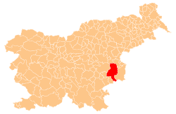
 Dolenja Vas pri Raki Location in Slovenia | |
| Coordinates: 45°55′8.31″N 15°21′46.44″E / 45.9189750°N 15.3629000°ECoordinates: 45°55′8.31″N 15°21′46.44″E / 45.9189750°N 15.3629000°E | |
| Country |
|
| Traditional region | Lower Carniola |
| Statistical region | Lower Sava |
| Municipality | Krško |
| Area | |
| • Total | 0.66 km2 (0.25 sq mi) |
| Elevation | 184.1 m (604.0 ft) |
| Population (2002) | |
| • Total | 56 |
| [1] | |
Dolenja Vas pri Raki (pronounced [dɔˈleːnja ˈʋaːs pɾi ˈɾaːki]; Slovene: Dolenja vas pri Raki, German: Niederdorf[2]) is a settlement southwest of Raka in the Municipality of Krško in eastern Slovenia. The area was traditionally part of Lower Carniola. It is now included with the rest of the municipality in the Lower Sava Statistical Region.[3]
Name
The name of the settlement was changed from Dolenja vas to Dolenja vas pri Raki in 1953.[4] In the past the German name was Niederdorf.[2]
References
- ↑ Statistical Office of the Republic of Slovenia
- 1 2 Leksikon občin kraljestev in dežel zastopanih v državnem zboru, vol. 6: Kranjsko. 1906. Vienna: C. Kr. Dvorna in Državna Tiskarna, p. 78.
- ↑ Krško municipal site
- ↑ Spremembe naselij 1948–95. 1996. Database. Ljubljana: Geografski inštitut ZRC SAZU, DZS.
External links
This article is issued from Wikipedia - version of the 1/4/2016. The text is available under the Creative Commons Attribution/Share Alike but additional terms may apply for the media files.