Srednje Pijavško
| Srednje Pijavško | |
|---|---|
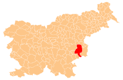
 Srednje Pijavško Location in Slovenia | |
| Coordinates: 45°59′15.56″N 15°25′54.35″E / 45.9876556°N 15.4317639°ECoordinates: 45°59′15.56″N 15°25′54.35″E / 45.9876556°N 15.4317639°E | |
| Country |
|
| Traditional region | Lower Carniola |
| Statistical region | Lower Sava |
| Municipality | Krško |
| Area | |
| • Total | 0.48 km2 (0.19 sq mi) |
| Elevation | 171.8 m (563.6 ft) |
| Population (2002) | |
| • Total | 15 |
| [1] | |
Srednje Pijavško (pronounced [ˈsɾeːdnjɛ piˈjaːu̯ʃkɔ]; German: Mitterpiauschko[2]) is a small settlement on the right bank of the Sava River in the Municipality of Krško in eastern Slovenia. The area was traditionally part of Lower Carniola and is now included with the rest of the municipality in the Lower Sava Statistical Region.[3]
There is a small chapel-shrine in the settlement. It was built in the late 19th century.[4]
References
- ↑ Statistical Office of the Republic of Slovenia
- ↑ Leksikon občin kraljestev in dežel zastopanih v državnem zboru, vol. 6: Kranjsko. 1906. Vienna: C. Kr. Dvorna in Državna Tiskarna, p. 78.
- ↑ Krško municipal site
- ↑ Slovenian Ministry of Culture register of national heritage reference number ešd 22288
External links
This article is issued from Wikipedia - version of the 11/9/2015. The text is available under the Creative Commons Attribution/Share Alike but additional terms may apply for the media files.