Stari Grad v Podbočju
| Stari Grad v Podbočju | |
|---|---|
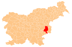
 Stari Grad v Podbočju Location in Slovenia | |
| Coordinates: 45°51′21.38″N 15°28′28.28″E / 45.8559389°N 15.4745222°ECoordinates: 45°51′21.38″N 15°28′28.28″E / 45.8559389°N 15.4745222°E | |
| Country |
|
| Traditional region | Lower Carniola |
| Statistical region | Lower Sava |
| Municipality | Krško |
| Area | |
| • Total | 1.47 km2 (0.57 sq mi) |
| Elevation | 319.8 m (1,049.2 ft) |
| Population (2002) | |
| • Total | 6 |
| [1] | |
Stari Grad v Podbočju (pronounced [ˈstaːɾi ˈɡɾaːt ʍ pɔdˈboːtʃju]) is a settlement south of Podbočje in the Municipality of Krško in eastern Slovenia. The area was traditionally part of Lower Carniola and is now included with the rest of the municipality in the Lower Sava Statistical Region.[2]
Name
The name of the settlement was changed from Stari Grad to Stari Grad v Podbočju in 1953.[3]
Cultural heritage
The site of a 13th-century medieval castle in the settlement was excavated and shown to have been occupied from the Early Iron Age with Hallstatt period and La Tène period occupation levels. Roman artefacts were also found. By 1581 the site of the castle is known from written sources to have been abandoned.[4]
References
- ↑ Statistical Office of the Republic of Slovenia
- ↑ Krško municipal site
- ↑ Spremembe naselij 1948–95. 1996. Database. Ljubljana: Geografski inštitut ZRC SAZU, DZS.
- ↑ Slovenian Ministry of Culture register of national heritage reference number ešd 16536
External links
This article is issued from Wikipedia - version of the 11/9/2015. The text is available under the Creative Commons Attribution/Share Alike but additional terms may apply for the media files.