Kostanjek
| Kostanjek | |
|---|---|
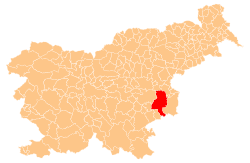
 Kostanjek Location in Slovenia | |
| Coordinates: 46°0′32.26″N 15°32′29.15″E / 46.0089611°N 15.5414306°ECoordinates: 46°0′32.26″N 15°32′29.15″E / 46.0089611°N 15.5414306°E | |
| Country |
|
| Traditional region | Styria |
| Statistical region | Lower Sava |
| Municipality | Krško |
| Area | |
| • Total | 2.97 km2 (1.15 sq mi) |
| Elevation | 337.7 m (1,107.9 ft) |
| Population (2002) | |
| • Total | 135 |
| [1] | |
Kostanjek (pronounced [kɔˈstaːnjək]) is a settlement north of Zdole in the Municipality of Krško in eastern Slovenia. The area was traditionally part of Styria. It is now included with the rest of the municipality in the Lower Sava Statistical Region.[2]
The local church is dedicated to Saint Vitus and belongs to the Parish of Zdole. It is a Baroque church dating to the early 18th century. Its nave was extended in 1853.[3]
References
External links
This article is issued from Wikipedia - version of the 10/30/2015. The text is available under the Creative Commons Attribution/Share Alike but additional terms may apply for the media files.