Finney County, Kansas
| Finney County, Kansas | |
|---|---|
| County | |
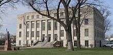 Finney County Courthouse in Garden City | |
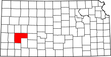 Location in the U.S. state of Kansas | |
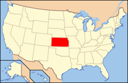 Kansas's location in the U.S. | |
| Founded | February 22, 1883 |
| Named for | David W. Finney |
| Seat | Garden City |
| Largest city | Garden City |
| Area | |
| • Total | 1,303 sq mi (3,375 km2) |
| • Land | 1,302 sq mi (3,372 km2) |
| • Water | 0.7 sq mi (2 km2), 0.05% |
| Population | |
| • (2010) | 36,776 |
| • Density | 28/sq mi (11/km²) |
| Congressional district | 1st |
| Time zone | Central: UTC-6/-5 |
| Website |
FinneyCounty |
Coordinates: 38°01′N 100°40′W / 38.017°N 100.667°W

Finney County (county code FI) is a county located in the U.S. state of Kansas. As of the 2010 census, the county population was 36,776.[1] Its county seat and most populous city is Garden City.[2]
History
Finney County began about 1880 as Buffalo County and Sequoyah County, named after Sequoyah, the Cherokee Indian responsible for the development of the Cherokee alphabet. The two counties were renamed Finney County in honor of then Lieutenant Governor David Wesley Finney.[3] The county grew to the current shape after Garfield County was annexed to it in 1893. The northeast block, separate from the otherwise rectangular area, represents what at one time was Garfield County, which is now occupied partially by the Garfield Township.[4]
Charles "Buffalo" Jones, a co-founder of Garden City, was the first member of the Kansas House of Representatives from Finney County. He was known for his efforts to preserve the buffalo from extinction.[5]
Between 2007 and 2008 Finney County became majority-minority.[6]
Geography
According to the U.S. Census Bureau, the county has a total area of 1,303 square miles (3,370 km2), of which 1,302 square miles (3,370 km2) is land and 0.7 square miles (1.8 km2) (0.05%) is water.[7] It is the second-largest county in Kansas by area.
Adjacent counties
- Scott County (north)
- Lane County (north)
- Ness County (northeast)
- Hodgeman County (east)
- Haskell County (south)
- Gray County (south)
- Grant County (southwest)
- Kearny County (west)
Demographics
| Historical population | |||
|---|---|---|---|
| Census | Pop. | %± | |
| 1890 | 4,231 | — | |
| 1900 | 3,469 | −18.0% | |
| 1910 | 6,908 | 99.1% | |
| 1920 | 7,674 | 11.1% | |
| 1930 | 11,014 | 43.5% | |
| 1940 | 10,092 | −8.4% | |
| 1950 | 15,092 | 49.5% | |
| 1960 | 16,093 | 6.6% | |
| 1970 | 18,947 | 17.7% | |
| 1980 | 23,825 | 25.7% | |
| 1990 | 33,070 | 38.8% | |
| 2000 | 40,523 | 22.5% | |
| 2010 | 36,776 | −9.2% | |
| Est. 2015 | 37,118 | [8] | 0.9% |
| U.S. Decennial Census[9] 1790-1960[10] 1900-1990[11] 1990-2000[12] 2010-2013[1] | |||

Finney County is included in the Garden City, KS Micropolitan Statistical Area.
2010 Census
As of the U.S. Census in 2010[13] there were 36,776 people, 12,359 households and 8,903 families residing in the county. The racial makeup of the county was 77.0% White, 2.3% Black or African American, 0.9% Native American, 3.4% Asian, 0.0% Pacific Islander, 13.6% from other races, and 2.9% from two or more races. Hispanic or Latino of any race were 46.7% of the population.
2000 Census
As of the U.S. Census in 2000,[13] there were 40,523 people, 12,948 households, and 9,749 families residing in the county. The population density was 31 people per square mile (12/km²). There were 13,763 housing units at an average density of 11 per square mile (4/km²). The racial makeup of the county was 69.05% White, 1.25% Black or African American, 0.96% Native American, 2.87% Asian, 0.08% Pacific Islander, 22.99% from other races, and 2.80% from two or more races. Hispanic or Latino of any race were 43.30% of the population.
There were 12,948 households out of which 46.00% had children under the age of 18 living with them, 59.80% were married couples living together, 10.50% had a female householder with no husband present, and 24.70% were non-families. 19.60% of all households were made up of individuals and 6.30% had someone living alone who was 65 years of age or older. The average household size was 3.09 and the average family size was 3.55.
In the county the population was spread out with 34.30% under the age of 18, 11.00% from 18 to 24, 31.10% from 25 to 44, 16.60% from 45 to 64, and 7.00% who were 65 years of age or older. The median age was 28 years. For every 100 females there were 104.20 males. For every 100 females age 18 and over, there were 103.30 males.
The median income for a household in the county was $38,474, and the median income for a family was $42,839. Males had a median income of $29,948 versus $21,510 for females. The per capita income for the county was $15,377. About 10.00% of families and 14.20% of the population were below the poverty line, including 18.60% of those under age 18 and 10.70% of those age 65 or over.
Law and government
Finney County was a prohibition, or "dry", county until the Kansas Constitution was amended in 1986 and voters approved the sale of alcoholic liquor by the individual drink with a 30% food sales requirement.[14]
Education
Unified school districts
Communities

Cities
Unincorporated communities
Ghost towns
Source:[15]
Townships
Finney County is divided into seven townships. The city of Garden City is considered governmentally independent and is excluded from the census figures for the townships. In the following table, the population center is the largest city (or cities) included in that township's population total, if it is of a significant size.
| Township | FIPS | Population center |
Population | Population density /km² (/sq mi) |
Land area km² (sq mi) | Water area km² (sq mi) | Water % | Geographic coordinates |
|---|---|---|---|---|---|---|---|---|
| Garden City | 25350 | 7,400 | 23 (59) | 327 (126) | 0 (0) | 0.11% | 37°57′39″N 100°51′22″W / 37.96083°N 100.85611°W | |
| Garfield | 25600 | 331 | 0 (1) | 1,116 (431) | 1 (0) | 0.09% | 38°8′13″N 100°26′47″W / 38.13694°N 100.44639°W | |
| Ivanhoe | 34675 | 666 | 2 (5) | 368 (142) | 0 (0) | 0% | 37°49′10″N 100°51′26″W / 37.81944°N 100.85722°W | |
| Pierceville | 55800 | 551 | 1 (4) | 378 (146) | 0 (0) | 0.01% | 37°53′39″N 100°42′56″W / 37.89417°N 100.71556°W | |
| Pleasant Valley | 56550 | 139 | 0 (1) | 371 (143) | 0 (0) | 0% | 38°10′40″N 100°48′6″W / 38.17778°N 100.80167°W | |
| Sherlock | 64800 | 2,758 | 7 (17) | 419 (162) | 0 (0) | 0.09% | 38°0′32″N 101°0′8″W / 38.00889°N 101.00222°W | |
| Terry | 70225 | 227 | 1 (2) | 371 (143) | 0 (0) | 0.11% | 38°9′22″N 100°59′52″W / 38.15611°N 100.99778°W | |
| Sources: "Census 2000 U.S. Gazetteer Files". U.S. Census Bureau, Geography Division. | ||||||||
See also
|
|
References
- 1 2 "State & County QuickFacts". United States Census Bureau. Retrieved July 24, 2014.
- ↑ "Find a County". National Association of Counties. Retrieved 2011-06-07.
- ↑ Gannett, Henry (1905). The Origin of Certain Place Names in the United States. Govt. Print. Off. p. 126.
- ↑ Kansas Place-Names, John Rydjord, University of Oklahoma Press, 1972, ISBN 0-8061-0994-7
- ↑ "Buffalo Jones". h-net.msu.edu. Retrieved September 4, 2010.
- ↑ Callebs, Sean. "Whites become minority in Kansas county." CNN. May 22, 2009. Retrieved on May 24, 2009.
- ↑ "US Gazetteer files: 2010, 2000, and 1990". United States Census Bureau. 2011-02-12. Retrieved 2011-04-23.
- ↑ "County Totals Dataset: Population, Population Change and Estimated Components of Population Change: April 1, 2010 to July 1, 2015". Retrieved July 2, 2016.
- ↑ "U.S. Decennial Census". United States Census Bureau. Retrieved July 24, 2014.
- ↑ "Historical Census Browser". University of Virginia Library. Retrieved July 24, 2014.
- ↑ "Population of Counties by Decennial Census: 1900 to 1990". United States Census Bureau. Retrieved July 24, 2014.
- ↑ "Census 2000 PHC-T-4. Ranking Tables for Counties: 1990 and 2000" (PDF). United States Census Bureau. Retrieved July 24, 2014.
- 1 2 "American FactFinder". United States Census Bureau. Retrieved 2008-01-31.
- ↑ "Map of Wet and Dry Counties". Alcoholic Beverage Control, Kansas Department of Revenue. November 2006. Retrieved 2007-12-28.
- ↑ Homesteading in Finney County
Further reading
- History of the State of Kansas; William G. Cutler; A.T. Andreas Publisher; 1883. (Online HTML eBook)
- Kansas : A Cyclopedia of State History, Embracing Events, Institutions, Industries, Counties, Cities, Towns, Prominent Persons, Etc; 3 Volumes; Frank W. Blackmar; Standard Publishing Co; 944 / 955 / 824 pages; 1912. (Volume1 - Download 54MB PDF eBook),(Volume2 - Download 53MB PDF eBook), (Volume3 - Download 33MB PDF eBook)
External links
| Wikimedia Commons has media related to Finney County, Kansas. |
- County
- Other
- Maps
- Finney County Maps: Current, Historic, KDOT
- Kansas Highway Maps: Current, Historic, KDOT
- Kansas Railroad Maps: Current, 1996, 1915, KDOT and Kansas Historical Society
 |
Scott County and Lane County | Ness County | | |
| Kearny County | |
Hodgeman County | ||
| ||||
| | ||||
| Grant County | Haskell County and Gray County |
Municipalities and communities of Finney County, Kansas, United States | ||
|---|---|---|
| Cities | | |
| Unincorporated communities | ||
| Ghost towns | ||
| Townships | ||