Ford County, Kansas
| Ford County, Kansas | |
|---|---|
| County | |
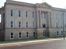 Ford County Courthouse in Dodge City | |
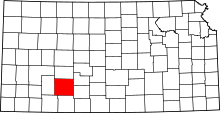 Location in the U.S. state of Kansas | |
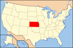 Kansas's location in the U.S. | |
| Founded | February 26, 1867 |
| Named for | James Ford |
| Seat | Dodge City |
| Largest city | Dodge City |
| Area | |
| • Total | 1,099 sq mi (2,846 km2) |
| • Land | 1,098 sq mi (2,844 km2) |
| • Water | 0.8 sq mi (2 km2), 0.07% |
| Population | |
| • (2010) | 33,848 |
| • Density | 31/sq mi (12/km²) |
| Congressional district | 1st |
| Time zone | Central: UTC-6/-5 |
| Website |
FordCounty |
Coordinates: 37°42′N 99°54′W / 37.700°N 99.900°W

Ford County (county code FO) is a county located in the U.S. state of Kansas. As of the 2010 census, the county population was 33,848.[1] Its county seat and most populous city is Dodge City.[2] The county is named in honor of Colonel James Hobart Ford.[3]
Geography
According to the U.S. Census Bureau, the county has a total area of 1,099 square miles (2,850 km2), of which 1,098 square miles (2,840 km2) is land and 0.8 square miles (2.1 km2) (0.07%) is water.[4]
Adjacent counties
- Hodgeman County (north)
- Edwards County (northeast)
- Kiowa County (east)
- Clark County (south)
- Meade County (southwest)
- Gray County (west)
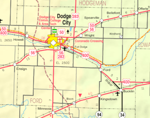
Major highways
Demographics
| Historical population | |||
|---|---|---|---|
| Census | Pop. | %± | |
| 1870 | 427 | — | |
| 1880 | 3,122 | 631.1% | |
| 1890 | 5,308 | 70.0% | |
| 1900 | 5,497 | 3.6% | |
| 1910 | 11,393 | 107.3% | |
| 1920 | 14,273 | 25.3% | |
| 1930 | 20,647 | 44.7% | |
| 1940 | 17,254 | −16.4% | |
| 1950 | 19,670 | 14.0% | |
| 1960 | 20,938 | 6.4% | |
| 1970 | 22,587 | 7.9% | |
| 1980 | 24,315 | 7.7% | |
| 1990 | 27,463 | 12.9% | |
| 2000 | 32,458 | 18.2% | |
| 2010 | 33,848 | 4.3% | |
| Est. 2015 | 34,536 | [5] | 2.0% |
| U.S. Decennial Census[6] 1790-1960[7] 1900-1990[8] 1990-2000[9] 2010-2013[1] | |||

The Dodge City Micropolitan Statistical Area includes all of Ford County.
As of the U.S. Census in 2000,[10] there were 32,458 people, 10,852 households, and 7,856 families residing in the county. The population density was 30 people per square mile (11/km²). There were 11,650 housing units at an average density of 11 per square mile (4/km²). The racial makeup of the county was 74.85% White, 1.62% Black or African American, 0.63% Native American, 2.05% Asian, 0.12% Pacific Islander, 18.17% from other races, and 2.56% from two or more races. Hispanic or Latino of any race were 37.68% of the population.
There were 10,852 households out of which 40.90% had children under the age of 18 living with them, 57.90% were married couples living together, 9.20% had a female householder with no husband present, and 27.60% were non-families. 22.70% of all households were made up of individuals and 9.50% had someone living alone who was 65 years of age or older. The average household size was 2.92 and the average family size was 3.42.
In the county the population was spread out with 31.10% under the age of 18, 11.20% from 18 to 24, 29.40% from 25 to 44, 17.30% from 45 to 64, and 11.00% who were 65 years of age or older. The median age was 30 years. For every 100 females there were 107.20 males. For every 100 females age 18 and over, there were 105.30 males.
The median income for a household in the county was $37,860, and the median income for a family was $42,734. Males had a median income of $27,189 versus $22,165 for females. The per capita income for the county was $15,721. About 9.90% of families and 12.40% of the population were below the poverty line, including 15.40% of those under age 18 and 8.40% of those age 65 or over.
Law and government
Ford County was a prohibition, or "dry", county until the Kansas Constitution was amended in 1986 and voters approved the sale of alcoholic liquor by the individual drink with a 30% food sales requirement.[11]
Education
Unified school districts
Colleges
Communities
Cities
Unincorporated places
Townships
Ford County is divided into fourteen townships. The city of Dodge City is considered governmentally independent and is excluded from the census figures for the townships. In the following table, the population center is the largest city (or cities) included in that township's population total, if it is of a significant size.
| Township | FIPS | Population center |
Population | Population density /km² (/sq mi) |
Land area km² (sq mi) | Water area km² (sq mi) | Water % | Geographic coordinates |
|---|---|---|---|---|---|---|---|---|
| Bloom | 07375 | 113 | 1 (2) | 144 (55) | 0 (0) | 0% | 37°30′23″N 99°55′4″W / 37.50639°N 99.91778°W | |
| Bucklin | 09025 | 900 | 3 (8) | 285 (110) | 0 (0) | 0.02% | 37°34′44″N 99°37′9″W / 37.57889°N 99.61917°W | |
| Concord | 15150 | 117 | 1 (2) | 187 (72) | 0 (0) | 0.11% | 37°36′36″N 100°5′52″W / 37.61000°N 100.09778°W | |
| Dodge | 18225 | 899 | 13 (33) | 70 (27) | 0 (0) | 0.21% | 37°47′0″N 100°0′52″W / 37.78333°N 100.01444°W | |
| Enterprise | 21450 | 1,113 | 6 (17) | 175 (67) | 0 (0) | 0.19% | 37°40′47″N 99°57′8″W / 37.67972°N 99.95222°W | |
| Fairview | 22500 | 346 | 2 (5) | 188 (73) | 0 (0) | 0.06% | 37°45′11″N 100°8′57″W / 37.75306°N 100.14917°W | |
| Ford | 23750 | 456 | 2 (5) | 249 (96) | 0 (0) | 0.01% | 37°36′58″N 99°46′27″W / 37.61611°N 99.77417°W | |
| Grandview | 27350 | 784 | 3 (9) | 226 (87) | 0 (0) | 0.20% | 37°47′10″N 99°55′54″W / 37.78611°N 99.93167°W | |
| Richland | 59300 | 931 | 9 (24) | 99 (38) | 0 (0) | 0.17% | 37°42′10″N 100°2′19″W / 37.70278°N 100.03861°W | |
| Royal | 61575 | 105 | 1 (1) | 185 (72) | 0 (0) | 0.06% | 37°51′51″N 100°6′44″W / 37.86417°N 100.11222°W | |
| Sodville | 66150 | 110 | 1 (2) | 145 (56) | 0 (0) | 0.01% | 37°31′16″N 99°45′6″W / 37.52111°N 99.75167°W | |
| Spearville | 67150 | 1,150 | 2 (6) | 479 (185) | 0 (0) | 0.03% | 37°47′58″N 99°45′4″W / 37.79944°N 99.75111°W | |
| Wheatland | 77675 | 170 | 1 (2) | 193 (74) | 0 (0) | 0% | 37°48′58″N 99°37′22″W / 37.81611°N 99.62278°W | |
| Wilburn | 79100 | 88 | 0 (1) | 187 (72) | 0 (0) | 0% | 37°31′22″N 100°7′10″W / 37.52278°N 100.11944°W | |
| Sources: "Census 2000 U.S. Gazetteer Files". U.S. Census Bureau, Geography Division. | ||||||||
Notable people
Numerous figures of the American Old West lived in Dodge City during its period as a frontier cowtown. These included, most notably, lawmen Wyatt Earp and Bat Masterson as well as gunfighter Doc Holliday.[12]
See also
|
|
References
- 1 2 "State & County QuickFacts". United States Census Bureau. Retrieved July 24, 2014.
- ↑ "Find a County". National Association of Counties. Retrieved 2011-06-07.
- ↑ Gannett, Henry (1905). The Origin of Certain Place Names in the United States. Govt. Print. Off. p. 128.
- ↑ "US Gazetteer files: 2010, 2000, and 1990". United States Census Bureau. 2011-02-12. Retrieved 2011-04-23.
- ↑ "County Totals Dataset: Population, Population Change and Estimated Components of Population Change: April 1, 2010 to July 1, 2015". Retrieved July 2, 2016.
- ↑ "U.S. Decennial Census". United States Census Bureau. Retrieved July 24, 2014.
- ↑ "Historical Census Browser". University of Virginia Library. Retrieved July 24, 2014.
- ↑ "Population of Counties by Decennial Census: 1900 to 1990". United States Census Bureau. Retrieved July 24, 2014.
- ↑ "Census 2000 PHC-T-4. Ranking Tables for Counties: 1990 and 2000" (PDF). United States Census Bureau. Retrieved July 24, 2014.
- ↑ "American FactFinder". United States Census Bureau. Retrieved 2008-01-31.
- ↑ "Map of Wet and Dry Counties". Alcoholic Beverage Control, Kansas Department of Revenue. November 2006. Retrieved 2007-12-28.
- ↑ "More Dodge City History". Dodge City Convention and Visitors Bureau. Retrieved 2011-09-23.
Further reading
- History of the State of Kansas; William G. Cutler; A.T. Andreas Publisher; 1883. (Online HTML eBook)
- Kansas : A Cyclopedia of State History, Embracing Events, Institutions, Industries, Counties, Cities, Towns, Prominent Persons, Etc; 3 Volumes; Frank W. Blackmar; Standard Publishing Co; 944 / 955 / 824 pages; 1912. (Volume1 - Download 54MB PDF eBook), (Volume2 - Download 53MB PDF eBook), (Volume3 - Download 33MB PDF eBook)
External links
| Wikimedia Commons has media related to Ford County, Kansas. |
- County
- Historical
- Ford County History from FCHS, Dodge City, KS
- Ford County GenWeb
- Ford County from American History and Genealogy Project (AHGP)
- Maps
- Ford County Maps: Current, Historic, KDOT
- Kansas Highway Maps: Current, Historic, KDOT
- Kansas Railroad Maps: Current, 1996, 1915, KDOT and Kansas Historical Society
 |
Hodgeman County | Edwards County | | |
| Gray County | |
Kiowa County | ||
| ||||
| | ||||
| Meade County | Clark County |
Municipalities and communities of Ford County, Kansas, United States | ||
|---|---|---|
| Cities | | |
| CDPs | ||
| Other unincorporated communities | ||
| Townships | ||