Gölmarmara
| Gölmarmara | |
|---|---|
| District | |
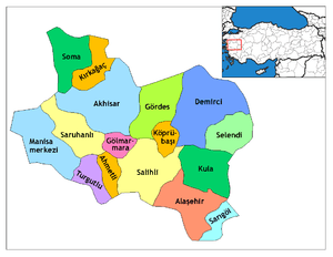 Location of Gölmarmara within Turkey. | |
 Gölmarmara Location of Gölmarmara | |
| Coordinates: 38°43′N 27°55′E / 38.717°N 27.917°ECoordinates: 38°43′N 27°55′E / 38.717°N 27.917°E | |
| Country |
|
| Region | Aegean |
| Province | Manisa |
| Area[1] | |
| • District | 288.34 km2 (111.33 sq mi) |
| Elevation | 91 m (299 ft) |
| Population (2012)[2] | |
| • Urban | 9,699 |
| • District | 15,609 |
| • District density | 54/km2 (140/sq mi) |
| Time zone | EET (UTC+2) |
| • Summer (DST) | EEST (UTC+3) |
| Postal code | 45xxx |
| Area code(s) | 236 |
| Licence plate | 45 |
| Website | www.golmarmara.bel.tr |
Gölmarmara is a town and district of Manisa Province in Turkey's Aegean at a distance of 66 km (41 mi) from the province center of Manisa. The town owes its name to the nearby Lake Marmara, called under various names throughout history. The town of Gölmarmara itself was a mere village in Ottoman times cited under such names as "Marmaracık" or "Mermere". It was made into a township with its own municipality depending the district center of Akhisar at the time of the foundation of the Turkish Republic (1923) and in 1987 a district center by its own right and under the same name, Gölmarmara.
According to the 2000 census, population of the district is 17,831 of which 11,205 live in the town of Gölmarmara.[3][4] The annual rate of increase in population for Gölmarmara town is 0,206% while an annual decrease of 0,381% is registered for its depending villages. The district covers an area of 288 km2 (111 sq mi),[5] and counts 18 eighteen settlements, the district center being the only one with its own municipality and the remainder consisting of 15 villages and two village dependencies (hamlets). Gölmarmara town lies at an elevation of 91 m (299 ft).
Agricultural lands and forest lands each occupy roughly around 11-11,500 hectares in the district area total of 288 km2 and with a few thousand in the fertile plain of the Gediz River valley remaining unused. Lake Marmara, aside from being a recreational center for the province as a whole, is also an important source for fishing and agricultural irrigation. Slightly lower than the town center at 79 m (259 ft), the lake is also an Important Bird Area.
There are six primary schools and two high schools in Gölmarmara with a total teacher's corpus of 117 and a student's corpus of 3094. A small professional higher school depending Celal Bayar University is also located in Gölmarmara, its academic corpus composed of six teachers prodiving education higher education with a professional focus to 144 students.
The town's most important historical building is Halime Hatun Religious Complex built by the Ottoman sultan Mehmed III during his tenure in Manisa (1583-1595) in the name of his wet nurse and his future grand vizier Tekeli Lala Mehmed Pasha's mother-in-law Halime Hatun.
In 2015 an important archaeological discovery was made in the area: it was a Middle and Late Bronze Age city (2000-1200 BC) whose area was approximately 4 times larger than that of Troy.[6]
Notes
- ↑ "Area of regions (including lakes), km²". Regional Statistics Database. Turkish Statistical Institute. 2002. Retrieved 2013-03-05.
- ↑ "Population of province/district centers and towns/villages by districts - 2012". Address Based Population Registration System (ABPRS) Database. Turkish Statistical Institute. Retrieved 2013-02-27.
- ↑ Turkish Statistical Institute. "Census 2000, Key statistics for urban areas of Turkey" (XLS) (in Turkish). Retrieved 2009-04-04.
- ↑ GeoHive. "Statistical information on Turkey's administrative units". Retrieved 2009-04-04.
- ↑ Statoids. "Statistical information on districts of Turkey". Retrieved 2009-04-04.
- ↑ http://www.hurriyetdailynews.com/archaeology-world-excited-about-golmarmara-findings-.aspx?pageID=238&nid=86542
References
- Falling Rain Genomics, Inc. "Geographical information on Gölmarmara, Turkey". Retrieved 2009-04-04.