Leyden Township, Cook County, Illinois
| Leyden Township | |
|---|---|
| Township | |
 Location in Cook County | |
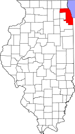 Cook County's location in Illinois | |
| Coordinates: 41°56′17″N 87°52′07″W / 41.93806°N 87.86861°WCoordinates: 41°56′17″N 87°52′07″W / 41.93806°N 87.86861°W | |
| Country | United States |
| State | Illinois |
| County | Cook |
| Area | |
| • Total | 19.84 sq mi (51.39 km2) |
| • Land | 19.84 sq mi (51.39 km2) |
| • Water | 0 sq mi (0 km2) 0% |
| Elevation | 643 ft (196 m) |
| Population (2010) | |
| • Total | 92,890 |
| • Density | 4,682/sq mi (1,807.6/km2) |
| Time zone | CST (UTC-6) |
| • Summer (DST) | CDT (UTC-5) |
| ZIP codes | 60018, 60068, 60131, 60160, 60164, 60171, 60176, 60656, 60706, 60707 |
| GNIS feature ID | 0429252 |
| Website |
www |
Leyden Township is one of 29 townships in Cook County, Illinois, USA. As of the 2010 census, its population was 92,890.[1]
Geography
Leyden Township is located just northwest of the city of Chicago, an edge of which lies within the township but as a separate entity. According to the United States Census Bureau, the township covers an area of 19.84 square miles (51.4 km2).
Cities, towns, villages
- Bensenville (east of Mt. Prospect Rd.)
- Elmwood Park
- Franklin Park
- Melrose Park (north of North Av.)
- Norridge (west edge)
- Northlake (north of North Av.)
- Park Ridge (south edge)
- River Grove
- Rosemont (southeast three-quarters)
- Schiller Park
Adjacent townships
- Maine Township (north)
- Norwood Park Township (northeast)
- Oak Park Township (southeast)
- River Forest Township (southeast)
- Proviso Township (south)
- York Township, DuPage County (southwest)
- Addison Township, DuPage County (west)
Cemeteries
The township contains these five cemeteries: Eden Memorial Park, Elmwood, Fairview Memorial, Memorial Estates and Saint Joseph.
Major highways
Landmarks
- O'Hare International Airport
- Cook County Forest Preserve (south quarter)
Political districts
- Illinois' 4th congressional district
- State House District 65
- State House District 77
- State Senate District 33
- State Senate District 39
References
- "Leyden Township, Cook County, Illinois". Geographic Names Information System. United States Geological Survey. Retrieved 2010-01-10.
- United States Census Bureau 2007 TIGER/Line Shapefiles
- United States National Atlas
- ↑ "Geographic Identifiers: 2010 Demographic Profile Data (DP-1): Leyden township, Cook County, Illinois". U.S. Census Bureau, American Factfinder. Retrieved March 21, 2013.
External links
- Leyden Township official website
- City-Data.com
- Illinois State Archives
- Township Officials of Illinois
- Cool County official site
This article is issued from Wikipedia - version of the 11/17/2016. The text is available under the Creative Commons Attribution/Share Alike but additional terms may apply for the media files.