Wheeling Township, Cook County, Illinois
| Wheeling Township | |
|---|---|
| Township | |
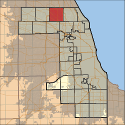 Location in Cook County | |
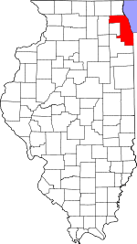 Cook County's location in Illinois | |
| Coordinates: 42°06′37″N 87°56′51″W / 42.11028°N 87.94750°WCoordinates: 42°06′37″N 87°56′51″W / 42.11028°N 87.94750°W | |
| Country | United States |
| State | Illinois |
| County | Cook |
| Government | |
| • Supervisor | Jean-Denis Deletraz |
| Area | |
| • Total | 35.99 sq mi (93.21 km2) |
| • Land | 35.90 sq mi (92.97 km2) |
| • Water | 0.09 sq mi (0.24 km2) 0.26% |
| Elevation | 673 ft (205 m) |
| Population (2010) | |
| • Total | 153,630 |
| • Density | 4,280/sq mi (1,652.5/km2) |
| Time zone | CST (UTC-6) |
| • Summer (DST) | CDT (UTC-5) |
| ZIP codes | 60004, 60005, 60008, 60016, 60025, 60056, 60062, 60067, 60070, 60089, 60090 |
| GNIS feature ID | 0429927 |
| Website |
www |
Wheeling Township is one of 29 townships in Cook County, Illinois, USA. As of the 2010 census, its population was 153,630.[1] It is the northeasternmost and most populated of the six northwest Cook County townships that form the panhandle.
Geography
According to the United States Census Bureau, Wheeling Township covers an area of 35.99 square miles (93.2 km2); of this, 35.9 square miles (93 km2) (99.74 percent) is land and 0.09 square miles (0.23 km2) (0.26 percent) is water.
Cities, towns, villages
- Arlington Heights
- Buffalo Grove
- Des Plaines
- Glenview
- Mount Prospect
- Northbrook
- Palatine (east of Hwy 53)
- Prospect Heights (vast majority)
- Rolling Meadows
- Wheeling (vast majority)
Adjacent townships
- Vernon Township, Lake County (north)
- West Deerfield Township, Lake County (northeast)
- Northfield Township (east)
- Maine Township (southeast)
- Elk Grove Township (south)
- Palatine Township (west)
- Ela Township, Lake County (northwest)
Cemeteries
The township contains these seven cemeteries: English, Memory Gardens, Randhill Park, Saint Marys, Saint Pauls Evangelical Lutheran, Shalom Memorial Park and Wheeling.
Major highways
Airports and landing strips
Lakes
- Potawatomi Lake
Landmarks
- Hersey High School
- Prospect High School
- Buffalo Grove High School
- Wheeling High School
Political districts
- Illinois' 10th congressional district
- State House District 53
- State House District 57
- State House District 59
- State House District 66
- State Senate District 27
- State Senate District 29
- State Senate District 30
- State Senate District 33
References
- "Wheeling Township, Cook County, Illinois". Geographic Names Information System. United States Geological Survey. Retrieved 2010-01-10.
- United States Census Bureau 2007 TIGER/Line Shapefiles
- United States National Atlas
- ↑ "Geographic Identifiers: 2010 Demographic Profile Data (DP-1): Wheeling township, Cook County, Illinois". U.S. Census Bureau, American Factfinder. Retrieved March 21, 2013.
External links
- Wheeling Township official website
- City-Data.com
- Illinois State Archives
- Township Officials of Illinois
- Cook County official site
This article is issued from Wikipedia - version of the 11/17/2016. The text is available under the Creative Commons Attribution/Share Alike but additional terms may apply for the media files.