Palos Township, Cook County, Illinois
| Palos Township | |
|---|---|
| Township | |
 Location in Cook County | |
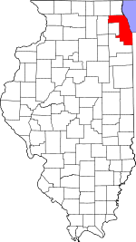 Cook County's location in Illinois | |
| Coordinates: 41°41′05″N 87°51′11″W / 41.68472°N 87.85306°WCoordinates: 41°41′05″N 87°51′11″W / 41.68472°N 87.85306°W | |
| Country | United States |
| State | Illinois |
| County | Cook |
| Area | |
| • Total | 35.37 sq mi (91.62 km2) |
| • Land | 33.91 sq mi (87.83 km2) |
| • Water | 1.46 sq mi (3.79 km2) 4.14% |
| Elevation | 604 ft (184 m) |
| Population (2010) | |
| • Total | 54,615 |
| • Density | 1,610/sq mi (621.8/km2) |
| Time zone | CST (UTC-6) |
| • Summer (DST) | CDT (UTC-5) |
| ZIP codes | 60457, 60462, 60463, 60464, 60465, 60480, 60482 |
| GNIS feature ID | 0429523 |
| Website |
www |
Palos Township is one of 29 townships in Cook County, Illinois, USA. As of the 2010 census, its population was 54,615.[1] In 1850 the small town of Trenton, Illinois, changed its name to Palos. This recommendation was made by M.S. Powell, the local postmaster, whose ancestor supposedly sailed with Christopher Columbus from Palos de la Frontera. When it incorporated as a Village in 1914, Palos officially became Palos Park. The neighboring communities of Palos Hills and Palos Heights incorporated at later points. All three municipalities lie within Palos Township.
Township Duties
According to Illinois law, Townships are responsible for the maintenance of Township roadways, the governance of the General Assistance program and the assessment of real property. In Cook County, Townships are not responsible for assessing real property as the Cook County Assessor performs that function.
Some Townships have adopted other duties including the provision of health services. Palos Township runs a Health Clinic providing low or no cost physical examinations, sick visits, cholesterol tests and screenings, pregnancy tests, blood pressure screening, immunizations and other services.
Geography
According to the United States Census Bureau, Palos Township covers an area of 35.37 square miles (91.6 km2); of this, 33.91 square miles (87.8 km2) (95.86 percent) is land and 1.46 square miles (3.8 km2) (4.14 percent) is water.
Boundaries
Palos Township is bordered by Harlem Avenue (Illinois Route 43) on the east, 135th Street on the south, Will-Cook Road on the west and 87th Street on the north. The northwest border with DuPage County is along the Chicago Sanitary and Ship Canal (managed by the Metropolitan Water Reclamation District of Greater Chicago) which connects Lake Michigan with the Mississippi River.
Cities, towns, villages
- Bridgeview (south quarter)
- Hickory Hills (south three-quarters)
- Orland Park (Small northern section)
- Palos Heights (west half)
- Palos Hills (Entire town)
- Palos Park
- Willow Springs
- Worth (west quarter)
Governance
Palos Township is governed by a Township Board of Trustees sometimes called the Township Board or Town Board. The Town Board consists of five voting members and includes the elected Township Supervisor and four elected Township Trustees.
The Town Board is responsible for providing a budget and taxes sufficient to run the operations of the Township Government each year. The Supervisor is a voting member of the Town Board but is also the Chief Executive Officer and the Chief Financial Officer of the Township.
The Township Clerk, Assessor and Highway Commissioner are elected officials, however they do not have a vote on the Town Board.
Duties and Powers of the Supervisor
The Township Supervisor is the Chief Executive Officer of the Township and is responsible for the day-to-day operations of the Township along with the following other duties:
- Chairing all meetings of the Township Board;
- Serving as Township Treasurer;
- Serving as Supervisor of General Assistance;
- Serving as Supervisor of Buildings and Grounds.
Current Township Elected Officials
- Supervisor Colleen Grant-Schumann (Palos Heights - Republican)
- Clerk Jane Nolan (Palos Hills - Democratic)
- Assessor Robert E. Maloney (Palos Hills - Democratic)
- Highway Commissioner Gene Adams (Palos Park - Republican)
- Trustee Brent Woods (Worth - Republican)
- Trustee Richard C. Riley (Palos Hills - Republican)
- Trustee Sharon M. Brannigan (Palos Heights - Republican)
- Trustee Pam Jeanes (Palos Park - Republican)
Adjacent townships
- Lyons Township (north)
- Stickney Township (northeast)
- Worth Township (east)
- Bremen Township (southeast)
- Orland Township (south)
- Homer Township, Will County (southwest)
- Lemont Township (west)
- Downers Grove Township, DuPage County (northwest)
Cemeteries
The township contains these three cemeteries: Fairmount, Oak Hill and Sacred Heart Catholic.
Major highways
Airports and landing strips
- Palos Community Hospital Heliport
Lakes
- Bull Frog Lake
- Hambone Lake
- Horsetail Lake
- Maple Lake
- Papoose Lake
- Tuma Lake
Landmarks
- Orland Grove Forest Preserve
- Palos Sag-Valley Forest Preserve
These Cook County Forest Preserves woods:
- Burr Oak Woods (west quarter)
- Cherry Hill Woods
- Crooked Creek Woods
- Forty Acres Woods
- Groundhog Slough Woods
- Henry De Tonty
- Hickory Hills Woods
- Hidden Pond Woods
- Mcclaughry Springs Woods
- Mcmahon Woods
- Paddock Woods
- Palos Park Woods
- Paw Paw Woods
- Pioneer Woods
- Pulaski Woods
- Saganashkee Slough Woods
- Spears Woods
- Swallow Cliff Woods
- Tampier Slough Woods (east half)
- White Oak Woods
- Willow Springs Woods
- Wolf Road Woods
Education
- Moraine Valley Community College
- Amos Alonzo Stagg High School - High School District 230
- Carl Sandburg High School - High School District 230
- Conrady Junior High School - North Palos School District 117
- Glen Oaks Elementary School - North Palos School District 117
- Oak Ridge Elementary School - North Palos School District 117
- Dorn Elementary School - North Palos School District 117
- Sorrick Elementary School - North Palos School District 117
- Palos East Elementary School - Palos School District 118
- Palos West Elementary School - Palos School District 118
- Palos South Elementary School - Palos School District 118
- Worthwoods Elementary School - Worth School District 127
Political districts
- Illinois' 1st Congressional District - Congressman Bobby Rush (D)
- Illinois' 3rd Congressional District - Congressman Daniel Lipinski (D)
- State Senate District 14 - Senator Emil Jones, Jr. (D)
- State Senate District 16 - Senator Jacqueline Y. Collins (D)
- State Senate District 18 - Senator William Cunnigham (D)
- State House District 27 - Monique D. Davis (D)
- State House District 31 - Mary E. Flowers (D)
- State House District 32 - André Thapedi (D)
- State House District 35 - Representative Fran Hurley (D)
- State House District 36 - Representative Kelly Burke (D)
- Cook County Board District 6 - Commissioner Joan Patricia Murphy (D)
- Cook County Board District 17 - Commissioner Sean M. Morrison (R)
- Cook County Board of (Tax) Review District 1 - Commissioner Dan Patlak (R)
- 4th Judicial Sub-Circuit
- 15th Judicial Sub-Circuit
References
- "Palos Township, Cook County, Illinois". Geographic Names Information System. United States Geological Survey. Retrieved 2010-01-10.
- United States Census Bureau 2007 TIGER/Line Shapefiles
- United States National Atlas
- ↑ "Geographic Identifiers: 2010 Demographic Profile Data (DP-1): Palos township, Cook County, Illinois". U.S. Census Bureau, American Factfinder. Retrieved March 21, 2013.
External links
- Palos Township official website
- City-Data.com
- Illinois State Archives
- Township Officials of Illinois
- Cook County official site