List of cultural property of national significance in Switzerland: Graubünden
This list contains all cultural property of national significance (class A) in the canton of Graubünden from the 2009 'Swiss Inventory of Cultural Property of National and Regional Significance. It is sorted by municipality and contains 174 individual buildings, 16 collections and 38 archaeological finds. The names are given in either German, Italian or Romansh according to the majority language of the municipality. Some names were translated for clarity.
The geographic coordinates provided are in the Swiss coordinate system as given in the inventory.
Alvaneu
| KGS No.? |
Picture | Name | Street Address | CH1903 X coordinate | CH1903 Y coordinate | Location |
|---|---|---|---|---|---|---|
| Unknown | 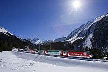 |
UNESCO World Heritage Site Rhaetian Railway in the Albula / Bernina Landscapes (since 2008) |
||||
| Unknown |  |
ISOS vitg: Alvaneu |
Albula/Alvra
| KGS No.? |
Picture | Name | Street Address | CH1903 X coordinate | CH1903 Y coordinate | Location |
|---|---|---|---|---|---|---|
| Unknown | |
UNESCO World Heritage Site Rhaetian Railway in the Albula / Bernina Landscapes (since 2008) |
||||
| 2828 |  |
Church of S. Peder E Conturn | Curt Da Mistail 50 | 762.400 | 170.580 | 46°40′00″N 9°33′39″E / 46.666682°N 9.560961°E |
| 3115 | Catholic Church of St. Francestg E Chasa Pravenda | Veia Principala, Mon | 762.762 | 168.781 | 46°39′01″N 9°33′54″E / 46.650416°N 9.565053°E | |
| 3349 |  |
Catholic Church of St. Stefan E Conturn | Veia Baselgia | 763.490 | 170.040 | 46°39′42″N 9°34′30″E / 46.66156°N 9.575007°E |
| Unknown |  |
ISOS vitg: Alvaschein |
Andeer
| KGS No.? |
Picture | Name | Street Address | CH1903 X coordinate | CH1903 Y coordinate | Location |
|---|---|---|---|---|---|---|
| 2833 |  |
Padrun House | (Giassa Dad Asens) Veia Sgraffito 64 | 752.323 | 163.194 | 46°36′09″N 9°25′37″E / 46.602637°N 9.426882°E |
| Unknown | ISOS vitg: Andeer | |||||
| Unknown | ISOS vitg: Pignia |
Arosa
| KGS No.? |
Picture | Name | Street Address | CH1903 X coordinate | CH1903 Y coordinate | Location |
|---|---|---|---|---|---|---|
| 9613 | Carschlingg, Prehistoric / Late-Roman / Early Middle Ages Settlement | Castiel | 765.000 | 189.750 | 46°50′18″N 9°36′07″E / 46.838422°N 9.601831°E | |
| 9075 | 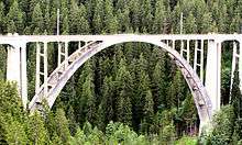 |
Langwieser Viaduct of the Rhatian Railway | Langwies | 772.929 | 187.652 | 46°49′03″N 9°42′18″E / 46.817544°N 9.704932°E |
| Unknown | ISOS Hamlet: Medergen | |||||
| Unknown | ISOS Hamlet: Sapün | |||||
| Unknown | ISOS Hamlet: Strassberg |
Avers
| KGS No.? |
Picture | Name | Street Address | CH1903 X coordinate | CH1903 Y coordinate | Location |
|---|---|---|---|---|---|---|
| 2855 |  |
Swiss Reformed Church | (Chilchawäg) Cresta 105 | 759.477 | 148.783 | 46°28′17″N 9°30′55″E / 46.471379°N 9.51524°E |
| Unknown | ISOS Spezialfall: Averser Hofweiler |
Bergün/Bravuogn
| KGS No.? |
Picture | Name | Street Address | CH1903 X coordinate | CH1903 Y coordinate | Location |
|---|---|---|---|---|---|---|
| 2860 |  |
Swiss Reformed Church | Stugl | 775.500 | 169.140 | 46°39′02″N 9°43′53″E / 46.650418°N 9.731515°E |
| 2864 |  |
Jenatsch House | Unterdorf | 776.620 | 166.857 | 46°37′47″N 9°44′43″E / 46.629595°N 9.745262°E |
| Unknown | |
UNESCO World Heritage Site Rhaetian Railway in the Albula / Bernina Landscapes (since 2008) |
||||
| Unknown | ISOS vitg: Bravuogn | |||||
| Unknown | ISOS fracziun: Latsch | |||||
| Unknown | ISOS fracziun: Stugl |
Bever
| KGS No.? |
Picture | Name | Street Address | CH1903 X coordinate | CH1903 Y coordinate | Location |
|---|---|---|---|---|---|---|
| Unknown | |
UNESCO World Heritage Site Rhaetian Railway in the Albula / Bernina Landscapes (since 2008) |
||||
| Unknown | ISOS vitg: Bever |
Bregaglia
| KGS No.? |
Picture | Name | Street Address | CH1903 X coordinate | CH1903 Y coordinate | Location |
|---|---|---|---|---|---|---|
| 3312 | 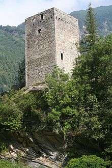 |
Castelmur Castle, Roman Way-Station / Medieval Fortress |
Bondo | 763.340 | 134.400 | 46°20′28″N 9°33′38″E / 46.341112°N 9.560451°E |
| 2879 |  |
Church Swiss Reformed Church di Nossa Donna | Bondo | 763.446 | 134.219 | 46°20′22″N 9°33′42″E / 46.339458°N 9.561763°E |
| 2878 |  |
Palazzo Salis with a garden | Bondo, Villaggio 1 | 762.845 | 133.761 | 46°20′08″N 9°33′14″E / 46.335486°N 9.5538°E |
| 9269 | Antonio House | Soglio, Villaggio 139 | 761.794 | 134.478 | 46°20′32″N 9°32′25″E / 46.342187°N 9.540405°E | |
| 9270 |  |
Battista House | Soglio, Villaggio 131 (Hotel Palazzo Salis) | 761.734 | 134.476 | 46°20′32″N 9°32′23″E / 46.342184°N 9.539625°E |
| 9271 | Di Mezzo House, with Stables | Soglio, Villaggio 137 | 761.771 | 134.477 | 46°20′32″N 9°32′24″E / 46.342184°N 9.540106°E | |
| 3289 | Cas’Alta | Soglio, Villaggio 120 | 761.716 | 134.463 | 46°20′31″N 9°32′22″E / 46.342071°N 9.539387°E | |
| 9612 |  |
Castello Castelmur | Stampa, Coltura | 763.440 | 134.260 | 46°20′23″N 9°33′42″E / 46.339828°N 9.5617°E |
| Unknown | ISOS villaggio: Bondo | |||||
| Unknown | ISOS villaggio: Borgonovo | |||||
| Unknown | ISOS villaggio: Castasegna | |||||
| Unknown | ISOS villaggio: Coltura | |||||
| Unknown | ISOS villaggio: Promontogno | |||||
| Unknown | ISOS villaggio: Soglio | |||||
| Unknown | ISOS villaggio: Stampa | |||||
| Unknown | ISOS villaggio: Vicosoprano |
Breil/Brigels
| KGS No.? |
Picture | Name | Street Address | CH1903 X coordinate | CH1903 Y coordinate | Location |
|---|---|---|---|---|---|---|
| 2883 |  |
Chaplutta S. Sievi | Cuort | 723.980 | 181.660 | 46°46′28″N 9°03′43″E / 46.774572°N 9.062031°E |
Brienz/Brinzauls
| KGS No.? |
Picture | Name | Street Address | CH1903 X coordinate | CH1903 Y coordinate | Location |
|---|---|---|---|---|---|---|
| 2884 | 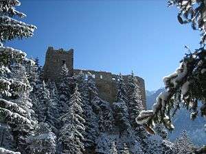 |
Ruins of Belfort Castle | 766.160 | 171.180 | 46°40′16″N 9°36′37″E / 46.671151°N 9.610291°E | |
| 10035 | Tgesa Gronda | Vazerol 66 | 763.552 | 171.025 | 46°40′13″N 9°34′34″E / 46.670402°N 9.576167°E | |
| Unknown | |
UNESCO World Heritage Site Rhaetian Railway in the Albula / Bernina Landscapes (since 2008) |
||||
| Unknown | ISOS vitg: Brienz / Brinzauls |
Brusio
| KGS No.? |
Picture | Name | Street Address | CH1903 X coordinate | CH1903 Y coordinate | Location |
|---|---|---|---|---|---|---|
| 10380 | Casa Di Risch | Via Cantonale 186 | 807.624 | 124.998 | 46°14′40″N 10°07′52″E / 46.244354°N 10.131102°E | |
| 2887 | 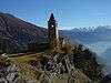 |
Church di S. Romerio e dintorni | Alpe San Romerio | 806.360 | 129.140 | 46°16′55″N 10°07′00″E / 46.28198°N 10.116557°E |
| 2886 | 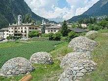 |
Gruppo di 9 «Crot» | La Costa | 807.347 | 126.342 | 46°15′23″N 10°07′41″E / 46.256522°N 10.12811°E |
| Unknown | 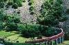 |
UNESCO World Heritage Site Rhaetian Railway in the Albula / Bernina Landscapes (since 2008) |
||||
| Unknown | ISOS casale / piccolo villaggio: Cavaione |
Calanca
| KGS No.? |
Picture | Name | Street Address | CH1903 X coordinate | CH1903 Y coordinate | Location |
|---|---|---|---|---|---|---|
| Unknown | ISOS casale / piccolo villaggio: Landarenca | |||||
| Unknown | ISOS villaggio: Braggio Aira | |||||
| Unknown | ISOS villaggio: Bodio / Cauco |
Calfreisen
| KGS No.? |
Picture | Name | Street Address | CH1903 X coordinate | CH1903 Y coordinate | Location |
|---|---|---|---|---|---|---|
| Unknown | ISOS Dorf: Calfreisen |
Castrisch
| KGS No.? |
Picture | Name | Street Address | CH1903 X coordinate | CH1903 Y coordinate | Location |
|---|---|---|---|---|---|---|
| Unknown | ISOS vitg: Castrisch |
Cazis
| KGS No.? |
Picture | Name | Street Address | CH1903 X coordinate | CH1903 Y coordinate | Location |
|---|---|---|---|---|---|---|
| 2907 | Cresta Prehistoric Settlement |
752.330 | 175.250 | 46°42′40″N 9°25′51″E / 46.711051°N 9.43097°E | ||
| 2911 | 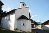 |
Chapel St. Wendelin | Am Dorfplatz 17 | 752.140 | 176.310 | 46°43′14″N 9°25′44″E / 46.720627°N 9.428838°E |
| 2908 |  |
Catholic Burial Church of St. Martin | St. Martinsstrasse | 752.726 | 176.200 | 46°43′10″N 9°26′11″E / 46.719504°N 9.436464°E |
| Unknown | ISOS Dorf: Präz | |||||
| Unknown | ISOS Dorf: Sarn |
Celerina/Schlarigna
| KGS No.? |
Picture | Name | Street Address | CH1903 X coordinate | CH1903 Y coordinate | Location |
|---|---|---|---|---|---|---|
| 2912 | 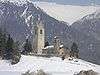 |
Church Swiss Reformed S. Gian E Conturn | Vietta Plaun San Gian | 786.550 | 154.220 | 46°30′48″N 9°52′11″E / 46.513272°N 9.869749°E |
| Unknown | |
UNESCO World Heritage Site Rhaetian Railway in the Albula / Bernina Landscapes (since 2008) |
Chur
| KGS No.? |
Picture | Name | Street Address | CH1903 X coordinate | CH1903 Y coordinate | Location |
|---|---|---|---|---|---|---|
| 9082 | |
Old Armory (Zeughaus 3) | Waffenplatzstrasse 58 | 757.145 | 190.714 | 46°50′56″N 9°29′57″E / 46.848992°N 9.49923°E |
| 2915 | 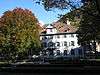 |
Altes Gebäude (Court House) with Garden | Poststrasse 14 | 759.641 | 190.873 | 46°50′59″N 9°31′55″E / 46.849827°N 9.532°E |
| 9614 |  |
Old City, Early Medieval Church, Medieval and Early Modern City |
759.700 | 190.800 | 46°50′57″N 9°31′58″E / 46.849156°N 9.532748°E | |
| 10037 |  |
Antistitium with Hasenstube | Kirchgasse 12, 14 | 759.721 | 190.664 | 46°50′53″N 9°31′59″E / 46.847929°N 9.532975°E |
| 2917, 9332, 8901 |  |
Bishops Manor with Library and Archive | Hof 19–22 | 759.886 | 190.700 | 46°50′54″N 9°32′07″E / 46.848213°N 9.53515°E |
| 8479 |  |
Bündner Art Museum | Postplatz / Bahnhofstrasse 35 | 759.664 | 191.041 | 46°51′05″N 9°31′56″E / 46.851332°N 9.53236°E |
| 8481 |  |
Bündner Natural History Museum | Masanserstrasse 31 | 759.797 | 191.366 | 46°51′15″N 9°32′03″E / 46.854223°N 9.534217°E |
| 2927 | |
Federal Powder Mill | Pulvermühlestrasse 79, 81 | 757.840 | 191.288 | 46°51′14″N 9°30′31″E / 46.853989°N 9.508538°E |
| 2920 | .jpg) |
Gabentempel (Federal Fortification 1863) | Pulvermühlestrasse | 757.373 | 191.267 | 46°51′14″N 9°30′09″E / 46.85391°N 9.502409°E |
| 2941 |  |
Main Post Office | Postplatz / Gäuggelistrasse 1 | 759.572 | 190.960 | 46°51′02″N 9°31′52″E / 46.850626°N 9.531126°E |
| 9103 | 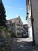 |
Oberer Spaniöl House | Kirchgasse 16 | 759.753 | 190.659 | 46°50′52″N 9°32′00″E / 46.847876°N 9.533393°E |
| 2921 | 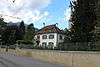 |
Schwartz House with Garden | Jochstrasse 14 | 759.713 | 190.614 | 46°50′51″N 9°31′58″E / 46.847481°N 9.532853°E |
| 9333 |  |
Cantonal Library of Graubünden | Karlihofplatz 1 | 759.801 | 190.851 | 46°50′59″N 9°32′03″E / 46.849591°N 9.534089°E |
| 2925, 8480 | 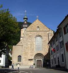 |
Cathedral Mariä-Himmelfahrt and Museum | Hof 18 | 759.920 | 190.640 | 46°50′52″N 9°32′08″E / 46.847665°N 9.535575°E |
| 2923 | 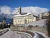 |
Catholic Church St. Luzi | Alte Schanfiggerstrasse 9 | 760.039 | 190.651 | 46°50′52″N 9°32′14″E / 46.847735°N 9.537138°E |
| 2949 |  |
Crematorium auf dem Totengütli | Sandstrasse 50 | 760.250 | 190.060 | 46°50′33″N 9°32′23″E / 46.84237°N 9.539696°E |
| 2926 | 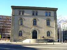 |
Neues Gebäude (Administration Building) | Reichsgasse 35 | 759.771 | 190.907 | 46°51′00″N 9°32′01″E / 46.850102°N 9.533716°E |
| 2929, 8867 | 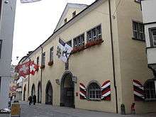 |
Rathaus (Town council house) and City Archive of Chur | Poststrasse 33 | 759.683 | 190.781 | 46°50′56″N 9°31′57″E / 46.84899°N 9.532518°E |
| 2930, 8478 | 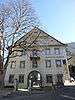 |
Rätisches Museum (Haus Buol) | Hofstrasse 1 / | 759.770 | 190.690 | 46°50′53″N 9°32′01″E / 46.848151°N 9.533627°E |
| 2928 |  |
Swiss Reformed Church of St. Martin | St. Martinsplatz 10 | 759.716 | 190.696 | 46°50′54″N 9°31′59″E / 46.848217°N 9.532921°E |
| 8782 |  |
Regional Archive of Graubünden | Karlihofplatz | 759.800 | 190.890 | 46°51′00″N 9°32′03″E / 46.849942°N 9.53409°E |
| 2932 |  |
Administration Building of the Rhaetian Railway | Bahnhofstrasse 25 | 759.680 | 191.091 | 46°51′06″N 9°31′57″E / 46.851778°N 9.532587°E |
| 2933 |  |
Villa Planta and Sulserbau | Bahnhofstrasse 35 | 759.664 | 191.041 | 46°51′05″N 9°31′56″E / 46.851332°N 9.53236°E |
| 2934 |  |
Welschdörfli Prehistoric Settlement and Roman Vicus |
759.120 | 190.550 | 46°50′49″N 9°31′30″E / 46.847047°N 9.525059°E | |
| Unknown | ISOS Stadt: Chur | |||||
| Unknown | ISOS Spezialfall: Eidgenössische Pulvermühle (Federal Powder Mill) |
Churwalden
| KGS No.? |
Picture | Name | Street Address | CH1903 X coordinate | CH1903 Y coordinate | Location |
|---|---|---|---|---|---|---|
| 2961 | 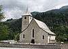 |
Catholic Church St. Maria and Michael | Hauptstrasse | 760.110 | 184.160 | 46°47′22″N 9°32′09″E / 46.78935°N 9.535794°E |
| 3123 | 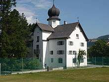 |
Parpan Castle | Mahlerweg 28 / Turrabüel | 761.898 | 181.004 | 46°45′38″N 9°33′29″E / 46.760538°N 9.558085°E |
| 10457 |  |
Wohnturm (tower house) | 760.140 | 184.090 | 46°47′19″N 9°32′10″E / 46.788713°N 9.536162°E |
Davos
| KGS No.? |
Picture | Name | Street Address | CH1903 X coordinate | CH1903 Y coordinate | Location |
|---|---|---|---|---|---|---|
| 8961 | 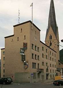 |
Archive of the Landschaft Davos Municipality, Rathaus (Town council house) | 781.900 | 185.240 | 46°47′36″N 9°49′17″E / 46.793466°N 9.821469°E | |
| 9049 | 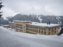 |
Berghotel Schatzalp (Formerly Sanatorium) | Schatzalp 878 | 781.313 | 186.092 | 46°48′05″N 9°48′51″E / 46.801286°N 9.814123°E |
| 2969 |  |
Former Grand Hotel Belvédère | Promenade 89 | 782.286 | 186.052 | 46°48′02″N 9°49′37″E / 46.800661°N 9.826847°E |
| 2968 |  |
Grosses Jenatschhaus (Formerly Pfrundhaus) | Museumstrasse 1 a | 783.507 | 186.923 | 46°48′29″N 9°50′35″E / 46.808157°N 9.843183°E |
| 8482 |  |
Kirchner Museum | Platz, Promenade 82 | 782.280 | 185.995 | 46°48′01″N 9°49′36″E / 46.80015°N 9.826745°E |
| 10458 |  |
Waldfriedhof (Cemetery) | Wildboden | 780.869 | 182.752 | 46°46′17″N 9°48′25″E / 46.771376°N 9.806988°E |
| 2967 | Zürcher Höhenklinik | Klinikstrasse 6 / Clavadel 681 | 781.500 | 182.480 | 46°46′08″N 9°48′54″E / 46.768759°N 9.815137°E | |
| Unknown | ISOS Dorf: Monstein |
Disentis/Mustér
| KGS No.? |
Picture | Name | Street Address | CH1903 X coordinate | CH1903 Y coordinate | Location |
|---|---|---|---|---|---|---|
| 2986 |  |
Catholic Church of St. Gada | Via Sontga Gada | 707.858 | 172.481 | 46°41′41″N 8°50′56″E / 46.694821°N 8.848819°E |
| 2987, 8557, 9303 |  |
Abbey of St. Martin | Via Claustra 3 | 708.366 | 173.800 | 46°42′24″N 8°51′21″E / 46.706602°N 8.85577°E |
| 2988 |  |
Chaplutta St. Luzi | Via Disla | 709.720 | 174.340 | 46°42′40″N 8°52′25″E / 46.711237°N 8.873602°E |
| 2985 |  |
Chaplutta St. Maria | Via Acletta | 706.692 | 173.056 | 46°42′01″N 8°50′01″E / 46.70018°N 8.833711°E |
| 10512 |  |
Punt Russein (shared with Sumvitg) | 711.429 | 175.539 | 46°43′18″N 8°53′46″E / 46.721738°N 8.896239°E | |
| Unknown | ISOS vitg: Segnas | |||||
| Unknown | ISOS fracziun: Cavardiras | |||||
| Unknown | ISOS fracziun: Disla |
Domat/Ems
| KGS No.? |
Picture | Name | Street Address | CH1903 X coordinate | CH1903 Y coordinate | Location |
|---|---|---|---|---|---|---|
| 2993 | 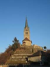 |
Church Catholic St. Gion | Chaplutta E Carner, Crestas | 753.460 | 189.320 | 46°50′14″N 9°27′02″E / 46.837316°N 9.450462°E |
| 2994 |  |
Chaplutta St. Pieder | Via Sogn Pieder | 753.320 | 189.090 | 46°50′07″N 9°26′55″E / 46.83528°N 9.448551°E |
Domleschg
| KGS No.? |
Picture | Name | Street Address | CH1903 X coordinate | CH1903 Y coordinate | Location |
|---|---|---|---|---|---|---|
| 3125 | 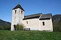 |
Chapel of St. Lorenz | Paspels | 752.660 | 180.340 | 46°45′24″N 9°26′13″E / 46.756748°N 9.43698°E |
| 3126 | 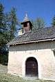 |
Chapel of St. Maria-Magdalena | Dusch, Paspels | 753.650 | 180.340 | 46°45′23″N 9°27′00″E / 46.75652°N 9.449934°E |
| 3157 | 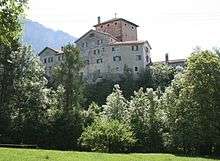 |
Rietberg Castle | Rietberg, Pratval | 753.564 | 178.033 | 46°44′09″N 9°26′53″E / 46.735794°N 9.448035°E |
| 3368 | Catholic Church of St. Maria E Maurezzi | Hauptstrasse, Tomils | 752.780 | 181.090 | 46°45′48″N 9°26′20″E / 46.763465°N 9.438801°E | |
| 3369 | 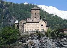 |
Ortenstein Castle | Ortenstein 71, Tomils | 752.522 | 180.672 | 46°45′35″N 9°26′07″E / 46.759765°N 9.435285°E |
| 9617 |  |
St. Murezzi Early Medieval Church |
Tomils | 753.070 | 181.050 | 46°45′47″N 9°26′33″E / 46.763038°N 9.442582°E |
| Unknown | ISOS Spezialfall: Paspels | |||||
| Unknown | ISOS Dorf: Almens | |||||
| Unknown | ISOS Spezialfall: Tumegl /Tomils-Ortenstein |
Duvin
| KGS No.? |
Picture | Name | Street Address | CH1903 X coordinate | CH1903 Y coordinate | Location |
|---|---|---|---|---|---|---|
| Unknown | ISOS vitg: Duvin |
Falera
| KGS No.? |
Picture | Name | Street Address | CH1903 X coordinate | CH1903 Y coordinate | Location |
|---|---|---|---|---|---|---|
| 2998 |  |
Catholic Church St. Rumetg | Planezzas St. Rumetg | 737.060 | 184.701 | 46°47′58″N 9°14′03″E / 46.799358°N 9.234155°E |
| 9615 |  |
Muota e Planezzas (Prehistoric Settlement / Megalithic Site) |
737.130 | 184.743 | 46°47′59″N 9°14′06″E / 46.799721°N 9.235085°E |
Felsberg
| KGS No.? |
Picture | Name | Street Address | CH1903 X coordinate | CH1903 Y coordinate | Location |
|---|---|---|---|---|---|---|
| Unknown | ISOS Dorf: Felsberg |
Fideris
| KGS No.? |
Picture | Name | Street Address | CH1903 X coordinate | CH1903 Y coordinate | Location |
|---|---|---|---|---|---|---|
| 3004 | 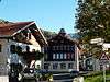 |
Türmlihaus | Hauptstrasse 12 | 775.479 | 198.602 | 46°54′55″N 9°44′33″E / 46.915333°N 9.742546°E |
| 10401 | Wohnhaus | Madinis 41 | 775.784 | 198.690 | 46°54′58″N 9°44′48″E / 46.916043°N 9.746583°E | |
| Unknown | ISOS Dorf: Fideris |
Filisur
| KGS No.? |
Picture | Name | Street Address | CH1903 X coordinate | CH1903 Y coordinate | Location |
|---|---|---|---|---|---|---|
| 10488 |  |
Ruins of Greifenstein Castle | 772.400 | 171.800 | 46°40′31″N 9°41′31″E / 46.675144°N 9.692035°E | |
| Unknown | 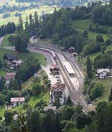 |
UNESCO World Heritage Site Rhaetian Railway in the Albula / Bernina Landscapes (since 2008) |
||||
| 3009 | 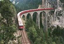 |
Schmittentobel-Landwasserviadukt of the Rhaetian Railway | 771.160 | 172.40 | 46°40′51″N 9°40′34″E / 46.680858°N 9.676059°E | |
| Unknown | ISOS Dorf: Filisur |
Fläsch
| KGS No.? |
Picture | Name | Street Address | CH1903 X coordinate | CH1903 Y coordinate | Location |
|---|---|---|---|---|---|---|
| 3011 |  |
Festung Luziensteig | 758.751 | 211.785 | 47°02′17″N 9°31′39″E / 47.038082°N 9.527637°E | |
| 10477 | Kleine Schanze | Schanze | 759.000 | 210.840 | 47°01′46″N 9°31′50″E / 47.029525°N 9.53058°E | |
| 10476 |  |
Letzi Grafenberg (Fortification) | Talsperre | 757.640 | 212.640 | 47°02′46″N 9°30′48″E / 47.046035°N 9.513321°E |
| Unknown | ISOS Dorf: Fläsch |
Flims
| KGS No.? |
Picture | Name | Street Address | CH1903 X coordinate | CH1903 Y coordinate | Location |
|---|---|---|---|---|---|---|
| 3016 |  |
Schlössli (Currently the Municipal Administration Building) |
Via dil Casti 2 / Via | 740.837 | 188.883 | 46°50′10″N 9°17′06″E / 46.836178°N 9.284906°E |
| Unknown | ISOS Spezialfall: Flims-Waldhaus |
Fürstenau
| KGS No.? |
Picture | Name | Street Address | CH1903 X coordinate | CH1903 Y coordinate | Location |
|---|---|---|---|---|---|---|
| 3020 |  |
Stoffel House | Schlossgass 65 | 753.481 | 176.379 | 46°43′15″N 9°26′47″E / 46.72094°N 9.446396°E |
| 10044 |  |
Oberes Schloss (Upper Castle) or Schauenstein Castle |
Schlossgass 71 | 753.456 | 176.421 | 46°43′17″N 9°26′46″E / 46.721323°N 9.446083°E |
| 3019 |  |
Unteres Schloss (Lower Castle) or Bishop's Castle |
Schlossgass 70 | 753.379 | 176.394 | 46°43′16″N 9°26′42″E / 46.721098°N 9.445067°E |
| Unknown | ISOS Kleinstadt / Flecken: Fürstenau |
Grono
| KGS No.? |
Picture | Name | Street Address | CH1903 X coordinate | CH1903 Y coordinate | Location |
|---|---|---|---|---|---|---|
| 3026 |  |
Torre Fiorenzana (Tower) | 731.983 | 123.528 | 46°15′01″N 9°09′01″E / 46.25023°N 9.150185°E | |
| Unknown | ISOS villaggio: Grono con Pont del Ram e S. Clemente |
Grüsch
| KGS No.? |
Picture | Name | Street Address | CH1903 X coordinate | CH1903 Y coordinate | Location |
|---|---|---|---|---|---|---|
| Unknown | ISOS Dorf: Grüsch / Schmitten (Grüsch, Seewis im Prättigau) |
Haldenstein
| KGS No.? |
Picture | Name | Street Address | CH1903 X coordinate | CH1903 Y coordinate | Location |
|---|---|---|---|---|---|---|
| 3032 |  |
Ruins of Alt-Haldenstein Castle | 758.890 | 194.260 | 46°52′50″N 9°31′24″E / 46.880463°N 9.523337°E | |
| 3030 |  |
Haldenstein Castle | Schlossweg 4 | 759.182 | 194.041 | 46°52′42″N 9°31′38″E / 46.878424°N 9.52709°E |
| Unknown | ISOS Dorf: Haldenstein |
Hinterrhein
| KGS No.? |
Picture | Name | Street Address | CH1903 X coordinate | CH1903 Y coordinate | Location |
|---|---|---|---|---|---|---|
| 3035 | 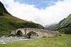 |
Alte Landbrücke (Bridge) | 735.280 | 154.579 | 46°31′44″N 9°12′07″E / 46.528827°N 9.201976°E |
Ilanz/Glion
| KGS No.? |
Picture | Name | Street Address | CH1903 X coordinate | CH1903 Y coordinate | Location |
|---|---|---|---|---|---|---|
| 3044 | 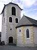 |
Swiss Reformed Church of St. Margreta | Via Porta Cotschna | 734.760 | 181.740 | 46°46′24″N 9°12′11″E / 46.773198°N 9.203163°E |
| 3045 | 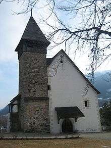 |
Swiss Reformed Church of St. Martin | Via Sogn Martin | 734.650 | 181.080 | 46°46′02″N 9°12′06″E / 46.767285°N 9.201529°E |
| 3134 |  |
Swiss Reformed Church | Sumvitg | 735.910 | 177.050 | 46°43′51″N 9°13′01″E / 46.730787°N 9.216824°E |
| Unknown | ISOS Kleinstadt / Flecken: Ilanz |
Jenins
| KGS No.? |
Picture | Name | Street Address | CH1903 X coordinate | CH1903 Y coordinate | Location |
|---|---|---|---|---|---|---|
| 3051 |  |
Ruins of Neu-Aspermont Castle | 761.710 | 207.990 | 47°00′12″N 9°33′55″E / 47.003243°N 9.565202°E | |
| Unknown | ISOS Dorf: Jenins |
Klosters-Serneus
| KGS No.? |
Picture | Name | Street Address | CH1903 X coordinate | CH1903 Y coordinate | Location |
|---|---|---|---|---|---|---|
| 3053 |  |
Swiss Reformed Church | Am Platz | 786.260 | 193.920 | 46°52′13″N 9°52′56″E / 46.870302°N 9.88209°E |
Küblis
| KGS No.? |
Picture | Name | Street Address | CH1903 X coordinate | CH1903 Y coordinate | Location |
|---|---|---|---|---|---|---|
| 9046 | 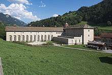 |
Küblis Central Power Plant of the Bündner Kraftwerke |
Büdemji 65 B | 778.477 | 198.505 | 46°54′49″N 9°46′55″E / 46.913662°N 9.781847°E |
| Unknown | ISOS Spezialfall: Village with Kraftwerk |
La Punt-Chamues-ch
| KGS No.? |
Picture | Name | Street Address | CH1903 X coordinate | CH1903 Y coordinate | Location |
|---|---|---|---|---|---|---|
| 3164 | Chasa Albertini | La Punt 324, 325 | 790.596 | 161.683 | 46°34′45″N 9°55′32″E / 46.579233°N 9.925525°E | |
| 3159 | Chesa Merleda | La Punt 345 | 790.665 | 161.686 | 46°34′45″N 9°55′35″E / 46.57924°N 9.926426°E |
Landquart
| KGS No.? |
Picture | Name | Street Address | CH1903 X coordinate | CH1903 Y coordinate | Location |
|---|---|---|---|---|---|---|
| 3039 |  |
Marschlins Castle and Surroundings | Gandastrasse | 763.324 | 202.618 | 46°57′16″N 9°35′04″E / 46.954543°N 9.584484°E |
Lantsch/Lenz
| KGS No.? |
Picture | Name | Street Address | CH1903 X coordinate | CH1903 Y coordinate | Location |
|---|---|---|---|---|---|---|
| 3061 | 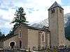 |
Veglia Catholic Church of S. Maria | Cun Santeri, Sumvoi 133 | 762.170 | 172.360 | 46°40′58″N 9°33′31″E / 46.682744°N 9.558586°E |
Lohn
| KGS No.? |
Picture | Name | Street Address | CH1903 X coordinate | CH1903 Y coordinate | Location |
|---|---|---|---|---|---|---|
| Unknown | ISOS vitg: Lohn |
Lumnezia
| KGS No.? |
Picture | Name | Street Address | CH1903 X coordinate | CH1903 Y coordinate | Location |
|---|---|---|---|---|---|---|
| 10043 | 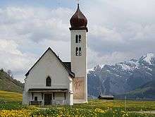 |
Chaplutta St. Bistgaun (Saint Sebastian Chapel) | Degen | 732.580 | 174.520 | 46°42′31″N 9°10′21″E / 46.708704°N 9.172538°E |
| 3074 |  |
Crestaulta E Cresta Petschna (Bronze Age Alpine Settlements) |
727.940 | 169.520 | 46°39′53″N 9°06′38″E / 46.664643°N 9.110481°E | |
| 10402 | Chasa dubla | Fontauna 30 | 729.756 | 171.629 | 46°41′00″N 9°08′05″E / 46.68326°N 9.1348°E | |
| 10061 | 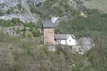 |
Catholic Church of St. Luregn | 733.186 | 173.761 | 46°42′06″N 9°10′49″E / 46.701758°N 9.180241°E | |
| 3389 |  |
Catholic Church of St. Vincenz | Pleif | 733.060 | 175.270 | 46°42′55″N 9°10′45″E / 46.715354°N 9.179031°E |
| 3412 |  |
Catholic Church of St. Maria E Carner | Via Principala | 727.110 | 168.450 | 46°39′19″N 9°05′58″E / 46.655178°N 9.099342°E |
| Unknown | ISOS vitg: Lumbrein | |||||
| Unknown | ISOS vitg: Degen | |||||
| Unknown | ISOS vitg: Tersnaus | |||||
| Unknown | ISOS vitg: Vella | |||||
| Unknown | ISOS vitg: Vrin |
Luven
| KGS No.? |
Picture | Name | Street Address | CH1903 X coordinate | CH1903 Y coordinate | Location |
|---|---|---|---|---|---|---|
| Unknown | ISOS vitg: Luven |
Luzein
| KGS No.? |
Picture | Name | Street Address | CH1903 X coordinate | CH1903 Y coordinate | Location |
|---|---|---|---|---|---|---|
| 10489 |  |
Ruins of Castels Castle | Putz | 775.640 | 199.650 | 46°55′29″N 9°44′42″E / 46.924713°N 9.745064°E |
| 3080 | Sprecher-House | Rathausgasse 66 | 777.120 | 199.300 | 46°55′16″N 9°45′52″E / 46.921173°N 9.764351°E | |
| Unknown | ISOS Dorf: Luzein | |||||
| Unknown | ISOS Weiler: Putz |
Maienfeld
| KGS No.? |
Picture | Name | Street Address | CH1903 X coordinate | CH1903 Y coordinate | Location |
|---|---|---|---|---|---|---|
| 3084 |  |
Brandis Castle | 759.090 | 208.270 | 47°00′23″N 9°31′51″E / 47.006394°N 9.530862°E | |
| 3085 | 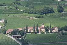 |
Salenegg Castle | Steigstrasse 21 | 758.907 | 208.737 | 47°00′38″N 9°31′43″E / 47.010637°N 9.52862°E |
| Unknown | ISOS Kleinstadt / Flecken: Maienfeld |
Malans
| KGS No.? |
Picture | Name | Street Address | CH1903 X coordinate | CH1903 Y coordinate | Location |
|---|---|---|---|---|---|---|
| 10478 | 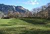 |
Rohan-Schanze | 761.220 | 204.760 | 46°58′28″N 9°33′27″E / 46.974318°N 9.557614°E | |
| 3095 | Bothmar Castle with Neighboring Buildings and Park | Rüfigasse 103 | 762.572 | 206.034 | 46°59′08″N 9°34′33″E / 46.985444°N 9.575831°E | |
| Unknown | ISOS Dorf: Malans |
Medel (Lucmagn)
| KGS No.? |
Picture | Name | Street Address | CH1903 X coordinate | CH1903 Y coordinate | Location |
|---|---|---|---|---|---|---|
| Unknown | ISOS vitg: Curaglia |
Mesocco
| KGS No.? |
Picture | Name | Street Address | CH1903 X coordinate | CH1903 Y coordinate | Location |
|---|---|---|---|---|---|---|
| 3109 |  |
Mesocco Castle | 738.050 | 138.150 | 46°22′50″N 9°13′59″E / 46.380512°N 9.233171°E | |
| 3110 |  |
Church di St. Maria al Castello | 738.050 | 138.200 | 46°22′51″N 9°13′59″E / 46.380961°N 9.233186°E | |
| Unknown | ISOS villaggio: Mesocco |
Mutten
| KGS No.? |
Picture | Name | Street Address | CH1903 X coordinate | CH1903 Y coordinate | Location |
|---|---|---|---|---|---|---|
| Unknown | |
UNESCO World Heritage Site Rhaetian Railway in the Albula / Bernina Landscapes (since 2008) |
||||
| Unknown | ISOS Weiler: Obermutten |
Pontresina
| KGS No.? |
Picture | Name | Street Address | CH1903 X coordinate | CH1903 Y coordinate | Location |
|---|---|---|---|---|---|---|
| 3135 | 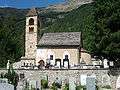 |
Swiss Reformed Church of St. Maria Cun Santeri | Giarsun | 789.690 | 151.730 | 46°29′24″N 9°54′35″E / 46.490002°N 9.90962°E |
| 3136 | 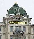 |
Grand Hotel Kronenhof | Via Maistra 1 | 789.040 | 152.120 | 46°29′37″N 9°54′05″E / 46.493692°N 9.901318°E |
| 10048 | 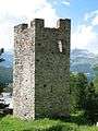 |
Tuor Spagnöla | Giarsun | 789.698 | 151.655 | 46°29′22″N 9°54′35″E / 46.489325°N 9.909693°E |
| Unknown | 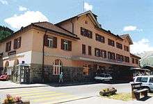 |
UNESCO World Heritage Site Rhaetian Railway in the Albula / Bernina Landscapes (since 2008) |
||||
| Unknown | ISOS Village urban: Pontresina |
Poschiavo
| KGS No.? |
Picture | Name | Street Address | CH1903 X coordinate | CH1903 Y coordinate | Location |
|---|---|---|---|---|---|---|
| 10049 | Casa Tomé | Via Pontonali 218 | 801.628 | 133.855 | 46°19′33″N 10°03′26″E / 46.325807°N 10.057241°E | |
| 3141 | 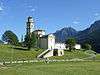 |
Catholic Church di St. Maria Assunta | Via da San Maria | 801.890 | 133.270 | 46°19′14″N 10°03′37″E / 46.320469°N 10.060387°E |
| 3142 |  |
Catholic Collegiate church di St. Vittore | Via dal Cunvent 476 | 801.710 | 133.886 | 46°19′34″N 10°03′30″E / 46.326061°N 10.058318°E |
| 3143 |  |
Catholic Parish church di St. Carlo Borromeo | Via Principale | 801.930 | 135.830 | 46°20′37″N 10°03′43″E / 46.343473°N 10.062018°E |
| 3138 | Devon House | Via di Palaz 104 | 801.766 | 133.578 | 46°19′24″N 10°03′32″E / 46.323275°N 10.058911°E | |
| 10378 | House | Li Curt | 802.083 | 132.241 | 46°18′40″N 10°03′45″E / 46.31116°N 10.062444°E | |
| 10050 | Mulino di Aino Sawmill and Forge |
Privilasco 427 | 801.759 | 135.260 | 46°20′18″N 10°03′34″E / 46.3384°N 10.05955°E | |
| 3140 | _in_Poschiavo.jpg) |
Palazzo De Bassus Mengotti (Museo) | 801.580 | 133.940 | 46°19′36″N 10°03′24″E / 46.326586°N 10.056655°E | |
| 9267 | Palazzo Dorizzi (Crameri) | Lino, Strada cantonale 473 | 801.855 | 135.807 | 46°20′36″N 10°03′40″E / 46.343289°N 10.061034°E | |
| 3144 | Vecchio Monastero con cappella monastica di St. Maria Presentata | Via da Sotsassa | 801.777 | 133.872 | 46°19′33″N 10°03′33″E / 46.325915°N 10.059182°E | |
| Unknown | 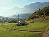 |
UNESCO World Heritage Site Rhaetian Railway in the Albula / Bernina Landscapes (since 2008) |
||||
| Unknown | ISOS casale / piccolo villaggio: Cantone | |||||
| Unknown | ISOS villaggio: Prada | |||||
| Unknown | ISOS villaggio: San Carlo | |||||
| Unknown | ISOS borgo : Poschiavo |
Rhäzüns
| KGS No.? |
Picture | Name | Street Address | CH1903 X coordinate | CH1903 Y coordinate | Location |
|---|---|---|---|---|---|---|
| 3168 |  |
Catholic Church of St. Georg with Frescoes | 750.390 | 185.470 | 46°48′12″N 9°24′32″E / 46.803396°N 9.408965°E | |
| 3169 | 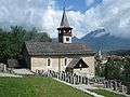 |
Catholic Church St. Paul | Via Mulin Sura | 749.380 | 184.580 | 46°47′44″N 9°23′44″E / 46.79562°N 9.395447°E |
Riom-Parsonz
| KGS No.? |
Picture | Name | Street Address | CH1903 X coordinate | CH1903 Y coordinate | Location |
|---|---|---|---|---|---|---|
| 3172 |  |
Chastè Da Riom, Riom Castle |
764.360 | 164.250 | 46°36′33″N 9°35′03″E / 46.609281°N 9.5843°E | |
| Unknown | ISOS vitg: Riom |
Rossa
| KGS No.? |
Picture | Name | Street Address | CH1903 X coordinate | CH1903 Y coordinate | Location |
|---|---|---|---|---|---|---|
| 3177 | Catholic Parish Church Di St. Domenica E Ossario | 729.630 | 134.770 | 46°21′06″N 9°07′22″E / 46.351793°N 9.122811°E | ||
| Unknown | ISOS villaggio: Augio | |||||
| Unknown | ISOS villaggio: Rossa |
Rothenbrunnen
| KGS No.? |
Picture | Name | Street Address | CH1903 X coordinate | CH1903 Y coordinate | Location |
|---|---|---|---|---|---|---|
| 10479 |  |
Hochjuvalt Castle Ruined Castle / Tower |
751.380 | 182.680 | 46°46′41″N 9°25′16″E / 46.778082°N 9.421006°E |
Roveredo
| KGS No.? |
Picture | Name | Street Address | CH1903 X coordinate | CH1903 Y coordinate | Location |
|---|---|---|---|---|---|---|
| 3184 | 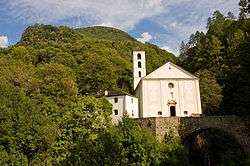 |
Church of Madonna Del Ponte Chiuso | San Fedele | 730.460 | 121.240 | 46°13′48″N 9°07′47″E / 46.22995°N 9.129802°E |
| Unknown | ISOS villaggio urbanizzato (Roveredo con Ai Rogg |
Safiental
| KGS No.? |
Picture | Name | Street Address | CH1903 X coordinate | CH1903 Y coordinate | Location |
|---|---|---|---|---|---|---|
| 9102 |  |
Türelihus | No. 69, Valendas | 740.800 | 183.550 | 46°47′18″N 9°16′58″E / 46.788226°N 9.282778°E |
| 3379 |  |
House with Stables | Haus Joos, Fraissa | 740.700 | 183.520 | 46°47′17″N 9°16′53″E / 46.787978°N 9.28146°E |
| 3342 | 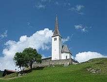 |
Swiss Reformed Church | Mitte 34, Tenna | 745.268 | 179.112 | 46°44′50″N 9°20′24″E / 46.747357°N 9.339867°E |
| Unknown | ISOS Dorf: Valendas | |||||
| Unknown | ISOS Weiler: Brün |
Sagogn
| KGS No.? |
Picture | Name | Street Address | CH1903 X coordinate | CH1903 Y coordinate | Location |
|---|---|---|---|---|---|---|
| 3196 |  |
Church Catholic of St. Maria | Cun Chasa Pravenda, Sil Plaz | 738.600 | 183.580 | 46°47′20″N 9°15′14″E / 46.788958°N 9.253983°E |
| 3197 |  |
Schiedberg Castle/Bregl da Haida Prehistoric Settlement / Medieval Castle and Church |
739.550 | 183.980 | 46°47′32″N 9°16′00″E / 46.792357°N 9.266543°E | |
| Unknown | ISOS vitg: Sagogn |
Samedan
| KGS No.? |
Picture | Name | Street Address | CH1903 X coordinate | CH1903 Y coordinate | Location |
|---|---|---|---|---|---|---|
| 10055 |  |
Catholic Church of Herz-Jesu | Surtuor | 786.320 | 156.520 | 46°32′02″N 9°52′04″E / 46.534016°N 9.867682°E |
| 9302 |  |
Biblioteca da la Fundaziun de Planta | Mulins 2 | 786.640 | 156.572 | 46°32′04″N 9°52′19″E / 46.534395°N 9.871872°E |
| Unknown | |
UNESCO World Heritage Site Rhaetian Railway in the Albula / Bernina Landscapes (since 2008) |
||||
| Unknown | ISOS Village urban: Samedan |
San Vittore
| KGS No.? |
Picture | Name | Street Address | CH1903 X coordinate | CH1903 Y coordinate | Location |
|---|---|---|---|---|---|---|
| 3207 | Chapel of St. Lucio e dintorni | Pala | 728.565 | 122.211 | 46°14′21″N 9°06′20″E / 46.239047°N 9.105512°E | |
| 3211 | Torre di Pala | Pala | 728.550 | 122.300 | 46°14′23″N 9°06′19″E / 46.239851°N 9.105342°E | |
| Unknown | ISOS villaggio: San Vittore |
Santa Maria in Calanca
| KGS No.? |
Picture | Name | Street Address | CH1903 X coordinate | CH1903 Y coordinate | Location |
|---|---|---|---|---|---|---|
| 3213 |  |
Castello or Torre di Sta. Maria | 731.620 | 124.860 | 46°15′44″N 9°08′45″E / 46.26228°N 9.145855°E | |
| 3212 | 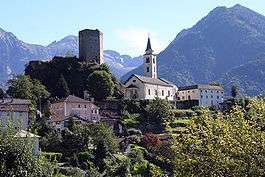 |
Parish Church of St. Maria Assunt | 731.630 | 124.830 | 46°15′43″N 9°08′46″E / 46.262009°N 9.145977°E |
S-chanf
| KGS No.? |
Picture | Name | Street Address | CH1903 X coordinate | CH1903 Y coordinate | Location |
|---|---|---|---|---|---|---|
| 10406 | Chasa Dubla Cun Stallas E Clavads Twin Homes and Barn |
Susauna 216, 217 | 795.329 | 168.217 | 46°38′12″N 9°59′24″E / 46.636613°N 9.990011°E | |
| 10404 | Chasa cun stalla e clavà House with Barn |
Bügl Suot 107 | 795.113 | 165.531 | 46°36′45″N 9°59′10″E / 46.612527°N 9.986052°E | |
| Unknown | ISOS vitg: S-chanf |
Scharans
| KGS No.? |
Picture | Name | Street Address | CH1903 X coordinate | CH1903 Y coordinate | Location |
|---|---|---|---|---|---|---|
| 3239 | Bardill House (Formerly Gees House) | Davos Cresta 37 | 754.475 | 175.894 | 46°42′59″N 9°27′33″E / 46.716349°N 9.459229°E | |
| Unknown | ISOS Dorf: Scharans |
Schiers
| KGS No.? |
Picture | Name | Street Address | CH1903 X coordinate | CH1903 Y coordinate | Location |
|---|---|---|---|---|---|---|
| 3243 |  |
Salginatobel Bridge | 773.422 | 205.931 | 46°58′54″N 9°43′06″E / 46.981771°N 9.718351°E |
Schluein
| KGS No.? |
Picture | Name | Street Address | CH1903 X coordinate | CH1903 Y coordinate | Location |
|---|---|---|---|---|---|---|
| 3246 | 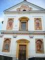 |
Catholic Church of Sts. Peter and Paul | Via Principala | 736.643 | 183.525 | 46°47′20″N 9°13′42″E / 46.788867°N 9.228343°E |
Schmitten
| KGS No.? |
Picture | Name | Street Address | CH1903 X coordinate | CH1903 Y coordinate | Location |
|---|---|---|---|---|---|---|
| 10499 |  |
Schmittentobel-Landwasserviadukt of the Rhaetian Railway | 771.160 | 172.400 | 46°40′51″N 9°40′34″E / 46.680858°N 9.676059°E | |
| Unknown | 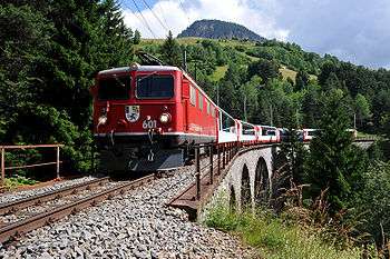 |
UNESCO World Heritage Site Rhaetian Railway in the Albula / Bernina Landscapes (since 2008) |
Scuol
| KGS No.? |
Picture | Name | Street Address | CH1903 X coordinate | CH1903 Y coordinate | Location |
|---|---|---|---|---|---|---|
| 3248 | 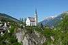 |
Swiss Reformed Church | Cun Conturn, Munt Baselgia / Plaz | 818.352 | 186.593 | 46°47′41″N 10°17′57″E / 46.794673°N 10.29924°E |
| 10057 |  |
Chasa Wieland | Porta 29 | 818.443 | 186.642 | 46°47′42″N 10°18′02″E / 46.795084°N 10.300454°E |
| 3249 | Chasa da cura Bogn Tarasp cun edifizis daspera | Nairs 500 | 816.577 | 185.973 | 46°47′23″N 10°16′33″E / 46.789679°N 10.275712°E | |
| 9611 |  |
Steinsberg Castle Prehistoric Settlement / Medieval Castle / Church |
Ardez | 811.240 | 184.080 | 46°46′28″N 10°12′18″E / 46.774376°N 10.204983°E |
| 10379 | 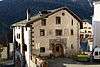 |
Dubla cun stallas e clavads House | Fusch 155, Ardez | 810.798 | 184.182 | 46°46′32″N 10°11′57″E / 46.775433°N 10.199246°E |
| 3338 |  |
Tarasp Castle | Sparsels 140 | 815.555 | 184.741 | 46°46′44″N 10°15′42″E / 46.778936°N 10.261755°E |
| 3341 | 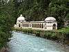 |
Bavetta | Bogn Tarasp | 816.840 | 185.880 | 46°47′20″N 10°16′45″E / 46.788758°N 10.27911°E |
| Unknown | ISOS cas spezial: Tarasp | |||||
| Unknown | ISOS cas spezial: Vulpera | |||||
| Unknown | ISOS vitg: Ardez | |||||
| Unknown | ISOS fracziun: Bos-cha | |||||
| Unknown | ISOS fracziun: Sur En | |||||
| Unknown | ISOS Village urban: Scuol | |||||
| Unknown | ISOS vitg: Guarda | |||||
| Unknown | ISOS vitg: Sent |
Seewis im Prättigau
| KGS No.? |
Picture | Name | Street Address | CH1903 X coordinate | CH1903 Y coordinate | Location |
|---|---|---|---|---|---|---|
| 3256 |  |
Ruins of Fracstein Castle | 765.580 | 205.050 | 46°58′33″N 9°36′54″E / 46.975852°N 9.614996°E | |
| Unknown | ISOS Dorf: Seewis im Prättigau | |||||
| Unknown | ISOS Dorf: Grüsch / Schmitten (Grüsch |
Sils im Domleschg
| KGS No.? |
Picture | Name | Street Address | CH1903 X coordinate | CH1903 Y coordinate | Location |
|---|---|---|---|---|---|---|
| 10058 |  |
Ehrenfels Castle | 753.960 | 173.700 | 46°41′48″N 9°27′06″E / 46.696738°N 9.45176°E | |
| 3270 |  |
Carschenna Prehistoric Petroglyphs |
754.500 | 173.400 | 46°41′38″N 9°27′31″E / 46.693916°N 9.458716°E | |
| 3271 |  |
Ruins of Hohenrätien Castle | 753.430 | 173.140 | 46°41′31″N 9°26′41″E / 46.691825°N 9.444645°E | |
| 3269 |  |
Ruins of Campell or Campi Castle | 755.440 | 174.180 | 46°42′03″N 9°28′17″E / 46.700712°N 9.471265°E | |
| Unknown | |
UNESCO World Heritage Site Rhaetian Railway in the Albula / Bernina Landscapes (since 2008) |
||||
| Unknown | ISOS Spezialfall: Campi | |||||
| Unknown | ISOS Spezialfall: Sils im Domleschg |
Soazza
| KGS No.? |
Picture | Name | Street Address | CH1903 X coordinate | CH1903 Y coordinate | Location |
|---|---|---|---|---|---|---|
| 10059 | Casa Paret | Ospizi 114 | 737.155 | 136.513 | 46°21′58″N 9°13′16″E / 46.365973°N 9.221058°E | |
| 3284 | 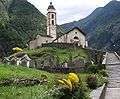 |
Catholic Parish Church of St. Martino | ossario e oratorio della Madonna Addolorata | 737.350 | 136.280 | 46°21′50″N 9°13′25″E / 46.363838°N 9.223522°E |
| 3286 | Ospizio e Via Crucis | Ospizi 118 | 737.118 | 136.506 | 46°21′57″N 9°13′14″E / 46.365918°N 9.220575°E | |
| Unknown | ISOS villaggio: Soazza |
Splügen
| KGS No.? |
Picture | Name | Street Address | CH1903 X coordinate | CH1903 Y coordinate | Location |
|---|---|---|---|---|---|---|
| 10555 | 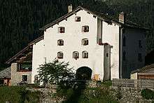 |
Former Säumerherberge Weiss Kreuz Seamstress Hostel, Weiss Kreuz |
Oberdorf 66 | 744.449 | 157.551 | 46°33′13″N 9°19′21″E / 46.553638°N 9.322377°E |
| Unknown | ISOS Dorf: Splügen |
St. Antönien
| KGS No.? |
Picture | Name | Street Address | CH1903 X coordinate | CH1903 Y coordinate | Location |
|---|---|---|---|---|---|---|
| 10405 | House with Barn | Berawis 68 | 780.504 | 203.811 | 46°57′39″N 9°48′38″E / 46.960822°N 9.81055°E |
St. Moritz
| KGS No.? |
Picture | Name | Street Address | CH1903 X coordinate | CH1903 Y coordinate | Location |
|---|---|---|---|---|---|---|
| 3303, 8607 | 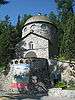 |
Segantini Museum | Via Somplaz 30 | 783.818 | 151.851 | 46°29′34″N 9°50′00″E / 46.492728°N 9.833225°E |
| Unknown | |
UNESCO World Heritage Site Rhaetian Railway in the Albula / Bernina Landscapes (since 2008) |
Stierva
| KGS No.? |
Picture | Name | Street Address | CH1903 X coordinate | CH1903 Y coordinate | Location |
|---|---|---|---|---|---|---|
| Unknown | ISOS vitg: Stierva |
Sumvitg
| KGS No.? |
Picture | Name | Street Address | CH1903 X coordinate | CH1903 Y coordinate | Location |
|---|---|---|---|---|---|---|
| 9070 | |
Punt Russein (Shared with Disentis/Mustér) | 711.429 | 175.539 | 46°43′18″N 8°53′46″E / 46.721738°N 8.896239°E | |
| Unknown | ISOS vitg: Sumvitg |
Surava
| KGS No.? |
Picture | Name | Street Address | CH1903 X coordinate | CH1903 Y coordinate | Location |
|---|---|---|---|---|---|---|
| Unknown | |
UNESCO World Heritage Site Rhaetian Railway in the Albula / Bernina Landscapes (since 2008) |
Surses
| KGS No.? |
Picture | Name | Street Address | CH1903 X coordinate | CH1903 Y coordinate | Location |
|---|---|---|---|---|---|---|
| 2873 |  |
Julier Pass Roman Religious Center / Mountain Pass |
Römisches Passheiligtum / Strasse | 775.820 | 149.340 | 46°28′20″N 9°43′41″E / 46.472297°N 9.728142°E |
| 3203 | Chasa Fontana | No. 26, Salouf | 763.686 | 165.946 | 46°37′29″N 9°34′34″E / 46.624698°N 9.576109°E | |
| 3220 | 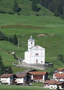 |
Catholic Church of St. Martegn | Veia Son Martegn, Savognin | 765.000 | 162.290 | 46°35′29″N 9°35′31″E / 46.591499°N 9.591949°E |
| 3221 | Padnal / Mot la Cresta Bronze Age Alpine Settlement |
766.100 | 162.370 | 46°35′31″N 9°36′23″E / 46.591946°N 9.606326°E | ||
| 3350 |  |
Catholic Church of S. Plasch Cun Chasa Pravenda | Julierstrasse 57, Tinizong-Rona | 766.907 | 161.388 | 46°34′58″N 9°36′59″E / 46.582915°N 9.616496°E |
| 9529 | Chasa Cresta | Sumvei 5, Tinizong-Rona | 767.271 | 161.083 | 46°34′48″N 9°37′16″E / 46.580081°N 9.621132°E | |
| Unknown | ISOS vitg: Salouf |
Susch
| KGS No.? |
Picture | Name | Street Address | CH1903 X coordinate | CH1903 Y coordinate | Location |
|---|---|---|---|---|---|---|
| 3332 | 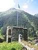 |
Fortezza (Schanzen) | 802.050 | 180.864 | 46°44′54″N 10°05′00″E / 46.748315°N 10.083306°E |
Tamins
| KGS No.? |
Picture | Name | Street Address | CH1903 X coordinate | CH1903 Y coordinate | Location |
|---|---|---|---|---|---|---|
| Unknown | ISOS Dorf: Tamins | |||||
| Unknown | ISOS Spezialfall: Reichenau |
Thusis
| KGS No.? |
Picture | Name | Street Address | CH1903 X coordinate | CH1903 Y coordinate | Location |
|---|---|---|---|---|---|---|
| Unknown | |
UNESCO World Heritage Site Rhaetian Railway in the Albula / Bernina Landscapes (since 2008) |
Trin
| KGS No.? |
Picture | Name | Street Address | CH1903 X coordinate | CH1903 Y coordinate | Location |
|---|---|---|---|---|---|---|
| 3353 |  |
Crap Sogn Parcazi Ruined Castle and Fortified Church |
745.850 | 188.230 | 46°49′45″N 9°21′01″E / 46.829226°N 9.350389°E |
Trun
| KGS No.? |
Picture | Name | Street Address | CH1903 X coordinate | CH1903 Y coordinate | Location |
|---|---|---|---|---|---|---|
| 3354 |  |
Cuort Ligia Grischa | Via Principala 74 | 718.071 | 177.976 | 46°44′33″N 8°59′01″E / 46.742513°N 8.983729°E |
| Unknown | ISOS Village urban: Trun | |||||
| Unknown | ISOS vitg: Schlans |
Untervaz
| KGS No.? |
Picture | Name | Street Address | CH1903 X coordinate | CH1903 Y coordinate | Location |
|---|---|---|---|---|---|---|
| 3370 |  |
Ruins of Neuburg Castle | 760.390 | 197.890 | 46°54′46″N 9°32′39″E / 46.912744°N 9.544287°E |
Val Müstair
| KGS No.? |
Picture | Name | Street Address | CH1903 X coordinate | CH1903 Y coordinate | Location |
|---|---|---|---|---|---|---|
| 3118 | 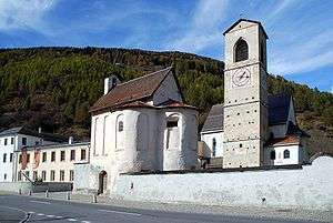 |
Benedictine Convent of Saint John | Via Maistra | 830.450 | 168.660 | 46°37′46″N 10°26′55″E / 46.629398°N 10.448564°E |
| Unknown | -_Clostra_San_Jon_(Kloster_St_Johann).jpg) |
UNESCO World Heritage Site Benedictine Convent of Saint John (since 1983) |
||||
| Unknown | ISOS Village urban: Müstair | |||||
| Unknown | ISOS vitg: Santa Maria Val Müstair |
Vals
| KGS No.? |
Picture | Name | Street Address | CH1903 X coordinate | CH1903 Y coordinate | Location |
|---|---|---|---|---|---|---|
| 10407 | 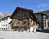 |
Double House | Platz 81 | 733.431 | 164.423 | 46°37′04″N 9°10′51″E / 46.617729°N 9.180732°E |
Valsot
| KGS No.? |
Picture | Name | Street Address | CH1903 X coordinate | CH1903 Y coordinate | Location |
|---|---|---|---|---|---|---|
| 3166 |  |
Chastè Da Tschanüff Tschanüff Castle |
824.020 | 191.080 | 46°49′59″N 10°22′32″E / 46.833124°N 10.375629°E | |
| 3167 | Mottata, Prehistoric Alpine Settlement / Cultivated Terraces |
825.880 | 191.780 | 46°50′20″N 10°24′01″E / 46.838787°N 10.400338°E | ||
| 3165 |  |
Swiss Reformed Church of St. Flurin | Sot Baselgia | 824.521 | 191.215 | 46°50′03″N 10°22′56″E / 46.834169°N 10.382258°E |
| 10064 |  |
Museum Stamparia Da Strada | Strada 154 | 828.320 | 194.470 | 46°51′44″N 10°26′01″E / 46.862134°N 10.433648°E |
| Unknown | ISOS vitg: Ramosch | |||||
| Unknown | ISOS vitg: Tschlin |
Vaz/Obervaz
| KGS No.? |
Picture | Name | Street Address | CH1903 X coordinate | CH1903 Y coordinate | Location |
|---|---|---|---|---|---|---|
| 3385 | Catholic Church of St. Leza | Pizzogna | 759.920 | 173.940 | 46°41′51″N 9°31′47″E / 46.697495°N 9.529738°E | |
| 10066 | Chasa Kessler | Voa Pas-cheus 65 | 759.517 | 173.341 | 46°41′32″N 9°31′27″E / 46.692205°N 9.524262°E | |
| Unknown | |
UNESCO World Heritage Site Rhaetian Railway in the Albula / Bernina Landscapes (since 2008) |
Waltensburg/Vuorz
| KGS No.? |
Picture | Name | Street Address | CH1903 X coordinate | CH1903 Y coordinate | Location |
|---|---|---|---|---|---|---|
| 3415 |  |
Swiss Reformed Church of Waltensburg / Vuorz with Frescos | Demvitg 40 | 728.210 | 182.030 | 46°46′38″N 9°07′03″E / 46.777099°N 9.117506°E |
| 9618 | 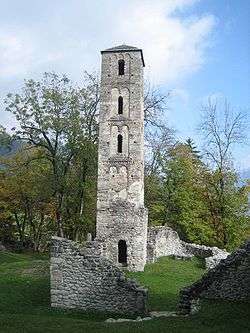 |
Munt St. Gieri (Jörgenberg Castle) Prehistoric Settlement / Medieval Castle |
729.780 | 182.440 | 46°46′50″N 9°08′17″E / 46.780482°N 9.138175°E | |
| 10067 | 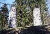 |
Execution site | 729.410 | 182.170 | 46°46′41″N 9°08′00″E / 46.778126°N 9.133254°E | |
| 3419 | 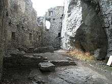 |
Ruina Grotta (ruins of Kropfenstein Castle) | 726.990 | 181.200 | 46°46′12″N 9°06′05″E / 46.769868°N 9.101305°E | |
| Unknown | ISOS vitg: Waltensburg |
Zernez
| KGS No.? |
Picture | Name | Street Address | CH1903 X coordinate | CH1903 Y coordinate | Location |
|---|---|---|---|---|---|---|
| 3067 | 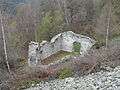 |
Abandoned village of Gonda | Lavin | 805.270 | 183.730 | 46°46′23″N 10°07′36″E / 46.773096°N 10.126706°E |
| 3422 | 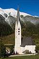 |
Swiss Reformed Church | Viel Dal Gallas | 803.230 | 175.680 | 46°42′05″N 10°05′47″E / 46.70135°N 10.096439°E |
| 3423 |  |
Chastè da Wildenberg (Wildenberg Castle) | Via Suot 124 / Runtasch | 803.220 | 175.502 | 46°41′59″N 10°05′46″E / 46.699753°N 10.09623°E |
| 9128 | 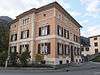 |
Palazzo Bezzola | Chasa da Plaz 88 | 803.100 | 175.591 | 46°42′02″N 10°05′41″E / 46.700589°N 10.094701°E |
| 3427 | Execution site | 801.940 | 178.520 | 46°43′38″N 10°04′51″E / 46.727275°N 10.080833°E | ||
| Unknown | ISOS Village urban: Zernez | |||||
| Unknown | ISOS village: Lavin |
Zillis-Reischen
| KGS No.? |
Picture | Name | Street Address | CH1903 X coordinate | CH1903 Y coordinate | Location |
|---|---|---|---|---|---|---|
| 3430 |  |
Swiss Reformed Church of S. Martegn/St Martin | 753.364 | 166.738 | 46°38′03″N 9°26′30″E / 46.634269°N 9.441645°E | |
| 9619 | Cave under Hasenstein (a Roman cult site) |
753.300 | 166.360 | 46°37′51″N 9°26′26″E / 46.630885°N 9.440684°E | ||
| 9516 | Wildener and Premoli Bridges | 753.801 | 169.835 | 46°39′43″N 9°26′54″E / 46.662019°N 9.448387°E | ||
| Unknown | ISOS vitg: Zillis | |||||
| Unknown | ISOS fracziun: Reischen |
Zizers
| KGS No.? |
Picture | Name | Street Address | CH1903 X coordinate | CH1903 Y coordinate | Location |
|---|---|---|---|---|---|---|
| 3434 | Upper Castle Zizers with Garden | Oberschloss Weg / Stöcklistrasse | 762.090 | 200.360 | 46°56′04″N 9°34′03″E / 46.934542°N 9.567474°E | |
| 3435 | Lower Castle Zizers (also known as Johannesstift) with Garden | Vialstrasse 16, 18 | 761.916 | 200.289 | 46°56′02″N 9°33′55″E / 46.933946°N 9.565164°E |
Zuoz
| KGS No.? |
Picture | Name | Street Address | CH1903 X coordinate | CH1903 Y coordinate | Location |
|---|---|---|---|---|---|---|
| 3439 | 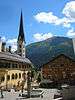 |
Chaplutta St. Bastiaun | 793.100 | 164.040 | 46°35′59″N 9°57′33″E / 46.599706°N 9.959163°E | |
| 3440 |  |
Chasa Pult | Plazzet / Aguel 37 | 793.108 | 164.434 | 46°36′12″N 9°57′34″E / 46.603246°N 9.959432°E |
References
- All entries, addresses and coordinates are from: "Kantonsliste A-Objekte". KGS Inventar (in German). Federal Office of Civil Protection. 2009. Retrieved 25 April 2011.
External links
- Swiss Inventory of Cultural Property of National and Regional Significance, 2009 edition:
- "Revision of the PCP Inventory (Revision des KGS-Inventars)". KGS Forum. Federal Office of Civil Protection (13/2008). 2008.
This article is issued from Wikipedia - version of the 10/15/2016. The text is available under the Creative Commons Attribution/Share Alike but additional terms may apply for the media files.