Montmorency County, Michigan
| Montmorency County, Michigan | ||
|---|---|---|
| ||
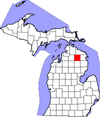 Location in the U.S. state of Michigan | ||
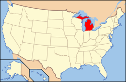 Michigan's location in the U.S. | ||
| Founded | 1881[1] | |
| Seat | Atlanta | |
| Largest village | Hillman | |
| Area | ||
| • Total | 563 sq mi (1,458 km2) | |
| • Land | 547 sq mi (1,417 km2) | |
| • Water | 16 sq mi (41 km2), 2.8% | |
| Population | ||
| • (2010) | 9,765 | |
| • Density | 18/sq mi (7/km²) | |
| Congressional district | 1st | |
| Time zone | Eastern: UTC-5/-4 | |
| Website |
www | |

Montmorency County is a county located in the U.S. state of Michigan. As of the 2010 census, the population was 9,765.[2] The county seat is Atlanta.[3]
History
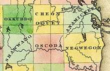
The county was created by the Michigan Legislature in 1840 as Cheonoquet County,[4] after a well known Chippewa (also known as Ojibwa) Chief, whose name meant Big Cloud.[5] Cheonoquet took part in Indian treaties in 1807, 1815, 1825 and 1837.[6][7] Renamed Montmorency County on March 8, 1843,[4] it was originally spelled Montmorenci, and historians conjecture this reflects the area's French-Canadian influence: the French Duke of Montmorency purchased a lieutenant governorship in Canada and the first archbishop of Canada--Montmorency-Laval--both could be influences on the county's name. (There was no "Count Morenci" aiding the American Revolution). The county was organized in 1881.[1] The reason for the change in spelling is subject to some dispute.[7] See List of Michigan county name etymologies. The name Montmorency probably means Mountain Moor. Montmorency is very much a boggy land or moor that is at the top of a broad mount or highland. When the county was formed in 1881, some land area was taken from Cheboygan and Alpena counties. Three townships were divided, namely Briley, Montmorency and Rust. By 1901 Albert, Hillman and Wheatfield were added. Brush Creek, now known as Hillman, was the first county seat. In 1891 the county seat was moved to Atlanta.[8]
Geography
According to the U.S. Census Bureau, the county has a total area of 563 square miles (1,460 km2), of which 547 square miles (1,420 km2) is land and 16 square miles (41 km2) (2.8%) is water.[9] The county is considered to be part of Northern Michigan.
Most of the county is covered by state forest land. There is and has been an abundance of lakes. Glaciers shaped the area, creating a unique regional ecosystem. A large portion of the area is the so-called Grayling outwash plain, which consists of broad outwash plain including sandy ice-disintegration ridges; jack pine barrens, some white pine-red pine forest, and northern hardwood forest. Large lakes were created by glacial action.[10]
Adjacent counties
- Presque Isle County - northeast
- Alpena County - east
- Alcona County - southeast
- Oscoda County - south
- Crawford County - southwest
- Otsego County - west
- Cheboygan County - northwest
Major highways
There are no traffic lights in Montmorency county, a few blinking lights are scattered about at highway junctions.
Demographics
| Historical population | |||
|---|---|---|---|
| Census | Pop. | %± | |
| 1890 | 1,487 | — | |
| 1900 | 3,234 | 117.5% | |
| 1910 | 3,755 | 16.1% | |
| 1920 | 4,089 | 8.9% | |
| 1930 | 2,814 | −31.2% | |
| 1940 | 3,840 | 36.5% | |
| 1950 | 4,125 | 7.4% | |
| 1960 | 4,424 | 7.2% | |
| 1970 | 5,247 | 18.6% | |
| 1980 | 7,492 | 42.8% | |
| 1990 | 8,936 | 19.3% | |
| 2000 | 10,315 | 15.4% | |
| 2010 | 9,765 | −5.3% | |
| Est. 2015 | 9,259 | [11] | −5.2% |
| U.S. Decennial Census[12] 1790-1960[13] 1900-1990[14] 1990-2000[15] 2010-2013[2] | |||
As of the census[16] of 2000, there were 10,315 people, 4,455 households, and 3,047 families residing in the county. The population density was 19 people per square mile (7/km²). There were 9,238 housing units at an average density of 17 per square mile (7/km²). The ethnic makeup of the county was 98.36% White, 0.24% Black or African American, 0.36% Native American, 0.10% Asian, 0.10% from other races, and 0.84% from two or more ethnic groups. 0.65% of the population were Hispanic or Latino of any ethnic group. 28.3% were of German, 12.7% English, 9.5% American, 8.8% Irish, 7.6% Polish and 7.4% French ancestry according to Census 2000. 98.1% spoke English as their first language.
There were 4,455 households out of which 22.50% had children under the age of 18 living with them, 58.10% were married couples living together, 7.10% had a female householder with no husband present, and 31.60% were non-families. 27.50% of all households were made up of individuals and 15.40% had someone living alone who was 65 years of age or older. The average household size was 2.29 and the average family size was 2.75.
In the county the population was spread out with 20.30% under the age of 18, 5.90% from 18 to 24, 20.90% from 25 to 44, 29.10% from 45 to 64, and 23.90% who were 65 years of age or older. The median age was 47 years. For every 100 females there were 96.60 males. For every 100 females age 18 and over, there were 94.90 males.
The median income for a household in the county was $30,005, and the median income for a family was $34,784. Males had a median income of $30,910 versus $19,299 for females. The per capita income for the county was $16,493. About 9.80% of families and 12.80% of the population were below the poverty line, including 20.00% of those under age 18 and 8.70% of those age 65 or over.
Economy
Dairy products and dry beans are an important part of the county's agricultural production. Service industry and retail trade relating to tourism make up most of the economic base in this rural area.[17] Boating, fishing, and other outdoor activities are offered in abundance.[18]
Government
The county government operates the jail, maintains rural roads, operates the major local courts, keeps files of deeds and mortgages, maintains vital records, administers public health regulations, and participates with the state in the provision of welfare and other social services. The county board of commissioners controls the budget but has only limited authority to make laws or ordinances. In Michigan, most local government functions — police and fire, building and zoning, tax assessment, street maintenance, etc. — are the responsibility of individual cities and townships.
Elected officials
- Prosecuting Attorney: Terrie Case
- Sheriff: Don Edwards
- County Clerk: Cheryl A. Neilsen
- County Treasurer: Karen Weiland-Tyler
- Register of Deeds: Teresa Walker
- Drain Commissioner: Jim Zavislak
- Road Commissioners: Joseph R. LaFleche; Theodore Orm; Linda Hicks
(information as of August 2008)
Recreation
- Atlanta is the "Elk Capital of Michigan." Every year during opening day of Elk hunting season the largest bagged are displayed at the "buck pole" on the town's central square.[19] During the nonseason, driving around in the wilderness surrounding Atlanta looking for these graceful creatures becomes a pastime of locals, cottagers, and tourists.[20]
- Rainbow trout, brook trout, steelhead, perch, bass and other pan fish abound. The county is a hotbed of fly fishing and angling on the edge of some world class streams and rivers.
- As is true in other rural parts of Michigan, White tail deer hunting is very popular local activity and the firearms deer season opening (November 15) being noted as a holiday to some residents, with schools being closed every year on opening day.[21] Most of the land in Montmorency County is owned by state and federal government, making the county a popular hunting area.[22]
- Snow shoeing, cross-country skiing and snow mobile riding are activities that fit right into the local winter weather and topography. Also, the Sno*Drift rallying race is held on snowy surfaces in January.
- Morel mushroom hunting is a local pastime and attracts many tourists.
- There are many recurring events throughout the area.[23] Such as the sled dog races held every year near the end of January on Clear Lake State Park.[24]
ORV/ATV and snowmobile trails are considered some of the best in the state of Michigan, many areas are designated as "trail mazes" on some maps.[25] Montmorency county is one of a few counties that allow ATVs on public county roads, thus creating access for fuel, food and various hotels to Hillman, Atlanta, and Lewiston.[26] The main trail system incorporates a scenic Elk tour and various levels of ATV trails.
Media
- The official newspaper of record is the Montmorency County Tribune.[27]
Endangered species
Montmorency County is home to Michigan's most endangered species and one of the most endangered species in the world: the Hungerford's crawling water beetle. The species lives in only five locations in the world, two of which are in Montmorency County, both inside the Mackinaw State Forest. The first site is along the East Branch of the Black River where two adult beetles were found in surveys in 1989 and two more again in 1996. In July 1999, six additional adult beetles were identified in the county living in Van Hetton Creek. This latter find was significant as it represented a new location beyond those originally identified when the Hungerford's crawling water beetle was categorized as endangered on March 7, 1994, under the provisions of the U.S. Endangered Species Act. The Van Hetton Creek sighting therefore provides the possibility that more of these very rare beetles might be found elsewhere in Montmorency County.
Communities
Village
Census-designated places
- Atlanta (county seat)
- Canada Creek Ranch
- Lewiston
Townships
- Albert Township
- Avery Township
- Briley Township
- Hillman Township
- Loud Township
- Montmorency Township
- Rust Township
- Vienna Township
See also
References
- 1 2 "Bibliography on Montmorency County". Clarke Historical Library, Central Michigan University. Retrieved January 20, 2013.
- 1 2 "State & County QuickFacts". United States Census Bureau. Retrieved August 28, 2013.
- ↑ "Find a County". National Association of Counties. Retrieved 2011-06-07.
- 1 2 3 Newberry Library. "Michigan: Individual County Chronologies". Atlas of County Historical Boundaries. Retrieved 2016-11-04.
- ↑ "A History of Northern Michigan and Its People". google.com.
- ↑ Montmorency County genealogical page.
- 1 2 Montmorency County home page.
- ↑ Montmorency County genealogical page
- ↑ "2010 Census Gazetteer Files". United States Census Bureau. August 22, 2012. Retrieved September 27, 2014.
- ↑ "NPWRC :: Regional Landscape". usgs.gov.
- ↑ "County Totals Dataset: Population, Population Change and Estimated Components of Population Change: April 1, 2010 to July 1, 2015". Retrieved July 2, 2016.
- ↑ "U.S. Decennial Census". United States Census Bureau. Retrieved September 27, 2014.
- ↑ "Historical Census Browser". University of Virginia Library. Retrieved September 27, 2014.
- ↑ "Population of Counties by Decennial Census: 1900 to 1990". United States Census Bureau. Retrieved September 27, 2014.
- ↑ "Census 2000 PHC-T-4. Ranking Tables for Counties: 1990 and 2000" (PDF). United States Census Bureau. Retrieved September 27, 2014.
- ↑ "American FactFinder". United States Census Bureau. Retrieved 2008-01-31.
- ↑ Montmorency County economic profile.
- ↑ "Montmorency County tourism profile" (PDF). Michigan State University extension service.
- ↑
- ↑ "Pigeon River Country Elk Range". state.mi.us.
- ↑ "J-L School Calendar". jlas.org.
- ↑ Economic profiler, Montmorency County
- ↑ List and calendar of events
- ↑
- ↑ Pg. 127, Section 3 & 4, Montmorency Township, "Michigan County Atlas" Second Edition, Universal Map; Kappa Publications ISBN 978-0-7625-6505-4
- ↑
- ↑ "The Montmorency County Tribune - News, Sports, Weather and Entertainment". montmorencytribune.com.
External links
| Wikimedia Commons has media related to Montmorency County, Michigan. |
- Atlanta, Michigan Chamber of Commerce, includes calendar of local events.
- "Bibliography on Montmorency County". Clarke Historical Library, Central Michigan University. Retrieved January 20, 2013.
- Economic profiler, Montmorency County
- Elk Country Animal Shelter.
- Enchanted forest, Northern Michigan source for information, calendars, etc.
- List and calendar of events throughout the county.
- Lewiston, Michigan Chamber of Commerce, includes calendar of local events and list of local official addresses, phone numbers.
- Montmorency County genealogical page.
- Montmorency County home page, including history of the county.
- Montmorency County prosecuting attorney.
- Montmorency County Tribune.
- Soil survey of Montmorency County -- much history and other current information -- U.S. Department of Agriculture, Michigan State University Extension Service.
 |
Cheboygan County | Presque Isle County | | |
| Otsego County | |
Alpena County | ||
| ||||
| | ||||
| Crawford County | Oscoda County | Alcona County |
Municipalities and communities of Montmorency County, Michigan, United States | ||
|---|---|---|
| Village | | |
| Townships | ||
| CDPs | ||
| Other unincorporated communities | ||
| Footnotes | ‡This populated place also has portions in an adjacent county or counties | |
| Central cities | |
|---|---|
| Counties | |
| Geography | |
| Transportation | |
| Economy | |
Coordinates: 45°02′N 84°08′W / 45.03°N 84.13°W