Oscoda County, Michigan
| Oscoda County, Michigan | |
|---|---|
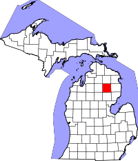 Location in the U.S. state of Michigan | |
 Michigan's location in the U.S. | |
| Founded |
April 1, 1840 (created) 1881 (organized)[1] |
| Seat | Mio |
| Largest community | Big Creek Township |
| Area | |
| • Total | 572 sq mi (1,481 km2) |
| • Land | 566 sq mi (1,466 km2) |
| • Water | 5.9 sq mi (15 km2), 1.0% |
| Population | |
| • (2010) | 8,640 |
| • Density | 15/sq mi (6/km²) |
| Congressional district | 1st |
| Time zone | Eastern: UTC-5/-4 |
| Website |
www |
Oscoda County is a county located in the U.S. state of Michigan. As of the 2010 census, the population was 8,640,[2] making it the fifth-least populous county in Michigan. The county seat is Mio.[3]
History
The county was founded in 1840 and organized in 1881.[1] The name is a Henry Schoolcraft neologism thought to be a combination of two Ojibwa words, "ossin" (stone) and "muskoda" (prairie) -- hence 'pebbly prairie.'[4]
Geography
According to the U.S. Census Bureau, the county has a total area of 572 square miles (1,480 km2), of which 566 square miles (1,470 km2) is land and 5.9 square miles (15 km2) (1.0%) is water.[5] Oscoda County is part of Northern Michigan.
Geographic features
- Mio is situated in the Au Sable River Valley.
- The County is surrounded by the Huron National Forest and the Rifle River State Recreation Area.
- The County is part of the Au Sable State Forest, specifically the
- Grayling FMU (Alcona, Crawford, Oscoda, and northern Iosco counties).
- Much of the area sits on the "Grayling outwash plain", a unique habitat.[6]
- The Oscoda County Park offers a good vantage point.[7]
Glaciers shaped the area, creating a unique regional ecosystem. A large portion of the area is the so-called Grayling outwash plain, which consists of broad outwash plain including sandy ice-disintegration ridges; jack pine barrens, some white pine-red pine forest, and northern hardwood forest. Large lakes were created by glacial action.[6]
Major highways
 M-33 runs from Alger in Arenac County north to Cheboygan at the tip of the "mitten".
 M-72 passes through Mio and the middle of the county. It is the 133 mile road that runs across the lower peninsula from Empire to Harrisville. It is one of three true cross peninsular highways.[8]
 F-32
F-32
Adjacent counties
- Montmorency County - north
- Alpena County - northeast
- Alcona County - east
- Iosco County - southeast
- Ogemaw County - south
- Roscommon County - southwest
- Crawford County - west
- Otsego County - northwest
National protected area
- Huron National Forest (part)
Demographics
| Historical population | |||
|---|---|---|---|
| Census | Pop. | %± | |
| 1870 | 70 | — | |
| 1880 | 467 | 567.1% | |
| 1890 | 1,904 | 307.7% | |
| 1900 | 1,468 | −22.9% | |
| 1910 | 2,027 | 38.1% | |
| 1920 | 1,783 | −12.0% | |
| 1930 | 1,728 | −3.1% | |
| 1940 | 2,543 | 47.2% | |
| 1950 | 3,134 | 23.2% | |
| 1960 | 3,447 | 10.0% | |
| 1970 | 4,726 | 37.1% | |
| 1980 | 6,858 | 45.1% | |
| 1990 | 7,842 | 14.3% | |
| 2000 | 9,418 | 20.1% | |
| 2010 | 8,640 | −8.3% | |
| Est. 2015 | 8,251 | [9] | −4.5% |
| U.S. Decennial Census[10] 1790-1960[11] 1900-1990[12] 1990-2000[13] 2010-2013[2] | |||
As of the census of 2000, there were 9,418 people, 3,921 households, and 2,717 families residing in the county. The population density was 17 people per square mile (6/km²). There were 8,690 housing units at an average density of 15 per square mile (6/km²). The racial makeup of the county was 97.82% White, 0.08% Black or African American, 0.71% Native American, 0.07% Asian, 0.01% Pacific Islander, 0.14% from other races, and 1.16% from two or more races. 0.94% of the population were Hispanic or Latino of any race. 30.2% were of German, 12.8% American, 9.6% English, 8.1% Polish, 6.8% French and 6.7% Irish ancestry according to Census 2000. 94.1% spoke English, 2.8% German and 1.5% Pennsylvania Dutch as their first language.
There were 3,921 households out of which 25.30% had children under the age of 18 living with them, 58.10% were married couples living together, 7.50% had a female householder with no husband present, and 30.70% were non-families. 26.00% of all households were made up of individuals and 12.70% had someone living alone who was 65 years of age or older. The average household size was 2.39 and the average family size was 2.85.
In the county the population was spread out with 23.30% under the age of 18, 5.60% from 18 to 24, 22.80% from 25 to 44, 28.00% from 45 to 64, and 20.20% who were 65 years of age or older. The median age was 44 years. For every 100 females there were 96.40 males. For every 100 females age 18 and over, there were 95.30 males.
The median income for a household in the county was $28,228, and the median income for a family was $32,225. Males had a median income of $30,013 versus $20,202 for females. The per capita income for the county was $15,697. About 10.30% of families and 14.60% of the population were below the poverty line, including 20.40% of those under age 18 and 8.80% of those age 65 or over.
Government
The county government operates the jail, maintains rural roads, operates the major local courts, keeps files of deeds and mortgages, maintains vital records, administers public health regulations, and participates with the state in the provision of welfare and other social services. The county board of commissioners controls the budget but has only limited authority to make laws or ordinances. In Michigan, most local government functions — police and fire, building and zoning, tax assessment, street maintenance, etc. — are the responsibility of individual cities and townships.
Elected officials
- Prosecuting Attorney: Cassandra Bills
- Sheriff: Kevin R. Grace
- County Clerk/Register of Deeds: Jeri Winton
- County Treasurer: William Kendall
- County Commissioners:
- Chair - John Kischnick District #2
- Vice Chair - Lee Christenbery District #4
- Commissioner - Larry Wilson District #1
- Commissioner - Bob Boerner District #3
- Commissioner - Mark Grantner District #5
Recreation
The Michigan Au Sable Valley Railroad is located in Fairview. It is 1/4 scale 16 gauge railroad, that offers rides on a passenger train through the scenic Northern Michigan landscape. It operates in jack pine country during the summer months. Riders travel through parts of the Huron National Forest and overlook the beautiful Comins Creek Valley.[14]
The gorgeous and clean AuSable River flows through Mio and offers some of Michigan’s best fishing and the opportunity to canoe, kayak, and tube. The M-33 Access Cite located off of M-33 on the north side of Mio has a launch area, restrooms, and a picnic area. Kayakers, fishermen, and swimmers can also go to the Mio Dam Pond located at the end of Mio Pond Drive where there is another launch area.
Oscoda County offers snowmobile trails, ATV trails, hiking trails, and cross country skiing trails. Snowmobile and ATV trails are located throughout Luzerne, McKinley, and Mio. In addition to the trails, there is a scramble area at Bull Gap in the Huron National Forest. As for hiking and cross country skiing, the Loud Creek Trail offers 7 different routes with varying difficulty levels. The trail’s total distance is 10 kilometers.
In Fairview, there is a horseback riding ranch and a golf course. Karefree Ranch Boarding Stables offers guided horseback rides through the beautiful, wooded Huron National Forest. The Fairview Hills Golf Club is a well-kept 9-hole golf course located on M-33. [15]
Communities
Census-designated place
- Mio (county seat)
Unincorporated communities
Townships
- Big Creek Township
- Clinton Township
- Comins Township
- Elmer Township
- Greenwood Township
- Mentor Township
See also
- List of Michigan State Historic Sites in Oscoda County, Michigan
- National Register of Historic Places listings in Oscoda County, Michigan
References
- 1 2 "Bibliography on Oscoda County". Clarke Historical Library, Central Michigan University. Retrieved January 29, 2013.
- 1 2 "State & County QuickFacts". United States Census Bureau. Retrieved August 29, 2013.
- ↑ "Find a County". National Association of Counties. Retrieved 2011-06-07.
- ↑ Michigan History, Arts and Libraries on sources of County names.
- ↑ "2010 Census Gazetteer Files". United States Census Bureau. August 22, 2012. Retrieved September 27, 2014.
- 1 2 "NPWRC :: Regional Landscape". usgs.gov.
- ↑ Oscoda County Park
- ↑ History of Michigan highways.
- ↑ "County Totals Dataset: Population, Population Change and Estimated Components of Population Change: April 1, 2010 to July 1, 2015". Retrieved July 2, 2016.
- ↑ "U.S. Decennial Census". United States Census Bureau. Retrieved September 27, 2014.
- ↑ "Historical Census Browser". University of Virginia Library. Retrieved September 27, 2014.
- ↑ "Population of Counties by Decennial Census: 1900 to 1990". United States Census Bureau. Retrieved September 27, 2014.
- ↑ "Census 2000 PHC-T-4. Ranking Tables for Counties: 1990 and 2000" (PDF). United States Census Bureau. Retrieved September 27, 2014.
- ↑ "Home". michiganausablevalleyrailroad.com.
- ↑ {www.eyeonmichigan.com/guides/mio/}
External links
| Wikimedia Commons has media related to Oscoda County, Michigan. |
- Oscoda County Web Site.
- "Bibliography on Oscoda County". Clarke Historical Library, Central Michigan University. Retrieved January 290, 2013. Check date values in:
|access-date=(help) - Au Sable Valley connection.
- Enchanted forest, Northern Michigan source for information, calendars, etc.
- Oscoda County Chamber of Commerce, including calendar of events, attractions.
- Calendar of Events, Sunrise side.
- Sunrise side travel and information
 |
Otsego County | Montmorency County | Alpena County | |
| Crawford County | |
Alcona County | ||
| ||||
| | ||||
| Roscommon County | Ogemaw County | Iosco County |
Municipalities and communities of Oscoda County, Michigan, United States | ||
|---|---|---|
| Townships | | |
| CDP | ||
| Other unincorporated communities | ||
| Central cities | |
|---|---|
| Counties | |
| Geography | |
| Transportation | |
| Economy | |
Coordinates: 44°41′N 84°08′W / 44.68°N 84.13°W