| [3] |
Name on the Register[4] |
Image |
Date listed[5] |
Location |
City or town |
Description |
|---|
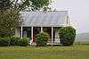
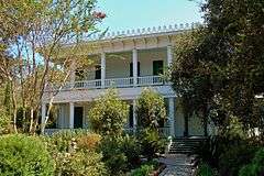
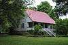
| 1 |
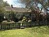
Austerlitz |
|
000000001991-04-22-0000April 22, 1991
(#91000416) |
Louisiana Highway 1 southeast of its junction with Louisiana Highway 78
30°37′15″N 91°28′40″W / 30.620833°N 91.477778°W / 30.620833; -91.477778 (Austerlitz) |
Oscar |
|
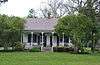
| 2 |
Jean Baptiste Bergeron House |
|
000000001994-05-13-0000May 13, 1994
(#94000407) |
13769 Chenal Rd.
30°36′40″N 91°22′51″W / 30.611111°N 91.380833°W / 30.611111; -91.380833 (Jean Baptiste Bergeron House) |
Jarreau |
|
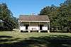
| 3 |
Valmont Bergeron House |
|
000000001992-05-14-0000May 14, 1992
(#92000512) |
Louisiana Highway 414
30°36′43″N 91°22′49″W / 30.611944°N 91.380278°W / 30.611944; -91.380278 (Valmont Bergeron House) |
Jarreau |
|
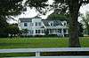
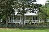
| 4 |
Bonnie Glen |
|
000000001980-01-11-0000January 11, 1980
(#80001749) |
Southwest of New Roads on Louisiana Highway 1
30°39′16″N 91°29′12″W / 30.654444°N 91.486667°W / 30.654444; -91.486667 (Bonnie Glen) |
New Roads |
|
| 5 |
Cherie Quarters Cabins |
|
000000001995-04-26-0000April 26, 1995
(#95000470) |
Major Ln., approximately ½ mile from its junction with Louisiana Highway 1
30°36′03″N 91°26′10″W / 30.600833°N 91.436111°W / 30.600833; -91.436111 (Cherie Quarters Cabins) |
Oscar |
|
| 6 |
Jacques Dupre House |
|
000000002003-12-05-0000December 5, 2003
(#03001232) |
13987 Chenal Rd.
30°36′49″N 91°22′48″W / 30.613611°N 91.38°W / 30.613611; -91.38 (Jacques Dupre House) |
Jarreau |
|
| 7 |
El Dorado Plantation House |
|
000000001982-03-24-0000March 24, 1982
(#82002791) |
Bayou Maringouin, Louisiana Highway 77
30°31′20″N 91°32′45″W / 30.522222°N 91.545833°W / 30.522222; -91.545833 (El Dorado Plantation House) |
Livonia |
|
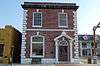
| 8 |
First National Bank |
|
000000002002-06-20-0000June 20, 2002
(#02000653) |
102 E. Main St.
30°41′33″N 91°26′03″W / 30.6925°N 91.434167°W / 30.6925; -91.434167 (First National Bank) |
New Roads |
|
| 9 |
Glynnwood |
|
000000001982-11-02-0000November 2, 1982
(#82000452) |
Louisiana Highway 416
30°37′27″N 91°21′24″W / 30.624167°N 91.356667°W / 30.624167; -91.356667 (Glynnwood) |
Glynn |
|
| 10 |
Labatut |
|
000000001991-08-15-0000August 15, 1991
(#91001056) |
Junction of Louisiana Highways 10 and Louisiana Highway 420
30°43′45″N 91°29′00″W / 30.729167°N 91.483333°W / 30.729167; -91.483333 (Labatut) |
New Roads |
|
| 11 |
Ovide LaCour Store |
Upload image |
000000001979-07-27-0000July 27, 1979
(#79001080) |
Louisiana Highway 419
30°49′40″N 91°36′38″W / 30.827778°N 91.610556°W / 30.827778; -91.610556 (Ovide LaCour Store) |
LaCour |
|
| 12 |
Lakeside |
Upload image |
000000001984-03-29-0000March 29, 1984
(#84001346) |
Louisiana Highway 419
30°50′15″N 91°38′40″W / 30.8375°N 91.644444°W / 30.8375; -91.644444 (Lakeside) |
Batchelor |
|
| 13 |
LeBeau House and Kitchen |
Upload image |
000000001985-05-09-0000May 9, 1985
(#85000974) |
Louisiana Highway 414
30°37′10″N 91°22′35″W / 30.619444°N 91.376389°W / 30.619444; -91.376389 (LeBeau House and Kitchen) |
Jarreau |
|
| 14 |
LeJeune House |
|
000000001978-11-28-0000November 28, 1978
(#78001435) |
507 E. Main St.
30°41′40″N 91°25′47″W / 30.694444°N 91.429722°W / 30.694444; -91.429722 (LeJeune House) |
New Roads |
|
| 15 |
Albin Major House |
|
000000001991-04-22-0000April 22, 1991
(#91000415) |
1304 False River Rd. (Louisiana Highway 1)
30°41′22″N 91°26′50″W / 30.689444°N 91.447222°W / 30.689444; -91.447222 (Albin Major House) |
New Roads |
|
| 16 |
North Bend |
|
000000001992-10-08-0000October 8, 1992
(#92001336) |
Louisiana Highway 1 west of its junction with Louisiana Highway 416, east of Oscar
30°36′41″N 91°26′52″W / 30.611389°N 91.447778°W / 30.611389; -91.447778 (North Bend) |
Oscar |
|
| 17 |
Old Hickory |
|
000000001979-06-15-0000June 15, 1979
(#79001081) |
Southeast of LaCour
30°49′27″N 91°36′11″W / 30.824167°N 91.603056°W / 30.824167; -91.603056 (Old Hickory) |
LaCour |
|
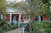
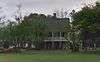
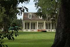
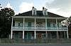
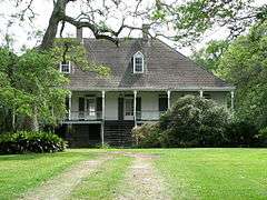
| 18 |
Parlange Plantation House |
|
000000001970-04-15-0000April 15, 1970
(#70000258) |
Junction of Louisiana Highways 1 and 78
30°37′49″N 91°29′14″W / 30.630278°N 91.487222°W / 30.630278; -91.487222 (Parlange Plantation House) |
Mix |
Large two-story French Colonial home built circa 1750 by Vincent de Ternant. Used as military headquarters by both C.S.A. and Union generals during the Civil War. Open by appointment.
|
| 19 |
Pleasant View Plantation House |
Upload image |
000000001984-04-05-0000April 5, 1984
(#84001347) |
Louisiana Highway 1
30°36′51″N 91°27′28″W / 30.614167°N 91.457778°W / 30.614167; -91.457778 (Pleasant View Plantation House) |
Oscar |
|
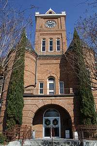
| 20 |
Pointe Coupee Parish Courthouse |
|
000000001981-10-07-0000October 7, 1981
(#81000710) |
Main St.
30°41′38″N 91°25′57″W / 30.693889°N 91.4325°W / 30.693889; -91.4325 (Pointe Coupee Parish Courthouse) |
New Roads |
|
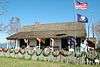
| 21 |
Pointe Coupee Parish Museum |
|
000000001980-09-30-0000September 30, 1980
(#80001750) |
6 miles southwest of New Roads on Louisiana Highway 1
30°37′59″N 91°29′13″W / 30.633056°N 91.486944°W / 30.633056; -91.486944 (Pointe Coupee Parish Museum) |
New Roads |
|
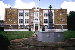
| 22 |
Poydras High School |
|
000000001996-03-07-0000March 7, 1996
(#96000229) |
500 W. Main St.
30°41′34″N 91°26′16″W / 30.692778°N 91.437778°W / 30.692778; -91.437778 (Poydras High School) |
New Roads |
|
| 23 |
Fannie Riche House |
|
000000001991-04-22-0000April 22, 1991
(#91000413) |
Louisiana Highway 420 near its junction with Louisiana Highway 10
30°43′46″N 91°28′19″W / 30.729444°N 91.471944°W / 30.729444; -91.471944 (Fannie Riche House) |
New Roads |
|
| 24 |
Riverlake |
|
000000001983-04-13-0000April 13, 1983
(#83000534) |
Louisiana Highway 1
30°36′28″N 91°26′07″W / 30.607778°N 91.435278°W / 30.607778; -91.435278 (Riverlake) |
Oscar |
|
| 25 |
St. Francis Chapel |
|
000000001979-05-25-0000May 25, 1979
(#79001082) |
Northwest of New Roads on Louisiana Highway 10
30°43′45″N 91°29′12″W / 30.729167°N 91.486667°W / 30.729167; -91.486667 (St. Francis Chapel) |
New Roads |
|
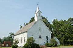
| 26 |
St. Stephen's Episcopal Church |
|
000000001974-04-24-0000April 24, 1974
(#74000939) |
North of Innis off Louisiana Highway 418
30°53′52″N 91°40′09″W / 30.897778°N 91.669167°W / 30.897778; -91.669167 (St. Stephen's Episcopal Church) |
Innis |
|
| 27 |
Saizon House |
|
000000001991-04-22-0000April 22, 1991
(#91000417) |
Louisiana Highway 414 east of its junction with Louisiana Highway 413
30°36′32″N 91°23′03″W / 30.608889°N 91.384167°W / 30.608889; -91.384167 (Saizon House) |
Jarreau |
|
| 28 |
Samson House |
|
000000001997-12-19-0000December 19, 1997
(#97001515) |
405 Richey St.
30°41′45″N 91°26′08″W / 30.695833°N 91.435556°W / 30.695833; -91.435556 (Samson House) |
New Roads |
|
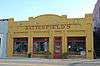
| 29 |
Satterfield Motor Company Building |
|
000000001994-07-07-0000July 7, 1994
(#94000700) |
108 E. Main St.
30°41′34″N 91°26′01″W / 30.692778°N 91.433611°W / 30.692778; -91.433611 (Satterfield Motor Company Building) |
New Roads |
|
| 30 |
Valverda Plantation House |
|
000000002002-04-01-0000April 1, 2002
(#02000297) |
2217 Louisiana Highway 977
30°32′19″N 91°32′43″W / 30.538611°N 91.545278°W / 30.538611; -91.545278 (Valverda Plantation House) |
Maringouin |
|
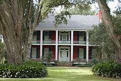
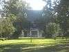
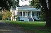
| 31 |
White Hall Plantation House |
|
000000001977-05-26-0000May 26, 1977
(#77000677) |
East of Simmesport on Louisiana Highway 418
30°58′59″N 91°46′42″W / 30.983056°N 91.778333°W / 30.983056; -91.778333 (White Hall Plantation House) |
Simmesport |
Late 1840s Italianate and Greek Revival mansion attributed to architect Henry Howard. Used as a headquarters by Union General Nathaniel Banks in 1863. Restored and opened to the public in 2013.
|
| 32 |
Wickliffe |
|
000000001991-04-22-0000April 22, 1991
(#91000414) |
Louisiana Highway 415 east of Patin Duke Slough
30°40′59″N 91°22′58″W / 30.683056°N 91.382778°W / 30.683056; -91.382778 (Wickliffe) |
New Roads |
|


.jpg)
.jpg)
.jpg)