Nunda (village), New York
| Nunda, New York | |
|---|---|
| Village | |
 Nunda, New York Location within the state of New York | |
| Coordinates: 42°34′50″N 77°56′18″W / 42.58056°N 77.93833°WCoordinates: 42°34′50″N 77°56′18″W / 42.58056°N 77.93833°W | |
| Country | United States |
| State | New York |
| County | Livingston |
| Area | |
| • Total | 1.0 sq mi (2.6 km2) |
| • Land | 1.0 sq mi (2.6 km2) |
| • Water | 0.0 sq mi (0.0 km2) |
| Elevation | 942 ft (287 m) |
| Population (2010) | |
| • Total | 1,377 |
| • Density | 1,400/sq mi (530/km2) |
| Time zone | Eastern (EST) (UTC-5) |
| • Summer (DST) | EDT (UTC-4) |
| ZIP code | 14517 |
| Area code(s) | 585 |
| FIPS code | 36-54078 |
| GNIS feature ID | 0959068 |
Nunda /nʌnˈdeɪ/ is a village in Livingston County, New York, United States. The population was 1,377 at the 2010 census.
The Village of Nunda is located on the west side of the Town of Nunda.
History
The village was incorporated in 1839 as "Nunda Valley." A large fire destroyed part of the village in 1852. In 1853, an attempt was made to found a new county with Nunda village as the county seat. This attempt failed.
The Union Block was added to the National Register of Historic Places in 1981.[1]
Geography
Nunda is located at 42°34′50″N 77°56′18″W / 42.58056°N 77.93833°W (42.580628, -77.938392).[2]
According to the United States Census Bureau, the village has a total area of 1.0 square miles (2.6 km²).None of the area is covered with water.
The village is at the junction of Routes NY-408 and NY-436.
Keshequa Creek and Crooked Creek flow through the village.
Nunda has a hard time with all of the water that flows through the village. Due to heavy rains and a burst in the village water reservoir there was a flood which ruined the brand new Keshequa Central School Middle School Gymnasium that had been completed 1 month before the flooding occurred.
Demographics
| Historical population | |||
|---|---|---|---|
| Census | Pop. | %± | |
| 1870 | 1,189 | — | |
| 1880 | 1,037 | −12.8% | |
| 1890 | 1,010 | −2.6% | |
| 1900 | 1,018 | 0.8% | |
| 1910 | 1,043 | 2.5% | |
| 1920 | 1,152 | 10.5% | |
| 1930 | 1,085 | −5.8% | |
| 1940 | 1,077 | −0.7% | |
| 1950 | 1,224 | 13.6% | |
| 1960 | 1,224 | 0.0% | |
| 1970 | 1,254 | 2.5% | |
| 1980 | 1,169 | −6.8% | |
| 1990 | 1,347 | 15.2% | |
| 2000 | 1,330 | −1.3% | |
| 2010 | 1,377 | 3.5% | |
| Est. 2015 | 1,328 | [3] | −3.6% |
As of the census[5] of 2000, there were 1,330 people, 505 households, and 360 families residing in the village. The population density was 1,349.9 people per square mile (518.7/km²). There were 547 housing units at an average density of 555.2 per square mile (213.3/km²). The racial makeup of the village was 97.59% White, 0.38% Black or African American, 0.15% Native American, 0.30% Asian, 0.08% Pacific Islander, 0.60% from other races, and 0.90% from two or more races. Hispanic or Latino of any race were 1.20% of the population.
There are 505 households out of which 40.0% have children under the age of 18 living with them, 48.9% were married couples living together, 18.8% had a female householder with no husband present, and 28.7% were non-families. 25.0% of all households were made up of individuals and 10.3% had someone living alone who was 65 years of age or older. The average household size was 2.54 and the average family size was 3.02.
In the village the population was spread out with 29.4% under the age of 18, 7.1% from 18 to 24, 29.8% from 25 to 44, 20.1% from 45 to 64, and 13.6% who were 65 years of age or older. The median age was 36 years. For every 100 females there were 90.8 males. For every 100 females age 18 and over, there were 83.0 males.
The median income for a household in the village was $39,125, and the median income for a family was $47,368. Males had a median income of $32,404 versus $26,250 for females. The per capita income for the village was $18,960. 12.7% of the population and 10.4% of families were below the poverty line. Out of the total population, 20.3% of those under the age of 18 and 5.6% of those 65 and older were living below the poverty line.
References
- ↑ National Park Service (2009-03-13). "National Register Information System". National Register of Historic Places. National Park Service.
- ↑ "US Gazetteer files: 2010, 2000, and 1990". United States Census Bureau. 2011-02-12. Retrieved 2011-04-23.
- ↑ "Annual Estimates of the Resident Population for Incorporated Places: April 1, 2010 to July 1, 2015". Retrieved July 2, 2016.
- ↑ "Census of Population and Housing". Census.gov. Retrieved June 4, 2015.
- ↑ "American FactFinder". United States Census Bureau. Retrieved 2008-01-31.
External links
Municipalities and communities of Livingston County, New York, United States | ||
|---|---|---|
| Towns | 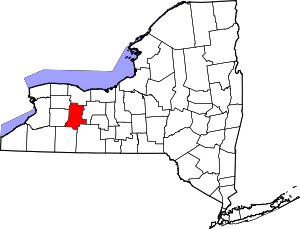 | |
| Villages | ||
| CDPs |
| |
| Other hamlet | ||