West Sparta, New York
| West Sparta, New York | |
|---|---|
| Town | |
 West Sparta, New York Location within the state of New York | |
| Coordinates: 42°36′42″N 77°46′43″W / 42.61167°N 77.77861°W | |
| Country | United States |
| State | New York |
| County | Livingston |
| Government | |
| • Type | Town Council |
| • Town Supervisor | Dominic I. Cosimano (D) |
| • Town Council |
Members' List
|
| Area | |
| • Total | 33.4 sq mi (86.6 km2) |
| • Land | 33.4 sq mi (86.6 km2) |
| • Water | 0.0 sq mi (0.0 km2) |
| Elevation | 1,050 ft (320 m) |
| Population (2010) | |
| • Total | 1,255 |
| Time zone | Eastern (EST) (UTC-5) |
| • Summer (DST) | EDT (UTC-4) |
| FIPS code | 36-81006[1] |
| GNIS feature ID | 0979627[2] |
West Sparta is a town in Livingston County, New York, United States. The population was 1,255 at the 2010 census. The name is derived from the Town of Sparta.
The Town of West Sparta is in the south-central part of the county and is north of Dansville, NY.
History
The area was first settled around 1795. The town was formed from the Town of Sparta in 1846.
The R. P. Kemp No. 1 Site was added to the National Register of Historic Places in 1977.[3]
Geography
According to the United States Census Bureau, the town has a total area of 33.4 square miles (87 km2), all of it land.
Canaseraga Creek, a tributary of the Genesee River, and Interstate 390 pass through the town. New York State Route 36 parallels the Interstate. The former Genesee Valley Canal passed through the town.
Hope Valley Camp
Hope Valley Camp (HVC) is a Christian camp and retreat center located at 9470 Schmidt Rd in the town of West Sparta. Hope Valley Camp is a co-ed program open to children from 7 to 17 and serves many local children through day camp programs, residential programs and weekend retreats. Children come from all over western New York and northern Pennsylvania to attend Hope Valley Camp, and each year they serve hundreds of children at their facility. The camp also offers gorgeous retreat facilities for year-round getaways, corporate trainings, civic group meetings and other uses. The facility features 49 acres of wooded land with a pond, 2 creeks, a paintball field and many other great features. Most of the camp activities are outdoor, including kayaking, hiking, fishing, archery, rifle range, geocacheing and much more. You can read more by visit their website at http://www.hopevalleycamp.com
Demographics
| Historical population | |||
|---|---|---|---|
| Census | Pop. | %± | |
| 1850 | 1,619 | — | |
| 1860 | 1,501 | −7.3% | |
| 1870 | 1,244 | −17.1% | |
| 1880 | 1,157 | −7.0% | |
| 1890 | 1,008 | −12.9% | |
| 1900 | 906 | −10.1% | |
| 1910 | 772 | −14.8% | |
| 1920 | 695 | −10.0% | |
| 1930 | 667 | −4.0% | |
| 1940 | 688 | 3.1% | |
| 1950 | 724 | 5.2% | |
| 1960 | 817 | 12.8% | |
| 1970 | 935 | 14.4% | |
| 1980 | 1,100 | 17.6% | |
| 1990 | 1,335 | 21.4% | |
| 2000 | 1,244 | −6.8% | |
| 2010 | 1,255 | 0.9% | |
| Est. 2014 | 1,291 | [4] | 2.9% |
As of the census[1] of 2000, there were 1,244 people, 451 households, and 332 families residing in the town. The population density was 37.2 people per square mile (14.4/km²). There were 480 housing units at an average density of 14.4 per square mile (5.5/km²). The racial makeup of the town was 98.47% White, 0.16% African American, 0.16% Native American, 0.32% Asian, and 0.88% from two or more races. Hispanic or Latino of any race were 0.24% of the population.
There were 451 households out of which 36.4% had children under the age of 18 living with them, 57.6% were married couples living together, 9.1% had a female householder with no husband present, and 26.2% were non-families. 19.5% of all households were made up of individuals and 7.3% had someone living alone who was 65 years of age or older. The average household size was 2.74 and the average family size was 3.10.
In the town the population was spread out with 25.9% under the age of 18, 7.7% from 18 to 24, 30.6% from 25 to 44, 24.7% from 45 to 64, and 11.1% who were 65 years of age or older. The median age was 37 years. For every 100 females there were 103.3 males. For every 100 females age 18 and over, there were 104.9 males.
The median income for a household in the town was $40,789, and the median income for a family was $44,583. Males had a median income of $31,781 versus $25,982 for females. The per capita income for the town was $16,304. About 6.6% of families and 8.9% of the population were below the poverty line, including 9.6% of those under age 18 and 4.9% of those age 65 or over.
Communities and locations in West Sparta
- Byersville – A hamlet in the south part of the town.
- Kysorville – A hamlet in the northern part of the town on NY-36.
- Union Corners – A hamlet by the west town line. It was also called "Brushville."
- West Sparta – The hamlet of West Sparta, located on NY-36 in the eastern part of the town, east of Interstate 390.
- West Sparta Station – A location east of West Sparta.
- Woodville – A hamlet in the southeast corner of the town on NY-36 and next to the Interstate highway.
References
- 1 2 "American FactFinder". United States Census Bureau. Retrieved 2008-01-31.
- ↑ "US Board on Geographic Names". United States Geological Survey. 2007-10-25. Retrieved 2008-01-31.
- ↑ National Park Service (2009-03-13). "National Register Information System". National Register of Historic Places. National Park Service.
- ↑ "Annual Estimates of the Resident Population for Incorporated Places: April 1, 2010 to July 1, 2014". Retrieved June 4, 2015.
- ↑ "Census of Population and Housing". Census.gov. Retrieved June 4, 2015.
External links
Municipalities and communities of Livingston County, New York, United States | ||
|---|---|---|
| Towns | 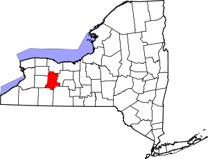 | |
| Villages | ||
| CDPs |
| |
| Other hamlet | ||
Coordinates: 42°37′37″N 77°46′23″W / 42.62694°N 77.77306°W