Groveland, New York
| Groveland, New York | |
|---|---|
| Town | |
 Groveland, New York Location of Groveland in New York | |
| Coordinates: 42°39′53″N 77°46′11″W / 42.66472°N 77.76972°W | |
| Country | United States |
| State | New York |
| County | Livingston |
| Settled | 1792 |
| Incorporated | 1789 |
| Government | |
| • Type | Town Council |
| • Town Supervisor | William E. Carman (R) |
| • Town Council |
Members' List
|
| Area | |
| • Total | 39.9 sq mi (103.3 km2) |
| • Land | 39.2 sq mi (101.4 km2) |
| • Water | 0.7 sq mi (1.9 km2) |
| Elevation | 1,053 ft (321 m) |
| Population (2010) | |
| • Total | 3,249 |
| • Density | 81/sq mi (31/km2) |
| Time zone | EDT (UTC-5) |
| • Summer (DST) | EDT (UTC-4) |
| ZIP codes | 14462, 14545 |
| Area code(s) | 585 |
| FIPS code | 36-31016 |
| GNIS feature ID | 0979029 |
Groveland is a town in Livingston County, New York, United States. The population was 3,249 at the 2010 census.
The Town of Groveland is centrally located in the county, south of Geneseo.
History
The Sullivan Expedition (1779) reached its farthest extent here. Groveland was the site of the Boyd and Parker ambush.
The first settlement occurred in 1792 and was called "Willamsburgh." The town was formed in 1789 before the creation of Livingston County. Part of Groveland was used to form parts of the Towns of Conesus (1819) and Sparta (1856).
There was formerly the Groveland Shaker Village settlement near present-day Sonyea, the buildings and land are now part of the Groveland Correctional Facility. The Craig Colony for Epileptics at Sonyea was a former Shaker colony.[1]
The Claud No. 1 Archeological Site was added to the National Register of Historic Places in 1975.[2]
Notable people
- Charles H. Carroll (1794-1865), Whig congressman for New York from 1843-1847.
- John Vance Cheney (1848-1922), poet, essayist and librarian was born in Groveland.
- Charles A. Goheen (1843-1899), Medal of Honor recipient in the American Civil War.[3]
- Daniel Kelly (1841-1912), Medal of Honor recipient in the American Civil War.[4]
- Walter W. Magee (1861-1927), Republican congressman for New York from 1915-1927.
Geography
According to the United States Census Bureau, the town has a total area of 39.9 square miles (103 km2), of which, 39.2 square miles (102 km2) of it is land and 0.7 square miles (1.8 km2) of it (1.85%) is water.

Conesus Lake, one of the Finger Lakes, forms part of the eastern boundary.
Interstate 390 passes north-to-south through the town. New York State Route 36, New York State Route 63, and New York State Route 256 are north-south highways through the town. New York State Route 408 is a highway terminating in the western part of the town at NY-63.
Groveland is on the Rochester-to-Dansville line of the Rochester & Southern Railroad. From 1882-1963, Groveland was on the Main Line of the Delaware, Lackawanna & Western Railroad (DL&W) and successor Erie-Lackawanna Railroad. In 1963, the Main Line over Dansville Hill from Groveland to Wayland was abandoned by order of the U. S. Interstate Commerce Commission to promote highway usage. That portion of today's R&S line west and north of Groveland was originally part of the DL&W, while that portion between Groveland and Dansville was part of the Dansville & Mount Morris Railroad and predecessors.
Demographics
| Historical population | |||
|---|---|---|---|
| Census | Pop. | %± | |
| 1820 | 1,273 | — | |
| 1830 | 1,703 | 33.8% | |
| 1840 | 2,000 | 17.4% | |
| 1850 | 1,724 | −13.8% | |
| 1860 | 1,565 | −9.2% | |
| 1870 | 1,455 | −7.0% | |
| 1880 | 1,342 | −7.8% | |
| 1890 | 1,307 | −2.6% | |
| 1900 | 1,949 | 49.1% | |
| 1910 | 2,820 | 44.7% | |
| 1920 | 2,920 | 3.5% | |
| 1930 | 3,295 | 12.8% | |
| 1940 | 4,135 | 25.5% | |
| 1950 | 3,381 | −18.2% | |
| 1960 | 3,373 | −0.2% | |
| 1970 | 3,004 | −10.9% | |
| 1980 | 2,140 | −28.8% | |
| 1990 | 3,190 | 49.1% | |
| 2000 | 3,853 | 20.8% | |
| 2010 | 3,249 | −15.7% | |
| Est. 2014 | 3,342 | [5] | 2.9% |
As of the census[7] of 2000, there were 3,853 people, 555 households, and 396 families residing in the town. The population density was 98.4 people per square mile (38.0/km²). There were 649 housing units at an average density of 16.6 per square mile (6.4/km²). The racial makeup of the town was 60.06% White, 32.44% African American, 0.26% Native American, 0.18% Asian, 6.46% from other races, and 0.60% from two or more races. Hispanic or Latino of any race were 15.23% of the population.
There were 555 households out of which 33.0% had children under the age of 18 living with them, 59.8% were married couples living together, 6.7% had a female householder with no husband present, and 28.6% were non-families. 20.9% of all households were made up of individuals and 7.0% had someone living alone who was 65 years of age or older. The average household size was 2.63 and the average family size was 3.04.
In the town the population was spread out with 9.9% under the age of 18, 10.4% from 18 to 24, 54.2% from 25 to 44, 20.4% from 45 to 64, and 5.1% who were 65 years of age or older. The median age was 36 years. For every 100 females there were 411.0 males. For every 100 females age 18 and over, there were 529.9 males.
The median income for a household in the town was $46,797, and the median income for a family was $48,828. Males had a median income of $24,353 versus $26,477 for females. The per capita income for the town was $13,433. About 7.7% of families and 8.8% of the population were below the poverty line, including 12.8% of those under age 18 and 1.2% of those age 65 or over.
Communities and locations in Groveland
- Cottonwood Point – A hamlet on the shore of Conesus Lake and on NY-256.
- East Groveland – A hamlet in the northeast part of the town.
- Gray Corners – A location south of Maple Beach.
- Groveland Station – The hamlet of Groveland is by the south town line on NY-63. The Sparta First Presbyterian Church was added to the National Register of Historic Places in 2007.[2]
- Groveland Corners – A hamlet in the central part of the town, north of Groveland village.
- Groveland Correctional Facility – A state prison by the west town line, near Sonyea.
- Hampton Corners – A location in the northwest part of the town on NY-63. The Black and White Farm Barn was added to the National Register of Historic Places in 1988.[2]
- Hunts Corners – A former community in the northeast part of the town.
- Maple Beach – A location on Conesus Lake, south of Cottonwood Point on NY-256.
- Ross Corners – A location by the south town line.
- Sonyea – A hamlet in the southwest part of the town on NY-36. The Sparta First Presbyterian Church was added to the National Register of Historic Places in 2007.[2]
- Tuscarora – The First Presbyterian Church of Tuscarora was added to the National Register of Historic Places in 2004.[2]
- Williamsburgh – A former community in the town that was the site of the first settlement, although it was soon abandoned.
References
- ↑ Trompeter, Grace (2012). "New York's Craig Colony for Epileptics tracing the deepest roots of deinstitutionalization" (PDF). Middle States Geographer. 45: 76–83. Retrieved 3 December 2015.
- 1 2 3 4 5 National Park Service (2009-03-13). "National Register Information System". National Register of Historic Places. National Park Service.
- ↑ "Charles A. Goheen". Retrieved July 1, 2014.
- ↑ "Daniel Armer Kelly". Retrieved August 2, 2014.
- ↑ "Annual Estimates of the Resident Population for Incorporated Places: April 1, 2010 to July 1, 2014". Retrieved June 4, 2015.
- ↑ "Census of Population and Housing". Census.gov. Retrieved June 4, 2015.
- ↑ "American FactFinder". United States Census Bureau. Retrieved 2008-01-31.
External links
| Wikimedia Commons has media related to Groveland, New York. |
Municipalities and communities of Livingston County, New York, United States | ||
|---|---|---|
| Towns | 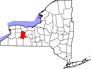 | |
| Villages | ||
| CDPs |
| |
| Other hamlet | ||
Coordinates: 42°39′53″N 77°46′11″W / 42.66472°N 77.76972°W