Ranipuram
| Ranipuram | |
|---|---|
| Hill Station | |
|
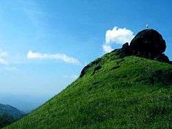
Ranipuram Mountain | |
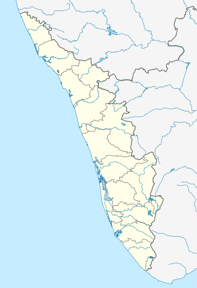 Ranipuram  Ranipuram Location in Kerala, India | |
| Coordinates: 12°25′19″N 75°21′40″E / 12.421866°N 75.361233°ECoordinates: 12°25′19″N 75°21′40″E / 12.421866°N 75.361233°E | |
| Country |
|
| State | Kerala |
| Elevation | 750 m (2,460 ft) |
| Languages | |
| • Official | Malayalam, English |
| Time zone | IST (UTC+5:30) |
Ranipuram (ooty of kerala Malayalam: റാണിപുരം) is a hill station located within Kasargod district of Kerala state [Panathady Panchayat, Vellarikundu Taluk], south India.
Location
Ranipuram lies 750 m (2,460 ft) above sea level adjacent to Kottancheri-Talacavery mountain range.
Etymology
It was Maadathumala in the earlier days which was later became famous with the name Ranipuram.
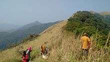
Tourism
The trekking spot starts from the Tourist home at the valley where you can opt two routes. The way gives you the raw picture of untouched forest and scenic beauty from the peak.
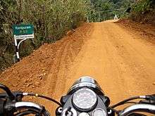
Transportation
This village is connected to Karnataka state through Panathur. There is a 20 km road from Panathur to Sullia in Karnataka from where Bangalore and Mysore can be easily accessed. Locations in Kerala can be accessed by driving towards the western side. The nearest railway station is Kanhangad railway station on Mangalore-Palakkad line. There are airports at Mangalore and Calicut.
References
| Wikimedia Commons has media related to Ranipuram. |