Tadiandamol
| Tadiandamol | |
|---|---|
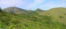
 Sholas on Tadiandamol showing Strobilanthes edges. | |
| Highest point | |
| Elevation | 1,748 m (5,735 ft) |
| Coordinates | 12°13′3.2308″N 75°36′31.7340″E / 12.217564111°N 75.608815000°ECoordinates: 12°13′3.2308″N 75°36′31.7340″E / 12.217564111°N 75.608815000°E |
| Geography | |
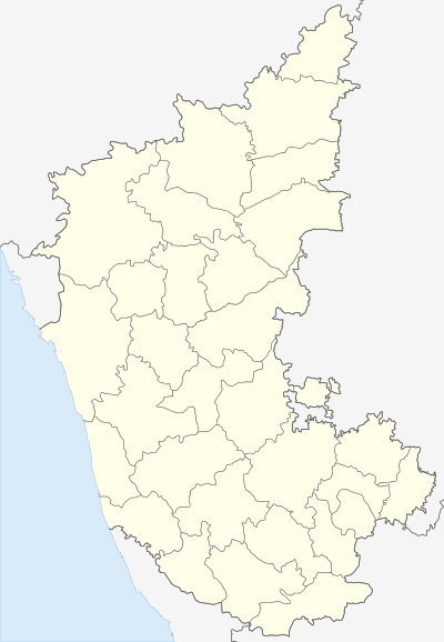 Tadiandamol Location of Tadiandamol, Karnataka | |
| Location | Karnataka, India |
| Parent range | Western Ghats |
| Climbing | |
| Easiest route | Hike |
Tadiandamol (Kannada: ತಡಿಯಂಡಮೋಳು, Tadiyandamolu, Kodava : ತಡಿಯಂಡಮೋಳ, Tadiyandamol, ) is the highest mountain of Kodagu district, Karnataka, India. It is the third highest peak in Karnataka. It is located Western Ghats range, and reaches an elevation of 1,748 m. The mountain has patches of shola forests in the valleys.
The Nalaknad (also known as Nalnad - meaning 4 villages) palace at the foothills is an important historical landmark. This was one of the landmarks mapped during the Great Trigonometric Survey.
It is a place of interest for trekkers and naturalists. The climb to the top and back can be completed as a day hike; but it is also a good location for overnight camping.
Etymology
The name Tadiandamol literally means largest base (thadi = broad, large, huge; anda = belonging to (possessive) in Kodava; mol = hill, base, peak). It loosely means Tallest Mount,[1][2] and the name also could translate as Broad Hill.[3]
See also
References
External links
| Wikimedia Commons has media related to Tadiandamol. |
- Dream Routes description
- India Hikes - trek details
| Wikimedia Commons has media related to Tadiandamol. |