Reynolds, Illinois
| Reynolds | |
| Village | |
| Country | United States |
|---|---|
| State | Illinois |
| County | Rock Island, Mercer |
| Coordinates | 41°19′49″N 90°40′16″W / 41.33028°N 90.67111°WCoordinates: 41°19′49″N 90°40′16″W / 41.33028°N 90.67111°W |
| Area | 0.37 sq mi (1 km2) |
| - land | 0.37 sq mi (1 km2) |
| - water | 0.00 sq mi (0 km2) |
| Population | 508 (2000) |
| Density | 1,377.6/sq mi (532/km2) |
| Timezone | CST (UTC-6) |
| - summer (DST) | CDT (UTC-5) |
| Postal code | 61279 |
| Area code | 309 |
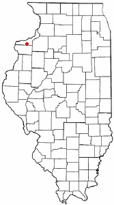
  Location of Reynolds within Illinois | |
| Wikimedia Commons: Reynolds, Illinois | |
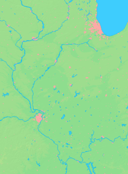
Reynolds is a village in Mercer and Rock Island Counties in the U.S. state of Illinois. The population was 508 at the 2000 census. Only a small portion on the south side is in Mercer County. The village was founded in 1876.
Geography
Reynolds is located at 41°19′49″N 90°40′16″W / 41.33028°N 90.67111°W (41.330181, -90.671148).[1]
According to the 2010 census, Reynolds has a total area of 0.37 square miles (0.96 km2), all land.[2]
Demographics
| Historical population | |||
|---|---|---|---|
| Census | Pop. | %± | |
| 1880 | 192 | — | |
| 1900 | 329 | — | |
| 1910 | 367 | 11.6% | |
| 1920 | 322 | −12.3% | |
| 1930 | 317 | −1.6% | |
| 1940 | 335 | 5.7% | |
| 1950 | 409 | 22.1% | |
| 1960 | 494 | 20.8% | |
| 1970 | 610 | 23.5% | |
| 1980 | 701 | 14.9% | |
| 1990 | 583 | −16.8% | |
| 2000 | 508 | −12.9% | |
| 2010 | 539 | 6.1% | |
| Est. 2015 | 519 | [3] | −3.7% |
As of the census[5] of 2000, there were 508 people, 206 households, and 154 families residing in the village. The population density was 1,377.6 people per square mile (530.1/km²). There were 221 housing units at an average density of 599.3 per square mile (230.6/km²). The racial makeup of the village was 99.80% White, 0.20% from other races. Hispanic or Latino of any race were 0.98% of the population.
There were 206 households out of which 29.1% had children under the age of 18 living with them, 55.3% were married couples living together, 15.0% had a female householder with no husband present, and 25.2% were non-families. 19.4% of all households were made up of individuals and 10.2% had someone living alone who was 65 years of age or older. The average household size was 2.47 and the average family size was 2.76.
In the village the population was spread out with 21.9% under the age of 18, 12.2% from 18 to 24, 25.8% from 25 to 44, 26.6% from 45 to 64, and 13.6% who were 65 years of age or older. The median age was 38 years. For every 100 females there were 93.2 males. For every 100 females age 18 and over, there were 95.6 males.
The median income for a household in the village was $42,917, and the median income for a family was $48,333. Males had a median income of $35,208 versus $21,364 for females. The per capita income for the village was $21,804. About 8.6% of families and 10.2% of the population were below the poverty line, including 19.7% of those under age 18 and 1.3% of those age 65 or over.
Media
- Good Time Oldies 1610, commercial free oldies station; five miles coverage area.[6]
References
- ↑ "US Gazetteer files: 2010, 2000, and 1990". United States Census Bureau. 2011-02-12. Retrieved 2011-04-23.
- ↑ "G001 - Geographic Identifiers - 2010 Census Summary File 1". United States Census Bureau. Retrieved 2015-12-25.
- ↑ "Annual Estimates of the Resident Population for Incorporated Places: April 1, 2010 to July 1, 2015". Retrieved July 2, 2016.
- ↑ "Census of Population and Housing". Census.gov. Retrieved June 4, 2015.
- ↑ "American FactFinder". United States Census Bureau. Retrieved 2008-01-31.
- ↑ Good Time Oldies
Municipalities and communities of Mercer County, Illinois, United States | ||
|---|---|---|
| Cities | ||
| Villages | ||
| Townships | ||
| Unincorporated communities | ||
| Footnotes | ‡This populated place also has portions in an adjacent county or counties | |
Municipalities and communities of Rock Island County, Illinois, United States | ||
|---|---|---|
| Cities | ||
| Villages | ||
| Townships | ||
| CDPs | ||
| Other unincorporated communities |
| |
| Footnotes | ‡This populated place also has portions in an adjacent county or counties | |