Saint-Ouen-le-Brisoult
| Saint-Ouen-le-Brisoult | |
|---|---|
|
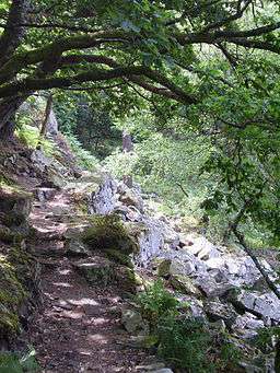
Villiers Gorge | |
 Saint-Ouen-le-Brisoult | |
|
Location within Normandy region  Saint-Ouen-le-Brisoult | |
| Coordinates: 48°30′39″N 0°20′19″W / 48.5108°N 0.3386°WCoordinates: 48°30′39″N 0°20′19″W / 48.5108°N 0.3386°W | |
| Country | France |
| Region | Normandy |
| Department | Orne |
| Arrondissement | Alençon |
| Canton | Carrouges |
| Intercommunality | Pays fertois |
| Government | |
| • Mayor (2008–2014) | Bernard Champain |
| Area1 | 9.75 km2 (3.76 sq mi) |
| Population (2006)2 | 134 |
| • Density | 14/km2 (36/sq mi) |
| Time zone | CET (UTC+1) |
| • Summer (DST) | CEST (UTC+2) |
| INSEE/Postal code | 61439 / 61410 |
| Elevation |
124–221 m (407–725 ft) (avg. 200 m or 660 ft) |
|
1 French Land Register data, which excludes lakes, ponds, glaciers > 1 km² (0.386 sq mi or 247 acres) and river estuaries. 2 Population without double counting: residents of multiple communes (e.g., students and military personnel) only counted once. | |
Saint-Ouen-le-Brisoult is a commune in the Orne department in north-western France.
The inhabitants are known as Audoniens and Audoniennes.[1]
Demographics
The population has varied over the past 50 years:
| Year | 1962 | 1968 | 1975 | 1982 | 1990 | 1999 | 2006 |
|---|---|---|---|---|---|---|---|
| Population | 200 | 172 | 138 | 125 | 121 | 105 | 141 |
| From the year 1962 on: No double counting—residents of multiple communes (e.g. students and military personnel) are counted only once. | |||||||
See also
References
- ↑ Mairie de Saint-Ouen-le-Brisoult, Ouest-France.fr.
| Wikimedia Commons has media related to Saint-Ouen-le-Brisoult. |
This article is issued from Wikipedia - version of the 11/16/2014. The text is available under the Creative Commons Attribution/Share Alike but additional terms may apply for the media files.