Sivrihisar
| Sivrihisar | |
|---|---|
| District | |
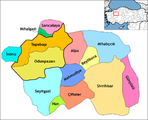 Location of Sivrihisar within Turkey. | |
 Sivrihisar Location of Sivrihisar within Turkey. | |
| Coordinates: 39°27′N 31°32′E / 39.450°N 31.533°E | |
| Country |
|
| Region | Central Anatolia |
| Province | Eskişehir |
| Government | |
| • Governor | Ahmet Katırcı |
| • Mayor | Fikret Arslan (DP) |
| Area[1] | |
| • District | 2,546.71 km2 (983.29 sq mi) |
| Elevation | 1,070 m (3,510 ft) |
| Population (2012)[2] | |
| • Urban | 9,820 |
| • District | 22,712 |
| • District density | 8.9/km2 (23/sq mi) |
| Time zone | EET (UTC+2) |
| • Summer (DST) | EEST (UTC+3) |
| Postal code | 26xxx |
| Area code(s) | 0222 |
| Licence plate | 26 |
| Website | www.sivrihisar.gov.tr |
Sivrihisar (Turkish: Sivrihisar, "a pointed castle") is a town and district of Eskişehir Province in the Central Anatolia region of Turkey. According to 2010 census, population of the district is 23 488 of which 9,817 live in the town of Sivrihisar.[3] The district covers an area of 2,987 km2 (1,153 sq mi), and the average elevation is 1,070 m (3,510 ft).
Location
The town of Sivrihisar lies 13 km (8.1 mi) north of the historical site of Pessinus, at the foot of a high double-peaked ridge of granite, which bears the ruins of a Byzantine castle, and gives the town its name (sivri "sharp, pointed", hisar "fortress, castle"). It is located at the intersection of the E-90 and E-96 routes.
Economy
As of 1920, Sivrihisar was producing knitting clothing.[4]
Notable natives
- Moushegh Ishkhan an Armenian Genocide survivor, poet, writer and educator.
- Nasreddin Hoca was born in Hortu village of Sivrihisar.[5]
See also
Notes
- ↑ "Area of regions (including lakes), km²". Regional Statistics Database. Turkish Statistical Institute. 2002. Retrieved 2013-03-05.
- ↑ "Population of province/district centers and towns/villages by districts - 2012". Address Based Population Registration System (ABPRS) Database. Turkish Statistical Institute. Retrieved 2013-02-27.
- ↑ Statistical Institute
- ↑ Prothero, G. W. (1920). Anatolia. London: H.M. Stationery Office. p. 112. Archived from the original on 2013-11-10.
- ↑ Turkish Ministry of Culture and Tourism. "Life of Nasreddin Hoca" (in Turkish). Retrieved 2008-04-06.
References

- "Geographical information on Sivrihisar, Turkey". Falling Rain Genomics. Archived from the original on 2012-10-25. Retrieved 2008-04-07.
- "General information on Sivrihisar, Eskişehir" (in Turkish). Governorship of Eskişehir, Turkey. Retrieved 2008-04-07.
- "Environmental Status Report for Eskişehir Province" (PDF) (in Turkish). Governorship of Eskişehir, Directorate of Provincial Environment and Forestry. 2006. Archived from the original (PDF) on 2009-03-05. Retrieved 2008-04-07.
External links
- District governor's official website (Turkish)
- Local guide to Sivrihisar (Turkish) / (English)
Coordinates: 39°27′00″N 31°32′16″E / 39.45000°N 31.53778°E