Starke County, Indiana
| Starke County, Indiana | |
|---|---|
| County | |
|
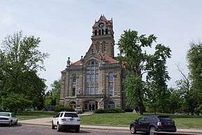
Starke County Courthouse in Knox | |
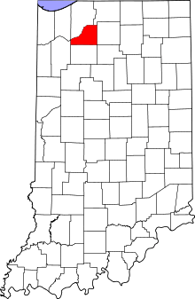 Location in the state of Indiana | |
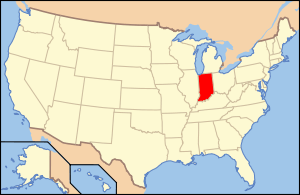 Indiana's location in the U.S. | |
| Coordinates: 41°16′N 86°39′W / 41.267°N 86.650°WCoordinates: 41°16′N 86°39′W / 41.267°N 86.650°W | |
| Country |
|
| State |
|
| Region | Michiana |
| Established | February 7, 1835 |
| Named for | General John Stark |
| County seat | Knox |
| Largest city |
Knox (population and total area) |
| Incorporated Municipalities |
Three cities and towns
|
| Government | |
| • Type | County |
| • Body | Board of Commissioners |
| • Commissioner | Kent Danford |
| • Commissioner | Donald Binkley |
| • Commissioner | Kathryn Norem |
| Area | |
| • Total | 312.21 sq mi (808.6 km2) |
| • Land | 309.13 sq mi (800.6 km2) |
| • Water | 3.07 sq mi (8.0 km2) |
| Area rank | 65th largest county in Indiana |
| Elevation | 712 ft (217 m) |
| Population (2010) | |
| • Total | 23,363 |
| • Estimate (2013) | 23,197 |
| • Rank |
78th largest county in Indiana 1,679th largest county in U.S.[1] |
| • Density | 75.6/sq mi (29.2/km2) |
| Time zone | Central (UTC-6) |
| • Summer (DST) | Central (UTC-5) |
| ZIP Codes | 46348, 46366, 46374, 46511, 46531-32, 46534, 46574, 46960 |
| Area code | 574 |
| Congressional district | 2nd |
| Indiana Senate district | 5th |
| Indiana House of Representatives district | 17th |
| FIPS code | 18-149 |
| GNIS feature ID | 0450389 |
| U.S. Routes |
|
| State Routes |
|
| Airport |
|
| Waterways | Kankakee River – Yellow River |
| Website | www.co.starke.in.us |
| |
| Demographics (2010)[2] | |||
|---|---|---|---|
| White | Black | Asian | |
| 97.1% | 0.3% | 0.2% | |
| Islander | Native | Other | Hispanic (any race) |
| 0.0% | 0.3% | 2.1% | 3.3% |
Starke County is a county located in the U.S. state of Indiana. As of 2010, the population was 23,363.[3] The county seat is Knox.[4]
History
Starke County was created in 1835 and organized in 1850.[5] It was named for Gen. John Stark,[6] who commanded New Hampshire troops at the Battle of Bunker Hill in 1775 in the Revolutionary War and defeated the British at the Battle of Bennington in 1777.[7]
Before white settlement, all of the land that forms modern-day Starke County and adjacent LaPorte County to the north belonged to the Potawatami Indian nation. These Indians were forcibly removed to Kansas by the United States government in 1838, and many died on what has been called the Trail of Death.[8][9]
When Starke County was created, it included the area of land that today comprises the LaPorte County townships of Cass, Dewey, Hanna, and Prairie. It was necessary for residents in this area to travel some distance east to Lemon's Bridge to cross the Kankakee River in order to travel south to the center of the county, the future site of the county seat at Knox. Therefore, because they were effectively isolated from the rest of Starke county, residents north of the river petitioned to be annexed to LaPorte county and this was done on January 28, 1842.[10]
Name
Despite being named after General John Stark and originally being known and appearing on maps as Stark County[11] when initially created and organized, an e was added to the county's name fairly early in its history. There does not seem to be any solid evidence to clearly explain this alteration. There are at least three as yet unsubstantiated explanations for the change. It is possible that an early scribe had 'fancy lettering', including a k with a long tail or flourish that appeared to others as ke, the new spelling sticking.[12] It has also been said that General Stark himself used a similar flourish at the end of his signature[13] which became a point of confusion to Indiana officials. This seems most unlikely when one considers that Stark County in Ohio (1808) and Illinois (1839) both preceded Starke County, Indiana and offered clear precedence and guidance on the spelling of the name, not to mention other numerous settlements within the United States named after the General also preceding Starke County. Lastly, and possibly most plausibly, it is thought that the change occurred around 1860 as the result of a clerical error by an official in Indianapolis.[14]
Geography
According to the 2010 census, the county has a total area of 312.21 square miles (808.6 km2), of which 309.13 square miles (800.6 km2) (or 99.01%) is land and 3.07 square miles (8.0 km2) (or 0.98%) is water.[15] The northwestern boundary of Starke County is defined by the Kankakee River; the Yellow River, a tributary of the Kankakee, flows through the central part of the county, past Knox.[16]
Major highways
Adjacent counties
- LaPorte County (north)
- St. Joseph County (northeast)
- Marshall County (east)
- Fulton County (southeast)
- Pulaski County (south)
- Jasper County (west)
- Porter County (northwest)
Municipalities
The municipalities in Starke County, and their populations as of the 2010 Census, are:
Cities and towns
- Hamlet – 800
- Knox – 3,704
- North Judson – 1,772
Census-designated places
- Bass Lake – 1,249
- Koontz Lake – 1,554
- San Pierre – 156
Unincorporated communities
Townships
The nine townships of Starke County, with their populations as of the 2010 Census, are:
- California – 2,011
- Center – 6,229
- Davis – 1,043
- Jackson – 549
- North Bend – 1,394
- Oregon – 3,367
- Railroad – 1,226
- Washington – 3,003
- Wayne – 4,541
Education
Public schools in Starke County are administered by four different districts:
- Culver Community Schools[17]
- Knox Community School Corporation[18]
- North Judson-San Pierre Schools[19]
- Oregon-Davis School Corporation[20]
Hospitals
- Indiana University Health Starke Hospital, Knox – 53 beds
Climate and weather
| Knox, Indiana | ||||||||||||||||||||||||||||||||||||||||||||||||||||||||||||
|---|---|---|---|---|---|---|---|---|---|---|---|---|---|---|---|---|---|---|---|---|---|---|---|---|---|---|---|---|---|---|---|---|---|---|---|---|---|---|---|---|---|---|---|---|---|---|---|---|---|---|---|---|---|---|---|---|---|---|---|---|
| Climate chart (explanation) | ||||||||||||||||||||||||||||||||||||||||||||||||||||||||||||
| ||||||||||||||||||||||||||||||||||||||||||||||||||||||||||||
| ||||||||||||||||||||||||||||||||||||||||||||||||||||||||||||
In recent years, average temperatures in Knox have ranged from a low of 14 °F (−10 °C) in January to a high of 84 °F (29 °C) in July, although a record low of −29 °F (−34 °C) was recorded in January 1985 and a record high of 102 °F (39 °C) was recorded in June 1988. Average monthly precipitation ranged from 1.68 inches (43 mm) in February to 4.09 inches (104 mm) in June.[21]
Government
The county government is a constitutional body, and is granted specific powers by the Constitution of Indiana, and by the Indiana Code.
County Council: The county council is the legislative branch of the county government and controls all the spending and revenue collection in the county. Representatives are elected from county districts. The council members serve four-year terms. They are responsible for setting salaries, the annual budget, and special spending. The council also has limited authority to impose local taxes, in the form of an income and property tax that is subject to state level approval, excise taxes, and service taxes.[22][23]
Board of Commissioners: The executive body of the county is made of a board of commissioners. The commissioners are elected county-wide, in staggered terms, and each serves a four-year term. One of the commissioners, typically the most senior, serves as president. The commissioners are charged with executing the acts legislated by the council, collecting revenue, and managing the day-to-day functions of the county government.[22][23]
Court: The judge on the court is elected to a term of six years. The judge is assisted by a magistrate who is appointed by the judge. The court handles criminal and civil cases, and has a small claims division. In some cases, court decisions can be appealed to the state level circuit court.[23]
County Officials: The county has several other elected offices, including sheriff, coroner, auditor, treasurer, recorder, surveyor, and circuit court clerk. Each of these elected officers serves a term of four years and oversees a different part of county government. Members elected to county government positions are required to declare party affiliations and to be residents of the county.[23]
Starke County is part of Indiana's 2nd congressional district in the United States House of Representatives; a district that has been represented by Jackie Walorski since January 2013.
Demographics
| Historical population | |||
|---|---|---|---|
| Census | Pop. | %± | |
| 1840 | 149 | — | |
| 1850 | 557 | 273.8% | |
| 1860 | 2,195 | 294.1% | |
| 1870 | 3,888 | 77.1% | |
| 1880 | 5,105 | 31.3% | |
| 1890 | 7,339 | 43.8% | |
| 1900 | 10,431 | 42.1% | |
| 1910 | 10,567 | 1.3% | |
| 1920 | 10,278 | −2.7% | |
| 1930 | 10,620 | 3.3% | |
| 1940 | 12,258 | 15.4% | |
| 1950 | 15,282 | 24.7% | |
| 1960 | 17,911 | 17.2% | |
| 1970 | 19,280 | 7.6% | |
| 1980 | 21,997 | 14.1% | |
| 1990 | 22,747 | 3.4% | |
| 2000 | 23,556 | 3.6% | |
| 2010 | 23,363 | −0.8% | |
| Est. 2015 | 22,958 | [24] | −1.7% |
| U.S. Decennial Census[25] 1790-1960[26] 1900-1990[27] 1990-2000[28] 2010-2013[3] | |||
As of the 2010 United States Census, there were 23,363 people, 9,038 households, and 6,484 families residing in the county.[29] The population density was 75.6 inhabitants per square mile (29.2/km2). There were 10,962 housing units at an average density of 35.5 per square mile (13.7/km2).[15] The racial makeup of the county was 97.1% white, 0.3% American Indian, 0.3% black or African American, 0.2% Asian, 0.9% from other races, and 1.3% from two or more races. Those of Hispanic or Latino origin made up 3.3% of the population.[29] In terms of ancestry, 27.2% were German, 16.3% were Irish, 8.9% were English, 8.7% were American, and 6.9% were Polish.[30]
Of the 9,038 households, 32.7% had children under the age of 18 living with them, 54.2% were married couples living together, 11.7% had a female householder with no husband present, 28.3% were non-families, and 23.5% of all households were made up of individuals. The average household size was 2.58 and the average family size was 3.02. The median age was 40.4 years.[29]
The median income for a household in the county was $47,697 and the median income for a family was $44,044. Males had a median income of $37,507 versus $28,628 for females. The per capita income for the county was $17,991. About 12.9% of families and 15.7% of the population were below the poverty line, including 25.1% of those under age 18 and 7.0% of those age 65 or over.[31]
See also
References
- ↑ "USA Counties in Profile". STATS Indiana. Retrieved 2014-06-29.
- ↑ U.S. Census Bureau. American Community Survey, Profile of General Population and Housing Characteristics 2010, Table DP-1, 2010 Demographic Profile Data. American FactFinder. Retrieved 2014-06-29.
- 1 2 "Starke County QuickFacts". United States Census Bureau. Retrieved 2011-09-25.
- ↑ "Find a County". National Association of Counties. Retrieved 2011-06-07.
- ↑ Starke county historical society, General Information. Retrieved 1-1-2010 http://www.starkehistory.com/index_files/Page832.htm
- ↑ Baker, Ronald L.; Marvin Carmony (1995). Indiana Place Names. Bloomington: Indiana University Press. p. 158. ISBN 0-253-28340-X.
- ↑ De Witt Clinton Goodrich & Charles Richard Tuttle (1875). An Illustrated History of the State of Indiana. Indiana: R. S. Peale & co. p. 577.
- ↑ "Starke County Public Library factsheet" (PDF). scpl.lib.in.us.
- ↑ "History of 1838 Trail of Death". potawatomi-tda.org.
- ↑ Brief history of LaPorte county
- ↑ "Stark County, Indiana, 1857". dickinson.edu.
- ↑ http://www.starkehistory.com/index_files/Page1027.htm
- ↑ http://www.countyhistory.com/starke/start.html
- ↑ http://www.starkehistory.com/index_files/timeline.pdf
- 1 2 "Population, Housing Units, Area, and Density: 2010 - County". United States Census Bureau. Retrieved 2015-07-10.
- ↑ Indiana Atlas & Gazetteer. Yarmouth, Me.: DeLorme. 1998. pp. 19–20, 25–26. ISBN 0-89933-211-0.
- ↑ "Culver Community Schools - Welcome!". culver.k12.in.us.
- ↑ "Knox Community School Corporation". knox.k12.in.us.
- ↑ "North Judson-San Pierre Schools". North Judson-San Pierre Schools.
- ↑ "Oregon Davis". od.k12.in.us.
- 1 2 "Monthly Averages for Knox, Indiana". The Weather Channel. Retrieved 2011-01-27.
- 1 2 Indiana Code. "Title 36, Article 2, Section 3". IN.gov. Retrieved 2008-09-16.
- 1 2 3 4 Indiana Code. "Title 2, Article 10, Section 2" (PDF). IN.gov. Retrieved 2008-09-16.
- ↑ "County Totals Dataset: Population, Population Change and Estimated Components of Population Change: April 1, 2010 to July 1, 2015". Retrieved July 2, 2016.
- ↑ "U.S. Decennial Census". United States Census Bureau. Retrieved July 10, 2014.
- ↑ "Historical Census Browser". University of Virginia Library. Retrieved July 10, 2014.
- ↑ "Population of Counties by Decennial Census: 1900 to 1990". United States Census Bureau. Retrieved July 10, 2014.
- ↑ "Census 2000 PHC-T-4. Ranking Tables for Counties: 1990 and 2000" (PDF). United States Census Bureau. Retrieved July 10, 2014.
- 1 2 3 "DP-1 Profile of General Population and Housing Characteristics: 2010 Demographic Profile Data". United States Census Bureau. Retrieved 2015-07-10.
- ↑ "DP02 SELECTED SOCIAL CHARACTERISTICS IN THE UNITED STATES – 2006-2010 American Community Survey 5-Year Estimates". United States Census Bureau. Retrieved 2015-07-10.
- ↑ "DP03 SELECTED ECONOMIC CHARACTERISTICS – 2006-2010 American Community Survey 5-Year Estimates". United States Census Bureau. Retrieved 2015-07-10.
External links
![]() Media related to Starke County, Indiana at Wikimedia Commons
Media related to Starke County, Indiana at Wikimedia Commons
 |
Porter County | LaPorte County | St. Joseph County | |
| Jasper County | |
Marshall County | ||
| ||||
| | ||||
| Pulaski County | Fulton County |
Municipalities and communities of Starke County, Indiana, United States | ||
|---|---|---|
| City | ||
| Towns | ||
| Townships | ||
| CDPs | ||
| Other unincorporated communities | ||
| Footnotes | ‡This populated place also has portions in an adjacent county or counties | |