Washington County, Indiana
| Washington County, Indiana | ||
|---|---|---|
 Washington County courthouse in Salem, Indiana | ||
| ||
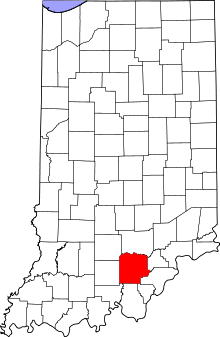 Location in the U.S. state of Indiana | ||
 Indiana's location in the U.S. | ||
| Founded | 1814 | |
| Named for | George Washington | |
| Seat | Salem | |
| Largest city | Salem | |
| Area | ||
| • Total | 516.60 sq mi (1,338 km2) | |
| • Land | 513.72 sq mi (1,331 km2) | |
| • Water | 2.87 sq mi (7 km2), 0.56% | |
| Population | ||
| • (2010) | 28,262 | |
| • Density | 54.9/sq mi (21/km²) | |
| Congressional district | 9th | |
| Time zone | Eastern: UTC-5/-4 | |
| Website |
www | |
| Footnotes: Indiana county number 88 | ||

Washington County is a county located in the U.S. state of Indiana. As of 2010, the population was 28,262.[1] The county seat is Salem.[2]
Washington County is part of the Louisville/Jefferson County, KY–IN Metropolitan Statistical Area.
History
Early settlers
As early as 1802, a man named Frederick Royce lived among the Ox Indians at a place known as the Lick, two miles east of Salem and is probably the first white man to inhabit this county. He was a hunter-trader and salt manufacturer. In 1803, Thomas Hopper was the first to settle in this county near Hardinsburg.
Washington County was formed in 1814. It was named for U.S. President George Washington.[3]
Geography
According to the 2010 census, the county has a total area of 516.60 square miles (1,338.0 km2), of which 513.72 square miles (1,330.5 km2) (or 99.44%) is land and 2.87 square miles (7.4 km2) (or 0.56%) is water.[4]
Adjacent counties
- Jackson County (north)
- Scott County (northeast)
- Clark County (southeast)
- Floyd County (south-southeast)
- Harrison County (south)
- Crawford County (southwest)
- Orange County (west)
- Lawrence County (northwest)
Cities and towns
CDPs
Unincorporated towns
Townships
Major highways
Climate and weather
| Salem, Indiana | ||||||||||||||||||||||||||||||||||||||||||||||||||||||||||||
|---|---|---|---|---|---|---|---|---|---|---|---|---|---|---|---|---|---|---|---|---|---|---|---|---|---|---|---|---|---|---|---|---|---|---|---|---|---|---|---|---|---|---|---|---|---|---|---|---|---|---|---|---|---|---|---|---|---|---|---|---|
| Climate chart (explanation) | ||||||||||||||||||||||||||||||||||||||||||||||||||||||||||||
| ||||||||||||||||||||||||||||||||||||||||||||||||||||||||||||
| ||||||||||||||||||||||||||||||||||||||||||||||||||||||||||||
In recent years, average temperatures in Salem have ranged from a low of 21 °F (−6 °C) in January to a high of 87 °F (31 °C) in July, although a record low of −32 °F (−36 °C) was recorded in February 1951 and a record high of 105 °F (41 °C) was recorded in July 1954. Average monthly precipitation ranged from 2.87 inches (73 mm) in October to 4.86 inches (123 mm) in May.[5]
Five people were reported killed in Washington County during the Early March 2012 tornado outbreak. Four were found dead in a home on Old Pekin Road according to Washington County officials. The fifth, a 15-month-old from the same family, had been found in a field, and died later in hospital.[6]
Government
| Washington County Sheriff's Department | |
|---|---|
| Agency overview | |
| Legal personality | Governmental: Government agency |
| Jurisdictional structure | |
| Operations jurisdiction* | County (US) of Washington in the state of Indiana, United States |
| Legal jurisdiction | As per operations jurisdiction. |
| General nature | |
| Operational structure | |
| Agency executive | Claude Combs, Sheriff |
| Footnotes | |
| * Divisional agency: Division of the country, over which the agency has usual operational jurisdiction. | |
The county government is a constitutional body, and is granted specific powers by the Constitution of Indiana, and by the Indiana Code.
County Council: The county council is the legislative branch of the county government and controls all the spending and revenue collection in the county. Representatives are elected from county districts. The council members serve four-year terms. They are responsible for setting salaries, the annual budget, and special spending. The council also has limited authority to impose local taxes, in the form of an income and property tax that is subject to state level approval, excise taxes, and service taxes.[7][8]
Board of Commissioners: The executive body of the county is made of a board of commissioners. The commissioners are elected county-wide, in staggered terms, and each serves a four-year term. One of the commissioners, typically the most senior, serves as president. The commissioners are charged with executing the acts legislated by the council, collecting revenue, and managing the day-to-day functions of the county government.[7][8]
Court: There are two judges in Washington County. The Judge of the Circuit Court is the Hon. Robert L. Bennett (D). The Judge of the Superior Court is the Hon. Frank E. Newkirk, Jr. (R). Case distribution is determined by local court rules. Each judge serves a six-year term.
County Officials: The county has several other elected offices, including sheriff, coroner, auditor, treasurer, recorder, surveyor, and circuit court clerk. Each of these elected officers serves a term of four years and oversees a different part of county government. Members elected to county government positions are required to declare party affiliations and to be residents of the county.[8]
Washington County is part of Indiana's 9th congressional district and is represented in Congress by Republican Todd Young.
Demographics
| Historical population | |||
|---|---|---|---|
| Census | Pop. | %± | |
| 1820 | 9,039 | — | |
| 1830 | 13,064 | 44.5% | |
| 1840 | 15,269 | 16.9% | |
| 1850 | 17,040 | 11.6% | |
| 1860 | 17,909 | 5.1% | |
| 1870 | 18,495 | 3.3% | |
| 1880 | 18,955 | 2.5% | |
| 1890 | 18,619 | −1.8% | |
| 1900 | 19,409 | 4.2% | |
| 1910 | 17,445 | −10.1% | |
| 1920 | 16,645 | −4.6% | |
| 1930 | 16,285 | −2.2% | |
| 1940 | 17,008 | 4.4% | |
| 1950 | 16,520 | −2.9% | |
| 1960 | 17,819 | 7.9% | |
| 1970 | 19,278 | 8.2% | |
| 1980 | 21,932 | 13.8% | |
| 1990 | 23,717 | 8.1% | |
| 2000 | 27,223 | 14.8% | |
| 2010 | 28,262 | 3.8% | |
| Est. 2015 | 27,827 | [9] | −1.5% |
| U.S. Decennial Census[10] 1790-1960[11] 1900-1990[12] 1990-2000[13] 2010-2013[1] | |||
As of the 2010 United States Census, there were 28,262 people, 10,850 households, and 7,799 families residing in the county.[14] The population density was 55.0 inhabitants per square mile (21.2/km2). There were 12,220 housing units at an average density of 23.8 per square mile (9.2/km2).[4] The racial makeup of the county was 98.1% white, 0.3% Asian, 0.2% American Indian, 0.2% black or African American, 0.3% from other races, and 0.9% from two or more races. Those of Hispanic or Latino origin made up 1.1% of the population.[14] In terms of ancestry, 25.2% were German, 14.3% were American, 13.7% were Irish, and 9.6% were English.[15]
Of the 10,850 households, 34.7% had children under the age of 18 living with them, 54.8% were married couples living together, 11.1% had a female householder with no husband present, 28.1% were non-families, and 23.7% of all households were made up of individuals. The average household size was 2.58 and the average family size was 3.02. The median age was 39.2 years.[14]
The median income for a household in the county was $47,697 and the median income for a family was $45,500. Males had a median income of $38,100 versus $28,092 for females. The per capita income for the county was $19,278. About 12.2% of families and 16.9% of the population were below the poverty line, including 24.7% of those under age 18 and 14.9% of those age 65 or over.[16]
Education
The county is served by 3 school districts:[17]
- Salem Community Schools
- East Washington School Corporation
- South Central Area Special Ed
- West Washington School Corporation.
East Washington School Corporation (Superintendent:Steve Darnell[18]) includes:[19]
- East Washington Elementary School
- East Washington Middle School
- Eastern High School
Salem Community Schools (Superintendent:Dr. D. Lynn Reed[20]) includes:[20]
- Salem High School
- Salem Middle School
- Bradie Shrum Elementary School
West Washington School Corporation (Superintendent:Gerald Jackson[21]) includes:[21]
- West Washington Elementary School
- West Washington Junior/Senior High School
See also
- Louisville-Jefferson County, KY-IN Metropolitan Statistical Area
- Louisville-Elizabethtown-Scottsburg, KY-IN Combined Statistical Area
- National Register of Historic Places listings in Washington County, Indiana
References
- Specific
- 1 2 "Washington County QuickFacts". United States Census Bureau. Retrieved 2011-09-25.
- ↑ "Find a County". National Association of Counties. Retrieved 2011-06-07.
- ↑ De Witt Clinton Goodrich & Charles Richard Tuttle (1875). An Illustrated History of the State of Indiana. Indiana: R. S. Peale & co. p. 575.
- 1 2 "Population, Housing Units, Area, and Density: 2010 - County". United States Census Bureau. Retrieved 2015-07-10.
- 1 2 "Monthly Averages for Salem, Indiana". The Weather Channel. Retrieved 2011-01-27.
- ↑ "US Tornadoes: Toddler Found in Field Dies After Coming off Life Support". London: The Guardian. 5 March 2012. Retrieved 5 March 2012.
- 1 2 Indiana Code. "Title 36, Article 2, Section 3". IN.gov. Retrieved 2008-09-16.
- 1 2 3 Indiana Code. "Title 2, Article 10, Section 2" (PDF). IN.gov. Retrieved 2008-09-16.
- ↑ "County Totals Dataset: Population, Population Change and Estimated Components of Population Change: April 1, 2010 to July 1, 2015". Retrieved July 2, 2016.
- ↑ "U.S. Decennial Census". United States Census Bureau. Retrieved July 10, 2014.
- ↑ "Historical Census Browser". University of Virginia Library. Retrieved July 10, 2014.
- ↑ "Population of Counties by Decennial Census: 1900 to 1990". United States Census Bureau. Retrieved July 10, 2014.
- ↑ "Census 2000 PHC-T-4. Ranking Tables for Counties: 1990 and 2000" (PDF). United States Census Bureau. Retrieved July 10, 2014.
- 1 2 3 "DP-1 Profile of General Population and Housing Characteristics: 2010 Demographic Profile Data". United States Census Bureau. Retrieved 2015-07-10.
- ↑ "DP02 SELECTED SOCIAL CHARACTERISTICS IN THE UNITED STATES – 2006-2010 American Community Survey 5-Year Estimates". United States Census Bureau. Retrieved 2015-07-10.
- ↑ "DP03 SELECTED ECONOMIC CHARACTERISTICS – 2006-2010 American Community Survey 5-Year Estimates". United States Census Bureau. Retrieved 2015-07-10.
- ↑ Education, Indiana Department of (2009). "Indiana Public Superintendent Directory 2009" (PDF). Retrieved 2009-05-28.
- ↑ Corporation, East Washington School (2009). "Central Office". Retrieved 2009-05-28.
- ↑ Corporation, East Washington School (2009). "Welcome to the EWSC". Retrieved 2009-05-28.
- 1 2 Schools, Salem Community (2009). ":: Salem Community Schools ::". Retrieved 2009-05-28.
- 1 2 Corporation, West Washington School. "West Washington School". Retrieved 2009-05-28.
- General
- American Legion Pekin Post 203, The. History of Pekin, Indiana (1959). The American Legion Pekin Post 203
- Everton Publishers, Inc, The. Handy book for Genealogists (1971). Everton Publishers, Inc, The
- History of Washington County 1884 (1884).
- Indiana Historical Commission. Indiana History Bulletin (August 1924). Wm. B. Burford
External links
 |
Lawrence County | Jackson County | Scott County | |
| Orange County | |
|||
| ||||
| | ||||
| Crawford County | Floyd County and Harrison County | Clark County |

Coordinates: 38°36′N 86°07′W / 38.60°N 86.11°W