Two Rock, California
| Two Rock, California | |
|---|---|
| unincorporated community | |
|
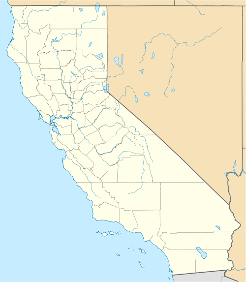
Two Rock and Dos Piedros in 2008 | |
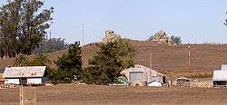
 Two Rock, California Location within the state of California | |
| Coordinates: 38°15′59″N 122°47′32″W / 38.26639°N 122.79222°WCoordinates: 38°15′59″N 122°47′32″W / 38.26639°N 122.79222°W | |
| Country | United States |
| State | California |
| County | Sonoma |
| Elevation[1] | 82 ft (25 m) |
| Population | |
| • Total | 6 |
| Time zone | PST (UTC-8) |
| • Summer (DST) | PDT (UTC-7) |
| ZIP code | 94952 |
| Area code(s) | 707 |
| FIPS code | 06-81108 |
| GNIS feature ID | 1660064 |
Two Rock is an unincorporated community in Sonoma County, California, United States. It is located on Stemple Creek in a rural area west of Petaluma. A hill named Dos Piedros (Spanish for "two rocks", 157 feet (48 m) above sea level) overlooks the community from the north.
The main road is Valley Ford Road, which passes northwest-southeast through Two Rock.
The Coast Guard's Training Center Petaluma facility is located just south of Two Rock.
Two Rock used to provide basic services to local ranches, but little remains today.[2]
References
External links
![]() Media related to Two Rock, California at Wikimedia Commons
Media related to Two Rock, California at Wikimedia Commons
 |
Bloomfield | | ||
| Tomales | |
Cotati | ||
| ||||
| | ||||
| Training Center Petaluma | Petaluma |
| Bodies of water |
|  |
|---|---|---|
| Counties | ||
| Major cities | ||
| Cities and towns 100k–250k | ||
| Cities and towns 50k–99k | ||
| Cities and towns 25k-50k | ||
| Cities and towns 10k–25k |
| |
| Sub-regions | ||
This article is issued from Wikipedia - version of the 8/1/2016. The text is available under the Creative Commons Attribution/Share Alike but additional terms may apply for the media files.