Weedville, Pennsylvania
| Weedville, Pennsylvania | |
|---|---|
| Census-designated place | |
 Weedville | |
| Coordinates: 41°16′35″N 78°29′30″W / 41.27639°N 78.49167°WCoordinates: 41°16′35″N 78°29′30″W / 41.27639°N 78.49167°W | |
| Country | United States |
| State | Pennsylvania |
| County | Elk |
| Township | Jay |
| Area | |
| • Total | 2.00 sq mi (5.18 km2) |
| • Land | 1.95 sq mi (5.06 km2) |
| • Water | 0.05 sq mi (0.13 km2) |
| Elevation | 1,170 ft (360 m) |
| Population (2010) | |
| • Total | 542 |
| • Density | 278/sq mi (107.2/km2) |
| Time zone | Eastern (EST) (UTC-5) |
| • Summer (DST) | EDT (UTC-4) |
| ZIP code | 15868 |
| FIPS code | 42-81960 |
| GNIS feature ID | 1190770 |
Weedville is an unincorporated community and census-designated place in Jay Township, Elk County, Pennsylvania, United States. As of the 2010 census the population was 542.[1]
It is located in the southern part of Jay Township, in southeastern Elk County, in the valley of the Bennett Branch Sinnemahoning Creek, a tributary of the West Branch Susquehanna River. It is bordered to the northwest by Byrnedale and to the southwest by Force. Pennsylvania Route 255 passes through the community, leading north 12 miles (19 km) to St. Marys and southwest 19 miles (31 km) to DuBois. Pennsylvania Route 555 branches off PA 255 in the center of Weedville, leading northeast then east down the Bennett Branch valley 26 miles (42 km) to Driftwood.
References
- ↑ "Geographic Identifiers: 2010 Demographic Profile Data (G001): Weedville CDP, Pennsylvania". American Factfinder. U.S. Census Bureau. Retrieved March 14, 2016.
Municipalities and communities of Elk County, Pennsylvania, United States | ||
|---|---|---|
| City | 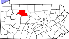 | |
| Boroughs | ||
| Townships | ||
| CDPs | ||
| Unincorporated communities | ||
This article is issued from Wikipedia - version of the 6/25/2016. The text is available under the Creative Commons Attribution/Share Alike but additional terms may apply for the media files.