Wrens, Georgia
| Wrens, Georgia | |
|---|---|
| City | |
 Location in Jefferson County and the state of Georgia | |
| Coordinates: 33°12′29″N 82°23′15″W / 33.20806°N 82.38750°WCoordinates: 33°12′29″N 82°23′15″W / 33.20806°N 82.38750°W | |
| Country | United States |
| State | Georgia |
| County | Jefferson |
| Area | |
| • Total | 3 sq mi (7.9 km2) |
| • Land | 3 sq mi (7.9 km2) |
| • Water | 0 sq mi (0 km2) |
| Elevation | 407 ft (124 m) |
| Population (2010) | |
| • Total | 2,187 |
| • Density | 771.3/sq mi (292.9/km2) |
| Time zone | Eastern (EST) (UTC-5) |
| • Summer (DST) | EDT (UTC-4) |
| ZIP codes | 30818, 30833 |
| Area code(s) | 706 |
| FIPS code | 13-84456[1] |
| GNIS feature ID | 0333472[2] |
Wrens is a city in Jefferson County, Georgia, United States. The population was 2,187 at the 2010 census.[3] It is located on U.S. Route 1, thirty miles south of Augusta.
Geography
Wrens is located at 33°12′29″N 82°23′15″W / 33.208171°N 82.387520°W.[4]
According to the United States Census Bureau, the city has a total area of 3.0 square miles (7.8 km2), of which 3.0 square miles (7.8 km2) is land and 0.33% is water.
Demographics
| Historical population | |||
|---|---|---|---|
| Census | Pop. | %± | |
| 1910 | 616 | — | |
| 1920 | 1,074 | 74.4% | |
| 1930 | 1,085 | 1.0% | |
| 1940 | 1,192 | 9.9% | |
| 1950 | 1,380 | 15.8% | |
| 1960 | 1,628 | 18.0% | |
| 1970 | 2,204 | 35.4% | |
| 1980 | 2,415 | 9.6% | |
| 1990 | 2,414 | 0.0% | |
| 2000 | 2,314 | −4.1% | |
| 2010 | 2,187 | −5.5% | |
| Est. 2015 | 2,051 | [5] | −6.2% |
As of the census[1] of 2000, there were 2,314 people, 903 households, and 632 families residing in the city. The population density was 760.1 people per square mile (293.9/km²). There were 1,030 housing units at an average density of 338.3 per square mile (130.8/km²). The racial makeup of the city was 65.17% African American, 33.19% White, 0.09% Native American, 0.17% Asian, 0.26% from other races, and 1.12% from two or more races. Hispanic or Latino people of any race were 0.78% of the population.
There were 903 households out of which 31.2% had children under the age of 18 living with them, 34.4% were married couples living together, 31.6% had a female householder with no husband present, and 30.0% were non-families. 27.4% of all households were made up of individuals and 12.0% had someone living alone who was 65 years of age or older. The average household size was 2.56 and the average family size was 3.10.
In the city the population was spread out with 29.9% under the age of 18, 9.6% from 18 to 24, 23.8% from 25 to 44, 23.7% from 45 to 64, and 13.0% who were 65 years of age or older. The median age was 34 years. For every 100 females there were 77.9 males. For every 100 females age 18 and over, there were 72.9 males.
The median income for a household in the city was $23,632, and the median income for a family was $26,776. Males had a median income of $30,208 versus $20,625 for females. The per capita income for the city was $12,425. About 23.8% of families and 27.4% of the population were below the poverty line, including 40.7% of those under age 18 and 22.1% of those age 65 or over.
Notable people
- Erskine Caldwell, author of Tobacco Road and God's Little Acre
- Dr. Molly Howard, 2008 National Principal of the Year, Secondary School[7]
- Bruce Kelly, landscape architect who created the John Lennon memorial Strawberry Fields in Central Park, New York[8]
- M.V. "Mark" Oliphant, actor, Tyler Perry's For Better or Worse, TV One's Fatal Attraction[9][10]
- Fernando Velasco, NFL center for the Tennessee Titans[11]
- Sean Walker, current NFL wide receiver[12]
See also
- Local radio station: WPEH, Big Peach Radio (92.1 FM and 1420 AM)
- Central Savannah River Area
References
- 1 2 "American FactFinder". United States Census Bureau. Retrieved 2008-01-31.
- ↑ "US Board on Geographic Names". United States Geological Survey. 2007-10-25. Retrieved 2008-01-31.
- ↑ http://factfinder2.census.gov/faces/tableservices/jsf/pages/productview.xhtml?fpt=table
- ↑ "US Gazetteer files: 2010, 2000, and 1990". United States Census Bureau. 2011-02-12. Retrieved 2011-04-23.
- ↑ "Annual Estimates of the Resident Population for Incorporated Places: April 1, 2010 to July 1, 2015". Retrieved July 2, 2016.
- ↑ "Census of Population and Housing". Census.gov. Retrieved June 4, 2015.
- ↑ USA Today Q&A with Jefferson County High principal Molly Howard
- ↑ New York Times Obituary for Bruce Kelly
- ↑
- ↑
- ↑ Tennessee Titans player page on Fernando Velasco
- ↑ Sean Walker's ESPN athlete page
External links
- Official website
- The News and Farmer and Wadley Herald / Jefferson Reporter, the county's weekly newspaper and the oldest weekly newspaper in Georgia
- Official Jefferson County economic wevelopment Website
- Old Quaker Road historical marker
- Ways Baptist Church and Stellaville School historical marker
Municipalities and communities of Jefferson County, Georgia, United States | ||
|---|---|---|
| Cities | 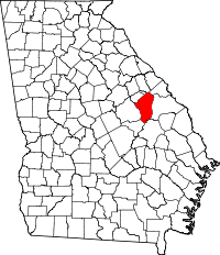 | |
| Town | ||
| CDP | ||
| Footnotes | ‡This populated place also has portions in an adjacent county or counties | |