McCormick County, South Carolina
| McCormick County, South Carolina | |
|---|---|
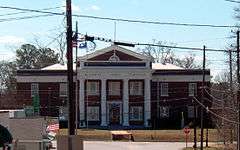 McCormick County Courthouse, McCormick | |
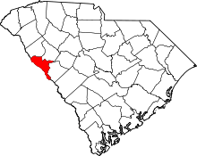 Location in the U.S. state of South Carolina | |
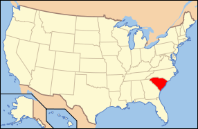 South Carolina's location in the U.S. | |
| Founded | 1916 |
| Named for | Cyrus McCormick |
| Seat | McCormick |
| Largest town | McCormick |
| Area | |
| • Total | 394 sq mi (1,020 km2) |
| • Land | 359 sq mi (930 km2) |
| • Water | 35 sq mi (91 km2), 8.8% |
| Population | |
| • (2010) | 10,233 |
| • Density | 28/sq mi (11/km²) |
| Congressional district | 3rd |
| Time zone | Eastern: UTC-5/-4 |
| Website |
mccormickcountysc |
McCormick County is a county located in the U.S. state of South Carolina. As of the 2010 census, its population was 10,233,[1] making it the least-populous county in South Carolina. Its county seat is McCormick.[2] The county was formed in 1916 from parts of Edgefield, Abbeville, and Greenwood Counties.[3]
Geography
According to the U.S. Census Bureau, the county has a total area of 394 square miles (1,020 km2), of which 359 square miles (930 km2) is land and 35 square miles (91 km2) (8.8%) is water.[4] It is the smallest county in South Carolina by land area and second-smallest by total area. McCormick County is in the Savannah River basin.
Notable People
Dr. Lisa Jennings, M.D.
Lieutenant Colonel Dwight Lomax, U.S. Army, Retired
Chief Petty Officer Tracy Thompkins, U.S. Navy, Retired
Clay Dorn, Federal Express Supervisor
Dudley Musier, Sheriff, Kingstree, SC
Owen P. McCormick - Count of Brooklyn
Johnny Letman - Musician
Patrick Noble - SC Governor
Adjacent Counties
- Greenwood County - northeast
- Edgefield County - east
- Columbia County, Georgia - south
- Lincoln County, Georgia - west
- Elbert County, Georgia - northwest
- Abbeville County - northwest
National protected area
- Sumter National Forest (part)
Demographics
| Historical population | |||
|---|---|---|---|
| Census | Pop. | %± | |
| 1920 | 16,444 | — | |
| 1930 | 11,471 | −30.2% | |
| 1940 | 10,367 | −9.6% | |
| 1950 | 9,577 | −7.6% | |
| 1960 | 8,629 | −9.9% | |
| 1970 | 7,955 | −7.8% | |
| 1980 | 7,797 | −2.0% | |
| 1990 | 8,868 | 13.7% | |
| 2000 | 9,958 | 12.3% | |
| 2010 | 10,233 | 2.8% | |
| Est. 2015 | 9,706 | [5] | −5.2% |
| U.S. Decennial Census[6] 1790-1960[7] 1900-1990[8] 1990-2000[9] 2010-2013[1] | |||
2000 census
As of the census[10] of 2000, there were 9,958 people, 3,558 households and 2,604 families residing in the county. The population density was 28 people per square mile (11/km²). There were 4,459 housing units at an average density of 12 per square mile (5/km²). The racial makeup of the county was 44.78% White, 53.88% Black or African American, 0.07% Native American, 0.29% Asian, 0.03% Pacific Islander, 0.38% from other races, and 0.57% from two or more races. 0.86% of the population were Hispanic or Latino of any race.
There were 3,558 households out of which 24.80% had children under the age of 18 living with them, 51.80% were married couples living together, 17.60% had a female householder with no husband present and 26.80% were non-families. 24.40% of all households were made up of individuals and 10.20% had someone living alone who was 65 years of age or older. The average household size was 2.39 and the average family size was 2.82.
In the county, the population was spread out with 19.50% under the age of 18, 8.30% from 18 to 24, 27.60% from 25 to 44, 28.10% from 45 to 64 and 16.50% who were 65 years of age or older. The median age was 41 years. For every 100 females there were 113.70 males. For every 100 females age 18 and over, there were 115.80 males.
The median income for a household in the county was $31,577, and the median income for a family was $38,822. Males had a median income of $28,824 versus $21,587 for females. The per capita income for the county was $14,770. About 15.10% of families and 17.90% of the population were below the poverty line, including 26.50% of those under age 18 and 11.90% of those age 65 or over.
2010 census
As of the 2010 United States Census, there were 10,233 people, 4,027 households, and 2,798 families residing in the county.[11] The population density was 28.5 inhabitants per square mile (11.0/km2). There were 5,453 housing units at an average density of 15.2 per square mile (5.9/km2).[12] The racial makeup of the county was 49.7% black or African American, 48.7% white, 0.3% Asian, 0.1% Pacific islander, 0.1% American Indian, 0.2% from other races, and 0.9% from two or more races. Those of Hispanic or Latino origin made up 0.8% of the population.[11] In terms of ancestry, 10.7% were English, 10.2% were American, 10.2% were German, and 6.0% were Irish.[13]
Of the 4,027 households, 21.0% had children under the age of 18 living with them, 50.4% were married couples living together, 15.2% had a female householder with no husband present, 30.5% were non-families, and 27.4% of all households were made up of individuals. The average household size was 2.22 and the average family size was 2.65. The median age was 50.0 years.[11]
The median income for a household in the county was $35,858 and the median income for a family was $43,021. Males had a median income of $32,606 versus $28,067 for females. The per capita income for the county was $19,411. About 14.2% of families and 18.2% of the population were below the poverty line, including 37.6% of those under age 18 and 7.9% of those age 65 or over.[14]
Communities
Towns
- McCormick (county seat)
- Parksville
- Plum Branch
Census-designated places
See also
References
- 1 2 "State & County QuickFacts". United States Census Bureau. Retrieved November 25, 2013.
- ↑ "Find a County". National Association of Counties. Archived from the original on May 31, 2011. Retrieved 2011-06-07.
- ↑ "South Carolina: Individual County Chronologies". South Carolina Atlas of Historical County Boundaries. The Newberry Library. 2009. Retrieved March 21, 2015.
- ↑ "2010 Census Gazetteer Files". United States Census Bureau. August 22, 2012. Retrieved March 18, 2015.
- ↑ "County Totals Dataset: Population, Population Change and Estimated Components of Population Change: April 1, 2010 to July 1, 2015". Retrieved July 2, 2016.
- ↑ "U.S. Decennial Census". United States Census Bureau. Archived from the original on May 11, 2015. Retrieved March 18, 2015.
- ↑ "Historical Census Browser". University of Virginia Library. Retrieved March 18, 2015.
- ↑ Forstall, Richard L., ed. (March 27, 1995). "Population of Counties by Decennial Census: 1900 to 1990". United States Census Bureau. Retrieved March 18, 2015.
- ↑ "Census 2000 PHC-T-4. Ranking Tables for Counties: 1990 and 2000" (PDF). United States Census Bureau. April 2, 2001. Retrieved March 18, 2015.
- ↑ "American FactFinder". United States Census Bureau. Archived from the original on September 11, 2013. Retrieved 2011-05-14.
- 1 2 3 "DP-1 Profile of General Population and Housing Characteristics: 2010 Demographic Profile Data". United States Census Bureau. Retrieved 2016-03-11.
- ↑ "Population, Housing Units, Area, and Density: 2010 - County". United States Census Bureau. Retrieved 2016-03-11.
- ↑ "DP02 SELECTED SOCIAL CHARACTERISTICS IN THE UNITED STATES – 2006-2010 American Community Survey 5-Year Estimates". United States Census Bureau. Retrieved 2016-03-11.
- ↑ "DP03 SELECTED ECONOMIC CHARACTERISTICS – 2006-2010 American Community Survey 5-Year Estimates". United States Census Bureau. Retrieved 2016-03-11.
 |
Abbeville County and Elbert County, Georgia | Greenwood County | | |
| Lincoln County, Georgia | |
Edgefield County | ||
| ||||
| | ||||
| Columbia County, Georgia |
Municipalities and communities of McCormick County, South Carolina, United States | ||
|---|---|---|
| Towns | | |
| CDPs | ||
Coordinates: 33°54′N 82°18′W / 33.90°N 82.30°W