Świna
| Świna | |
|---|---|
 Świna and the Baltic Sea | |
| Country | Poland, Germany |
| Basin | |
| Main source | Szczecin Lagoon |
| River mouth |
Baltic Sea 53°55′21″N 14°16′52″E / 53.92250°N 14.28111°ECoordinates: 53°55′21″N 14°16′52″E / 53.92250°N 14.28111°E |
| Physical characteristics | |
| Length | 16 km (9.9 mi) |
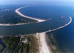
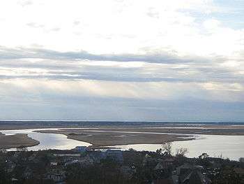
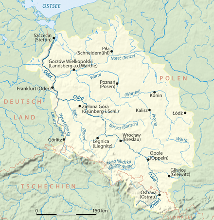
The Świna (German: Swine; Pomeranian: Swina) is a river in Poland flowing from the Oder Lagoon to the Baltic Sea, between the islands of Uznam and Wolin. It is a part of the Oder River estuary, and carries about 75% of that river's waterflow (of the remainder, Peenestrom carries 15% and Dziwna 10%). It has a length of about 16 km. Świnoujście is a major town on the river.
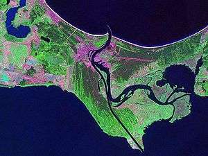
The German Empire dammed and deepened the river from 1874-1880 to create the Kaiserfahrt (Piast canal).[1] It connects the northern part of the Świna directly with the Szczecin Lagoon and the Pomeranian harbor of Szczecin (Stettin). The river thus gained importance as a direct waterway to the industrial city. The territory along the river's path was transferred from Germany to Poland following World War II.
Regressive Delta
The regressive delta was formed by the floods of Świna River in the area of the Wolin National Park in 1996. This water-muddy natural complex forms an archipelago of 44 islands and canals with changing directions of water flow. The Delta Świna River was formed by the Scandinavian glacier that withdrew from this territory 12 thousand years ago. During the western and northern storms sea water flowed into the Bay of Szczecin, overflowing the islands. The borders of islands are constantly shaped during the process of accumulation.
References
- ↑ http://swinemuende.name/Kaseburg%20%28Karsibor,%20district%20of%20Swinemuende%29.htm. Kaseburg (Karsibor district of Swinemuende). Accessed 28-04-2012.
See also
Tributaries of the Oder / Odra | ||
|---|---|---|
| Main tributaries of the left bank |
|  |
| Main tributaries of the right bank | ||
| Distributary | ||
| Cities | ||