Ambres
| Ambres | ||
|---|---|---|
|
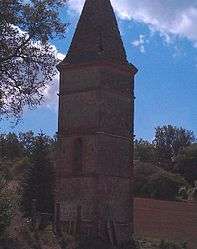
The Montplaisir Dovecote, in Ambres | ||
| ||
 Ambres | ||
|
Location within Occitanie region  Ambres | ||
| Coordinates: 43°43′58″N 1°48′51″E / 43.7328°N 1.8142°ECoordinates: 43°43′58″N 1°48′51″E / 43.7328°N 1.8142°E | ||
| Country | France | |
| Region | Occitanie | |
| Department | Tarn | |
| Arrondissement | Castres | |
| Canton | Lavaur | |
| Intercommunality | Tarn et Agout | |
| Government | ||
| • Mayor (2014–20) | Michel Tournier | |
| Area1 | 19.11 km2 (7.38 sq mi) | |
| Population (2013)2 | 963 | |
| • Density | 50/km2 (130/sq mi) | |
| Time zone | CET (UTC+1) | |
| • Summer (DST) | CEST (UTC+2) | |
| INSEE/Postal code | 81011 / 81500 | |
| Elevation |
100–225 m (328–738 ft) (avg. 201 m or 659 ft) | |
|
1 French Land Register data, which excludes lakes, ponds, glaciers > 1 km² (0.386 sq mi or 247 acres) and river estuaries. 2 Population without double counting: residents of multiple communes (e.g., students and military personnel) only counted once. | ||
.svg.png)
Ambres is a commune in the Tarn department and Occitanie region of southern France.
Geography
The river Dadou flows into the Agout in the commune.
See also
References
| Wikimedia Commons has media related to Ambres. |
This article is issued from Wikipedia - version of the 11/12/2016. The text is available under the Creative Commons Attribution/Share Alike but additional terms may apply for the media files.