Teyssode
| Teyssode | ||
|---|---|---|
|
Teyssode and its surroundings | ||
| ||
 Teyssode | ||
|
Location within Occitanie region  Teyssode | ||
| Coordinates: 43°39′02″N 1°56′08″E / 43.6506°N 1.9356°ECoordinates: 43°39′02″N 1°56′08″E / 43.6506°N 1.9356°E | ||
| Country | France | |
| Region | Occitanie | |
| Department | Tarn | |
| Arrondissement | Castres | |
| Canton | Saint-Paul-Cap-de-Joux | |
| Intercommunality | Pays d'Agout | |
| Government | ||
| • Mayor (2014-2020) | Daniel Castagne | |
| Area1 | 22.88 km2 (8.83 sq mi) | |
| Population (2006)2 | 358 | |
| • Density | 16/km2 (41/sq mi) | |
| Time zone | CET (UTC+1) | |
| • Summer (DST) | CEST (UTC+2) | |
| INSEE/Postal code | 81299 / 81220 | |
| Elevation |
127–327 m (417–1,073 ft) (avg. 288 m or 945 ft) | |
|
1 French Land Register data, which excludes lakes, ponds, glaciers > 1 km² (0.386 sq mi or 247 acres) and river estuaries. 2 Population without double counting: residents of multiple communes (e.g., students and military personnel) only counted once. | ||

.svg.png)
Teyssode is a commune in the Tarn department in southern France.
Geography
Localisation
Teyssode is located south-east of Lavaur, the main town nearby.
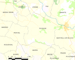
Map of Teyssode
Neighbouring communes
 |
Lavaur | Viterbe Fiac |
Damiatte | |
| Massac-Seran Pratviel |
|
Saint-Paul-Cap-de-Joux | ||
| ||||
| | ||||
| Magrin | Prades |
Toponymy
The name of Teyssode is of gallo-romance origin, from the word taxo meaning badger.[1]
History
Teyssode is located on a former Roman oppidum.
In 1824, Teyssode absorbed the neighbouring commune of Saint-Germier.
See also
References
External links
| Wikimedia Commons has media related to Teyssode. |
This article is issued from Wikipedia - version of the 7/26/2014. The text is available under the Creative Commons Attribution/Share Alike but additional terms may apply for the media files.