Ashburn, Missouri
| Ashburn, Missouri | |
|---|---|
| Village | |
 Location of Ashburn, Missouri | |
| Coordinates: 39°32′45″N 91°10′16″W / 39.54583°N 91.17111°WCoordinates: 39°32′45″N 91°10′16″W / 39.54583°N 91.17111°W | |
| Country | United States |
| State | Missouri |
| County | Pike |
| Area[1] | |
| • Total | 0.13 sq mi (0.34 km2) |
| • Land | 0.13 sq mi (0.34 km2) |
| • Water | 0 sq mi (0 km2) |
| Elevation | 472 ft (144 m) |
| Population (2010)[2] | |
| • Total | 52 |
| • Density | 400.0/sq mi (154.4/km2) |
| Time zone | Central (CST) (UTC-6) |
| • Summer (DST) | CDT (UTC-5) |
| ZIP code | 63433 |
| Area code(s) | 573 |
| FIPS code | 29-02152[3] |
| GNIS feature ID | 0713425[4] |
Ashburn is a village in Pike County, Missouri, United States. The population was 52 at the 2010 census.
Geography
Ashburn is located at 39°32′45″N 91°10′16″W / 39.54583°N 91.17111°W (39.545755, -91.170982).[5]
According to the United States Census Bureau, the village has a total area of 0.13 square miles (0.34 km2), all of it land.[1]
Demographics
2010 census
As of the census[2] of 2010, there were 52 people, 21 households, and 13 families residing in the village. The population density was 400.0 inhabitants per square mile (154.4/km2). There were 34 housing units at an average density of 261.5 per square mile (101.0/km2). The racial makeup of the village was 100.0% White.
There were 21 households of which 28.6% had children under the age of 18 living with them, 38.1% were married couples living together, 9.5% had a female householder with no husband present, 14.3% had a male householder with no wife present, and 38.1% were non-families. 23.8% of all households were made up of individuals and 14.3% had someone living alone who was 65 years of age or older. The average household size was 2.48 and the average family size was 2.85.
The median age in the village was 52.3 years. 23.1% of residents were under the age of 18; 3.8% were between the ages of 18 and 24; 15.4% were from 25 to 44; 34.6% were from 45 to 64; and 23.1% were 65 years of age or older. The gender makeup of the village was 53.8% male and 46.2% female.
2000 census
As of the census[3] of 2000, there were 51 people, 23 households, and 14 families residing in the town. The population density was 385.2 people per square mile (151.5/km²). There were 32 housing units at an average density of 241.7/sq mi (95.0/km²). The racial makeup of the town was 100.00% White.
There were 23 households out of which 17.4% had children under the age of 18 living with them, 47.8% were married couples living together, 8.7% had a female householder with no husband present, and 39.1% were non-families. 21.7% of all households were made up of individuals and 13.0% had someone living alone who was 65 years of age or older. The average household size was 2.22 and the average family size was 2.71.
In the town the population was spread out with 13.7% under the age of 18, 5.9% from 18 to 24, 25.5% from 25 to 44, 35.3% from 45 to 64, and 19.6% who were 65 years of age or older. The median age was 49 years. For every 100 females there were 88.9 males. For every 100 females age 18 and over, there were 100.0 males.
The median income for a household in the town was $11,797, and the median income for a family was $11,797. Males had a median income of $0 versus $0 for females. The per capita income for the town was $7,569. There were 69.6% of families and 72.2% of the population living below the poverty line, including 100.0% of under eighteens and none of those over 64.
References
- 1 2 "US Gazetteer files 2010". United States Census Bureau. Archived from the original on 2012-01-24. Retrieved 2012-07-08.
- 1 2 "American FactFinder". United States Census Bureau. Retrieved 2012-07-08.
- 1 2 "American FactFinder". United States Census Bureau. Archived from the original on 2013-09-11. Retrieved 2008-01-31.
- ↑ "US Board on Geographic Names". United States Geological Survey. 2007-10-25. Retrieved 2008-01-31.
- ↑ "US Gazetteer files: 2010, 2000, and 1990". United States Census Bureau. 2011-02-12. Retrieved 2011-04-23.
Municipalities and communities of Pike County, Missouri, United States | ||
|---|---|---|
| Cities | 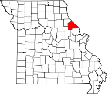 | |
| Villages | ||
| Townships |
| |
| CDPs | ||
| Unincorporated community | ||