Tarrants, Missouri
| Tarrants, Missouri | |
|---|---|
| Village | |
 Location of Tarrants, Missouri | |
| Coordinates: 39°21′23″N 91°11′0″W / 39.35639°N 91.18333°WCoordinates: 39°21′23″N 91°11′0″W / 39.35639°N 91.18333°W | |
| Country | United States |
| State | Missouri |
| County | Pike |
| Area[1] | |
| • Total | 0.04 sq mi (0.10 km2) |
| • Land | 0.04 sq mi (0.10 km2) |
| • Water | 0 sq mi (0 km2) |
| Elevation | 712 ft (217 m) |
| Population (2010)[2] | |
| • Total | 22 |
| • Density | 550.0/sq mi (212.4/km2) |
| Time zone | Central (CST) (UTC-6) |
| • Summer (DST) | CDT (UTC-5) |
| ZIP code | 63334 |
| Area code(s) | 573 |
| FIPS code | 29-72376[3] |
| GNIS feature ID | 0727467[4] |
Tarrants is a village in Pike County, Missouri, United States. The population was 22 at the 2010 census.
Geography
Tarrants is located at 39°21′23″N 91°11′0″W / 39.35639°N 91.18333°W (39.356275, -91.183321).[5]
According to the United States Census Bureau, the village has a total area of 0.04 square miles (0.10 km2), all of it land.[1]
Demographics
2010 census
As of the census[2] of 2010, there were 22 people, 12 households, and 9 families residing in the village. The population density was 550.0 inhabitants per square mile (212.4/km2). There were 13 housing units at an average density of 325.0 per square mile (125.5/km2). The racial makeup of the village was 100.0% White. Hispanic or Latino of any race were 4.5% of the population.
There were 12 households of which 8.3% had children under the age of 18 living with them, 58.3% were married couples living together, 16.7% had a female householder with no husband present, and 25.0% were non-families. 25.0% of all households were made up of individuals and 16.6% had someone living alone who was 65 years of age or older. The average household size was 1.83 and the average family size was 2.11.
The median age in the village was 61.5 years. 4.5% of residents were under the age of 18; 9% were between the ages of 18 and 24; 13.5% were from 25 to 44; 36.3% were from 45 to 64; and 36.4% were 65 years of age or older. The gender makeup of the village was 50.0% male and 50.0% female.
2000 census
As of the census[3] of 2000, there were 30 people, 15 households, and 10 families residing in the village. The population density was 689.3 people per square mile (289.6/km²). There were 15 housing units at an average density of 344.6 per square mile (144.8/km²). The racial makeup of the village was 96.67% White and 3.33% African American.
There were 15 households out of which 6.7% had children under the age of 18 living with them, 66.7% were married couples living together, and 33.3% were non-families. 20.0% of all households were made up of individuals and 13.3% had someone living alone who was 65 years of age or older. The average household size was 2.00 and the average family size was 2.30.
In the village the population was spread out with 3.3% under the age of 18, 6.7% from 18 to 24, 20.0% from 25 to 44, 40.0% from 45 to 64, and 30.0% who were 65 years of age or older. The median age was 57 years. For every 100 females there were 114.3 males. For every 100 females age 18 and over, there were 107.1 males.
The median income for a household in the village was $20,833, and the median income for a family was $20,833. Males had a median income of $21,250 versus $0 for females. The per capita income for the village was $11,358. None of the population and none of the families were below the poverty line.
References
- 1 2 "US Gazetteer files 2010". United States Census Bureau. Retrieved 2012-07-08.
- 1 2 "American FactFinder". United States Census Bureau. Retrieved 2012-07-08.
- 1 2 "American FactFinder". United States Census Bureau. Retrieved 2008-01-31.
- ↑ "US Board on Geographic Names". United States Geological Survey. 2007-10-25. Retrieved 2008-01-31.
- ↑ "US Gazetteer files: 2010, 2000, and 1990". United States Census Bureau. 2011-02-12. Retrieved 2011-04-23.
Municipalities and communities of Pike County, Missouri, United States | ||
|---|---|---|
| Cities | 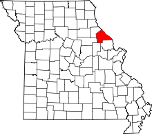 | |
| Villages | ||
| Townships |
| |
| CDPs | ||
| Unincorporated communities |
| |
| Ghost towns |
| |