Paynesville, Missouri
| Paynesville, Missouri | |
|---|---|
| Village | |
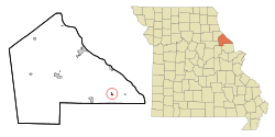 Location of Paynesville, Missouri | |
| Coordinates: 39°15′53″N 90°54′10″W / 39.26472°N 90.90278°WCoordinates: 39°15′53″N 90°54′10″W / 39.26472°N 90.90278°W | |
| Country | United States |
| State | Missouri |
| County | Pike |
| Area[1] | |
| • Total | 0.26 sq mi (0.67 km2) |
| • Land | 0.26 sq mi (0.67 km2) |
| • Water | 0 sq mi (0 km2) |
| Elevation | 535 ft (163 m) |
| Population (2010)[2] | |
| • Total | 77 |
| • Estimate (2012[3]) | 77 |
| • Density | 296.2/sq mi (114.4/km2) |
| Time zone | Central (CST) (UTC-6) |
| • Summer (DST) | CDT (UTC-5) |
| ZIP code | 63336 |
| Area code(s) | 573 |
| FIPS code | 29-56612[4] |
| GNIS feature ID | 0729602[5] |
Paynesville is a village in Pike County, Missouri, United States. The population was 77 at the 2010 census.
Geography
Paynesville is located at 39°15′53″N 90°54′10″W / 39.26472°N 90.90278°W (39.264615, -90.902837).[6]
According to the United States Census Bureau, the village has a total area of 0.26 square miles (0.67 km2), all of it land.[1]
Demographics
| Historical population | |||
|---|---|---|---|
| Census | Pop. | %± | |
| 1880 | 243 | — | |
| 1970 | 90 | — | |
| 1980 | 85 | −5.6% | |
| 1990 | 54 | −36.5% | |
| 2000 | 91 | 68.5% | |
| 2010 | 77 | −15.4% | |
| Est. 2015 | 77 | [7] | 0.0% |
2010 census
As of the census[2] of 2010, there were 77 people, 34 households, and 19 families residing in the village. The population density was 296.2 inhabitants per square mile (114.4/km2). There were 38 housing units at an average density of 146.2 per square mile (56.4/km2). The racial makeup of the village was 83.1% White, 14.3% African American, and 2.6% from two or more races.
There were 34 households of which 26.5% had children under the age of 18 living with them, 35.3% were married couples living together, 14.7% had a female householder with no husband present, 5.9% had a male householder with no wife present, and 44.1% were non-families. 44.1% of all households were made up of individuals and 20.5% had someone living alone who was 65 years of age or older. The average household size was 2.26 and the average family size was 3.16.
The median age in the village was 38.1 years. 26% of residents were under the age of 18; 3.9% were between the ages of 18 and 24; 26% were from 25 to 44; 24.7% were from 45 to 64; and 19.5% were 65 years of age or older. The gender makeup of the village was 54.5% male and 45.5% female.
2000 census
As of the census[4] of 2000, there were 91 people, 33 households, and 25 families residing in the village. The population density was 345.7 people per square mile (135.1/km²). There were 35 housing units at an average density of 133.0 per square mile (52.0/km²). The racial makeup of the village was 73.63% White and 26.37% African American.
There were 33 households out of which 36.4% had children under the age of 18 living with them, 48.5% were married couples living together, 15.2% had a female householder with no husband present, and 24.2% were non-families. 24.2% of all households were made up of individuals and 15.2% had someone living alone who was 65 years of age or older. The average household size was 2.76 and the average family size was 3.20.
In the village the population was spread out with 26.4% under the age of 18, 8.8% from 18 to 24, 28.6% from 25 to 44, 20.9% from 45 to 64, and 15.4% who were 65 years of age or older. The median age was 37 years. For every 100 females there were 116.7 males. For every 100 females age 18 and over, there were 103.0 males.
The median income for a household in the village was $25,625, and the median income for a family was $30,000. Males had a median income of $21,875 versus $18,125 for females. The per capita income for the village was $11,783. There were 9.1% of families and 14.3% of the population living below the poverty line, including 41.2% of those under 18 and 20.0% of those over 64.
References
- 1 2 "US Gazetteer files 2010". United States Census Bureau. Archived from the original on January 24, 2012. Retrieved 2012-07-08.
- 1 2 "American FactFinder". United States Census Bureau. Retrieved 2012-07-08.
- ↑ "Population Estimates". United States Census Bureau. Archived from the original on June 17, 2013. Retrieved 2013-05-30.
- 1 2 "American FactFinder". United States Census Bureau. Retrieved 2008-01-31.
- ↑ "US Board on Geographic Names". United States Geological Survey. 2007-10-25. Retrieved 2008-01-31.
- ↑ "US Gazetteer files: 2010, 2000, and 1990". United States Census Bureau. 2011-02-12. Retrieved 2011-04-23.
- ↑ "Annual Estimates of the Resident Population for Incorporated Places: April 1, 2010 to July 1, 2015". Retrieved July 2, 2016.
- ↑ "Census of Population and Housing". Census.gov. Archived from the original on May 11, 2015. Retrieved June 4, 2015.
Municipalities and communities of Pike County, Missouri, United States | ||
|---|---|---|
| Cities | 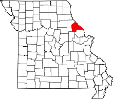 | |
| Villages | ||
| Townships |
| |
| CDPs | ||
| Unincorporated communities |
| |
| Ghost towns |
| |