Curryville, Missouri
| Curryville, Missouri | |
|---|---|
| City | |
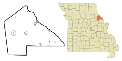 Location of Curryville, Missouri | |
| Coordinates: 39°20′41″N 91°20′33″W / 39.34472°N 91.34250°WCoordinates: 39°20′41″N 91°20′33″W / 39.34472°N 91.34250°W | |
| Country | United States |
| State | Missouri |
| County | Pike |
| Area[1] | |
| • Total | 0.27 sq mi (0.70 km2) |
| • Land | 0.27 sq mi (0.70 km2) |
| • Water | 0 sq mi (0 km2) |
| Elevation | 817 ft (249 m) |
| Population (2010)[2] | |
| • Total | 225 |
| • Estimate (2012[3]) | 225 |
| • Density | 833.3/sq mi (321.7/km2) |
| Time zone | Central (CST) (UTC-6) |
| • Summer (DST) | CDT (UTC-5) |
| ZIP code | 63339 |
| Area code(s) | 573 |
| FIPS code | 29-17902[4] |
| GNIS feature ID | 0716603[5] |
Curryville is a city in Pike County, Missouri, United States. The population was 225 at the 2010 census.
History
Curryville was laid out in 1867.[6] It was named for its founder, Perry Curry.[7]
Geography
Curryville is located at 39°20′41″N 91°20′33″W / 39.34472°N 91.34250°W (39.344683, -91.342506).[8]
According to the United States Census Bureau, the city has a total area of 0.27 square miles (0.70 km2), all of it land.[1]
Curryville was notorious for its strict enforcement of speed limits on US 54 which passes through it. It was well known as a blatant speed trap. Curryville has since changed its practices and is now within the limits of Missouri State Statutes.
Demographics
| Historical population | |||
|---|---|---|---|
| Census | Pop. | %± | |
| 1880 | 273 | — | |
| 1890 | 302 | 10.6% | |
| 1900 | 271 | −10.3% | |
| 1910 | 238 | −12.2% | |
| 1920 | 285 | 19.7% | |
| 1930 | 236 | −17.2% | |
| 1940 | 266 | 12.7% | |
| 1950 | 258 | −3.0% | |
| 1960 | 287 | 11.2% | |
| 1970 | 337 | 17.4% | |
| 1980 | 323 | −4.2% | |
| 1990 | 261 | −19.2% | |
| 2000 | 251 | −3.8% | |
| 2010 | 225 | −10.4% | |
| Est. 2015 | 226 | [9] | 0.4% |
2010 census
As of the census[2] of 2010, there were 225 people, 91 households, and 53 families residing in the city. The population density was 833.3 inhabitants per square mile (321.7/km2). There were 110 housing units at an average density of 407.4 per square mile (157.3/km2). The racial makeup of the city was 91.1% White, 1.8% African American, 1.8% Native American, 0.4% Asian, and 4.9% from two or more races. Hispanic or Latino of any race were 1.8% of the population.
There were 91 households of which 26.4% had children under the age of 18 living with them, 51.6% were married couples living together, 5.5% had a female householder with no husband present, 1.1% had a male householder with no wife present, and 41.8% were non-families. 36.3% of all households were made up of individuals and 11% had someone living alone who was 65 years of age or older. The average household size was 2.47 and the average family size was 3.28.
The median age in the city was 42.3 years. 24% of residents were under the age of 18; 5.9% were between the ages of 18 and 24; 24.5% were from 25 to 44; 32.9% were from 45 to 64; and 12.9% were 65 years of age or older. The gender makeup of the city was 50.2% male and 49.8% female.
2000 census
As of the census[4] of 2000, there were 251 people, 106 households, and 71 families residing in the city. The population density was 909.2 people per square mile (346.1/km²). There were 128 housing units at an average density of 463.7 per square mile (176.5/km²). The racial makeup of the city was 91.63% White, 3.98% African American, 0.40% Native American, 0.40% Asian, and 3.59% from two or more races.
There were 106 households out of which 32.1% had children under the age of 18 living with them, 49.1% were married couples living together, 17.0% had a female householder with no husband present, and 32.1% were non-families. 28.3% of all households were made up of individuals and 6.6% had someone living alone who was 65 years of age or older. The average household size was 2.37 and the average family size was 2.93.
In the city the population was spread out with 26.7% under the age of 18, 8.0% from 18 to 24, 25.1% from 25 to 44, 29.5% from 45 to 64, and 10.8% who were 65 years of age or older. The median age was 35 years. For every 100 females there were 91.6 males. For every 100 females age 18 and over, there were 85.9 males.
The median income for a household in the city was $27,500, and the median income for a family was $29,583. Males had a median income of $27,679 versus $16,250 for females. The per capita income for the city was $13,032. About 17.1% of families and 22.7% of the population were below the poverty line, including 20.8% of those under the age of eighteen and 25.0% of those sixty five or over.
References
- 1 2 "US Gazetteer files 2010". United States Census Bureau. Archived from the original on 2012-01-24. Retrieved 2012-07-08.
- 1 2 "American FactFinder". United States Census Bureau. Retrieved 2012-07-08.
- ↑ "Population Estimates". United States Census Bureau. Archived from the original on 2013-06-17. Retrieved 2013-05-30.
- 1 2 "American FactFinder". United States Census Bureau. Archived from the original on 2013-09-11. Retrieved 2008-01-31.
- ↑ "US Board on Geographic Names". United States Geological Survey. 2007-10-25. Retrieved 2008-01-31.
- ↑ Eaton, David Wolfe (1917). How Missouri Counties, Towns and Streams Were Named. The State Historical Society of Missouri. p. 342.
- ↑ Gannett, Henry (1905). The Origin of Certain Place Names in the United States. Govt. Print. Off. p. 97.
- ↑ "US Gazetteer files: 2010, 2000, and 1990". United States Census Bureau. 2011-02-12. Retrieved 2011-04-23.
- ↑ "Annual Estimates of the Resident Population for Incorporated Places: April 1, 2010 to July 1, 2015". Retrieved July 2, 2016.
- ↑ "Census of Population and Housing". Census.gov. Archived from the original on May 11, 2015. Retrieved June 4, 2015.
Municipalities and communities of Pike County, Missouri, United States | ||
|---|---|---|
| Cities | 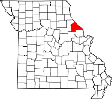 | |
| Villages | ||
| Townships |
| |
| CDPs | ||
| Unincorporated community | ||