Bowlus, Minnesota
| Bowlus, Minnesota | |
|---|---|
| City | |
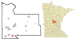 Location of Bowlus, Minnesota | |
| Coordinates: 45°49′N 94°24′W / 45.817°N 94.400°W | |
| Country | United States |
| State | Minnesota |
| County | Morrison |
| Area[1] | |
| • Total | 1.25 sq mi (3.24 km2) |
| • Land | 1.25 sq mi (3.24 km2) |
| • Water | 0 sq mi (0 km2) |
| Elevation | 1,109 ft (338 m) |
| Population (2010)[2] | |
| • Total | 290 |
| • Estimate (2012[3]) | 288 |
| • Density | 232.0/sq mi (89.6/km2) |
| Time zone | Central (CST) (UTC-6) |
| • Summer (DST) | CDT (UTC-5) |
| ZIP code | 56314 |
| Area code(s) | 320 |
| FIPS code | 27-07066[4] |
| GNIS feature ID | 0640404[5] |
Bowlus is a city in Morrison County, Minnesota, United States. The population was 290 at the 2010 census.[6]
History
Bowlus was platted in 1907.[7] A post office has been in operation at Bowlus since 1907.[8]
Geography
According to the United States Census Bureau, Bowlus has a total area of 1.25 square miles (3.24 km2), all of it land.[1]
Morrison County Roads 24 and 26; State Highway 238; and Main Street are four of the main routes in the community.
Bowlus has a fire department, a medical squad, two cafes, a bar, a church, and two gasoline stations.
Demographics
| Historical population | |||
|---|---|---|---|
| Census | Pop. | %± | |
| 1910 | 164 | — | |
| 1920 | 247 | 50.6% | |
| 1930 | 266 | 7.7% | |
| 1940 | 304 | 14.3% | |
| 1950 | 233 | −23.4% | |
| 1960 | 263 | 12.9% | |
| 1970 | 268 | 1.9% | |
| 1980 | 276 | 3.0% | |
| 1990 | 260 | −5.8% | |
| 2000 | 260 | 0.0% | |
| 2010 | 290 | 11.5% | |
| Est. 2015 | 283 | [9] | −2.4% |
2010 census
As of the census[2] of 2010, there were 290 people, 114 households, and 79 families residing in Bowlus. The population density was 232.0 inhabitants per square mile (89.6/km2). There were 122 housing units at an average density of 97.6 per square mile (37.7/km2). The racial makeup was 98.3% White, 0.3% African American, 0.3% Native American, and 1.0% from two or more races.
There were 114 households of which 33.3% had children under the age of 18 living with them, 52.6% were married couples living together, 10.5% had a female householder with no husband present, 6.1% had a male householder with no wife present, and 30.7% were non-families. 21.9% of all households were made up of individuals and 8.7% had someone living alone who was 65 years of age or older. The average household size was 2.54 and the average family size was 2.89.
The median age in Bowlus was 33 years. 24.1% of residents were under the age of 18; 9% were between the ages of 18 and 24; 29.3% were from 25 to 44; 22.1% were from 45 to 64; and 15.5% were 65 years of age or older. The sexual makeup was 55.2% male and 44.8% female.
2000 census
As of the census[4] of 2000, there were 260 people, 105 households, and 74 families residing in Bowlus. The population density was 208.2 people per square mile (80.3/km²). There were 111 housing units at an average density of 88.9 per square mile (34.3/km²). The racial makeup was 100.00% White.
There were 105 households out of which 29.5% had children under the age of 18 living with them, 60.0% were married couples living together, 4.8% had a female householder with no husband present, and 28.6% were non-families. 25.7% of all households were made up of individuals and 13.3% had someone living alone who was 65 years of age or older. The average household size was 2.48 and the average family size was 2.96.
The population was spread out with 25.0% under the age of 18, 10.0% from 18 to 24, 28.8% from 25 to 44, 21.2% from 45 to 64, and 15.0% who were 65 years of age or older. The median age was 35 years. For every 100 females there were 111.4 males. For every 100 females age 18 and over, there were 105.3 males.
The median income for a household in Bowlus was $32,222, and the median income for a family was $41,563. Males had a median income of $25,104 versus $24,063 for females. The per capita income was $13,868. About 6.2% of families and 10.3% of the population were below the poverty line, including none of those under the age of eighteen and 46.0% of those sixty five or over.
References
- 1 2 "US Gazetteer files 2010". United States Census Bureau. Archived from the original on 2012-01-24. Retrieved 2012-11-13.
- 1 2 "American FactFinder". United States Census Bureau. Retrieved 2012-11-13.
- ↑ "Population Estimates". United States Census Bureau. Archived from the original on 2013-06-17. Retrieved 2013-05-28.
- 1 2 "American FactFinder". United States Census Bureau. Archived from the original on 2013-09-11. Retrieved 2008-01-31.
- ↑ "US Board on Geographic Names". United States Geological Survey. 2007-10-25. Retrieved 2008-01-31.
- ↑ "2010 Census Redistricting Data (Public Law 94-171) Summary File". American FactFinder. U.S. Census Bureau, 2010 Census. Archived from the original on 21 July 2011. Retrieved 23 April 2011.
- ↑ Upham, Warren (1920). Minnesota Geographic Names: Their Origin and Historic Significance. Minnesota Historical Society. p. 351.
- ↑ "Morrison County". Jim Forte Postal History. Retrieved 21 July 2015.
- ↑ "Annual Estimates of the Resident Population for Incorporated Places: April 1, 2010 to July 1, 2015". Retrieved July 2, 2016.
- ↑ "Census of Population and Housing". Census.gov. Archived from the original on May 11, 2015. Retrieved June 4, 2015.
Municipalities and communities of Morrison County, Minnesota, United States | ||
|---|---|---|
| Cities | 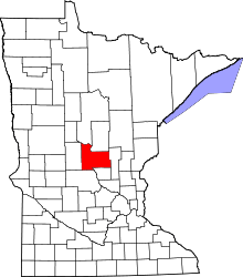 | |
| Townships | ||
| Unincorporated communities | ||
| Indian reservation | ||
| Footnotes | ‡This populated place also has portions in an adjacent county or counties | |
Coordinates: 45°49′N 94°24′W / 45.817°N 94.400°W