Genola, Minnesota
| Genola, Minnesota | |
|---|---|
| City | |
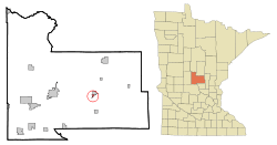 Location of Genola, Minnesota | |
| Coordinates: 45°57′40″N 94°6′51″W / 45.96111°N 94.11417°W | |
| Country | United States |
| State | Minnesota |
| County | Morrison |
| Area[1] | |
| • Total | 0.34 sq mi (0.88 km2) |
| • Land | 0.34 sq mi (0.88 km2) |
| • Water | 0 sq mi (0 km2) |
| Elevation | 1,161 ft (354 m) |
| Population (2010)[2] | |
| • Total | 75 |
| • Estimate (2012[3]) | 74 |
| • Density | 220.6/sq mi (85.2/km2) |
| Time zone | Central (CST) (UTC-6) |
| • Summer (DST) | CDT (UTC-5) |
| ZIP code | 56364 |
| Area code(s) | 320 |
| FIPS code | 27-23444[4] |
| GNIS feature ID | 0644071[5] |
Genola is a city in Morrison County, Minnesota, United States. The population was 75 at the 2010 census.[6]
History
Genola was platted in 1908 and was a station on the Soo Line Railroad, which originally went by the name of New Pierz. It had several other buildings, including but not limited to a post office, a saloon, and a bank. In 1915, the name was changed to Genola.[7] The present name is after Genola, in Italy.[8]
Geography
According to the United States Census Bureau, the city has a total area of 0.34 square miles (0.88 km2), all of it land.[1]
Minnesota State Highway 25 serves as a main route in the community.
The city of Pierz is adjacent to Genola.
Demographics
| Historical population | |||
|---|---|---|---|
| Census | Pop. | %± | |
| 1920 | 156 | — | |
| 1930 | 68 | −56.4% | |
| 1940 | 87 | 27.9% | |
| 1950 | 79 | −9.2% | |
| 1960 | 108 | 36.7% | |
| 1970 | 97 | −10.2% | |
| 1980 | 83 | −14.4% | |
| 1990 | 85 | 2.4% | |
| 2000 | 71 | −16.5% | |
| 2010 | 75 | 5.6% | |
| Est. 2015 | 73 | [9] | −2.7% |
2010 census
As of the census[2] of 2010, there were 75 people, 32 households, and 17 families residing in the city. The population density was 220.6 inhabitants per square mile (85.2/km2). There were 35 housing units at an average density of 102.9 per square mile (39.7/km2). The racial makeup of the city was 100.0% White.
There were 32 households of which 28.1% had children under the age of 18 living with them, 37.5% were married couples living together, 12.5% had a female householder with no husband present, 3.1% had a male householder with no wife present, and 46.9% were non-families. 40.6% of all households were made up of individuals and 25% had someone living alone who was 65 years of age or older. The average household size was 2.34 and the average family size was 3.29.
The median age in the city was 39.3 years. 28% of residents were under the age of 18; 8% were between the ages of 18 and 24; 20% were from 25 to 44; 24.1% were from 45 to 64; and 20% were 65 years of age or older. The gender makeup of the city was 46.7% male and 53.3% female.
2000 census
As of the census[4] of 2000, there were 71 people, 27 households, and 20 families residing in the city. The population density was 223.2 people per square mile (85.7/km²). There were 27 housing units at an average density of 84.9 per square mile (32.6/km²). The racial makeup of the city was 100.00% White.
There were 27 households out of which 37.0% had children under the age of 18 living with them, 55.6% were married couples living together, 3.7% had a female householder with no husband present, and 25.9% were non-families. 22.2% of all households were made up of individuals and 7.4% had someone living alone who was 65 years of age or older. The average household size was 2.63 and the average family size was 3.00.
In the city the population was spread out with 31.0% under the age of 18, 9.9% from 18 to 24, 28.2% from 25 to 44, 8.5% from 45 to 64, and 22.5% who were 65 years of age or older. The median age was 35 years. For every 100 females there were 91.9 males. For every 100 females age 18 and over, there were 96.0 males.
The median income for a household in the city was $33,750, and the median income for a family was $36,250. Males had a median income of $51,250 versus $17,500 for females. The per capita income for the city was $15,796. There were no families and 2.9% of the population living below the poverty line, including no under eighteens and none of those over 64.
References
- 1 2 "US Gazetteer files 2010". United States Census Bureau. Retrieved 2012-11-13.
- 1 2 "American FactFinder". United States Census Bureau. Retrieved 2012-11-13.
- ↑ "Population Estimates". United States Census Bureau. Retrieved 2013-05-28.
- 1 2 "American FactFinder". United States Census Bureau. Retrieved 2008-01-31.
- ↑ "US Board on Geographic Names". United States Geological Survey. 2007-10-25. Retrieved 2008-01-31.
- ↑ "2010 Census Redistricting Data (Public Law 94-171) Summary File". American FactFinder. U.S. Census Bureau, 2010 Census. Retrieved 23 April 2011.
- ↑ Fuller, Clara K. (1915). History of Morrison and Todd counties, Minnesota: their people, industries and institutions. B. F. Bowen & company, inc. pp. 162–163.
- ↑ Upham, Warren (1920). Minnesota Geographic Names: Their Origin and Historic Significance. Minnesota Historical Society. p. 352.
- ↑ "Annual Estimates of the Resident Population for Incorporated Places: April 1, 2010 to July 1, 2015". Retrieved July 2, 2016.
- ↑ "Census of Population and Housing". Census.gov. Retrieved June 4, 2015.
Municipalities and communities of Morrison County, Minnesota, United States | ||
|---|---|---|
| Cities | 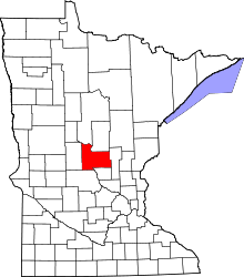 | |
| Townships | ||
| Unincorporated communities | ||
| Indian reservation | ||
| Footnotes | ‡This populated place also has portions in an adjacent county or counties | |
Coordinates: 45°57′37″N 94°06′59″W / 45.96028°N 94.11639°W