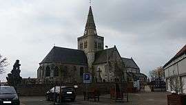
Cappelle-Brouck
| Cappelle-Brouck Kapellebroek | ||
|---|---|---|
 | ||
| ||
 Cappelle-Brouck | ||
|
Location within Hauts-de-France region  Cappelle-Brouck | ||
| Coordinates: 50°54′09″N 2°13′24″E / 50.9025°N 2.2233°ECoordinates: 50°54′09″N 2°13′24″E / 50.9025°N 2.2233°E | ||
| Country | France | |
| Region | Hauts-de-France | |
| Department | Nord | |
| Arrondissement | Dunkerque | |
| Canton | Bourbourg | |
| Intercommunality | la Colme | |
| Government | ||
| • Mayor (2008–2014) | Michel Decool | |
| Area1 | 17.55 km2 (6.78 sq mi) | |
| Population (2004)2 | 1,122 | |
| • Density | 64/km2 (170/sq mi) | |
| Time zone | CET (UTC+1) | |
| • Summer (DST) | CEST (UTC+2) | |
| INSEE/Postal code | 59130 / 59630 | |
| Elevation |
0–4 m (0–13 ft) (avg. 2 m or 6.6 ft) | |
|
1 French Land Register data, which excludes lakes, ponds, glaciers > 1 km² (0.386 sq mi or 247 acres) and river estuaries. 2 Population without double counting: residents of multiple communes (e.g., students and military personnel) only counted once. | ||
Cappelle-Brouck (from Dutch meaning "chapel marsh"; Kapellebroek in modern Dutch spelling) is a commune in the Nord department in northern France.
Heraldry
_Nord-France.svg.png) |
The arms of Cappelle-Brouck are blazoned : Gules, 2 keys addorsed in saltire argent. |
See also
References
| Wikimedia Commons has media related to Cappelle-Brouck. |
This article is issued from Wikipedia - version of the 10/29/2016. The text is available under the Creative Commons Attribution/Share Alike but additional terms may apply for the media files.