Cousolre
| Cousolre | ||
|---|---|---|
 | ||
| ||
 Cousolre | ||
|
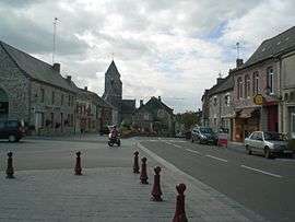
Location within Hauts-de-France region  Cousolre | ||
| Coordinates: 50°14′47″N 4°09′00″E / 50.2464°N 4.15°ECoordinates: 50°14′47″N 4°09′00″E / 50.2464°N 4.15°E | ||
| Country | France | |
| Region | Hauts-de-France | |
| Department | Nord | |
| Arrondissement | Avesnes-sur-Helpe | |
| Canton | Solre-le-Château | |
| Intercommunality | Nord-Est Avesnois | |
| Government | ||
| • Mayor (2008–2014) | Maurice Boisart | |
| Area1 | 20.98 km2 (8.10 sq mi) | |
| Population (1999)2 | 2,362 | |
| • Density | 110/km2 (290/sq mi) | |
| Time zone | CET (UTC+1) | |
| • Summer (DST) | CEST (UTC+2) | |
| INSEE/Postal code | 59157 / 59149 | |
| Elevation |
143–229 m (469–751 ft) (avg. 67 m or 220 ft) | |
|
1 French Land Register data, which excludes lakes, ponds, glaciers > 1 km² (0.386 sq mi or 247 acres) and river estuaries. 2 Population without double counting: residents of multiple communes (e.g., students and military personnel) only counted once. | ||
Cousolre is a commune in the Nord department in northern France.
The nearest major city is Charleroi in Belgium (the village is very close to the Belgian border). It is about 25 km (16 mi) southwest of Charleroi and 15 km (9.3 mi) east of Maubeuge.
Heraldry
.svg.png) |
The arms of Cousolre are blazoned : Or, 3 chevrons sable. (Bersillies, Boeschepe, Boussières-sur-Sambre, Colleret, Cousolre, Flaumont-Waudrechies, Hautmont, Limont-Fontaine, Lompret, Masny, Neuville-en-Avesnois and Saint-Rémy-du-Nord use the same arms.) |
See also
References
| Wikimedia Commons has media related to Cousolre. |
This article is issued from Wikipedia - version of the 11/14/2016. The text is available under the Creative Commons Attribution/Share Alike but additional terms may apply for the media files.