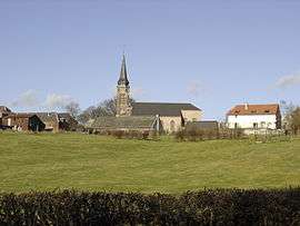
Le Favril, Nord
| Le Favril | ||
|---|---|---|
 | ||
| ||
 Le Favril | ||
|
Location within Hauts-de-France region  Le Favril | ||
| Coordinates: 50°06′13″N 3°43′22″E / 50.1036°N 3.7228°ECoordinates: 50°06′13″N 3°43′22″E / 50.1036°N 3.7228°E | ||
| Country | France | |
| Region | Hauts-de-France | |
| Department | Nord | |
| Arrondissement | Avesnes-sur-Helpe | |
| Canton | Landrecies | |
| Intercommunality | Pays de Mormal et Maroilles | |
| Government | ||
| • Mayor (2008–2014) | Daniel Laurent | |
| Area1 | 11.49 km2 (4.44 sq mi) | |
| Population (1999)2 | 403 | |
| • Density | 35/km2 (91/sq mi) | |
| Time zone | CET (UTC+1) | |
| • Summer (DST) | CEST (UTC+2) | |
| INSEE/Postal code | 59223 / 59550 | |
| Elevation |
138–191 m (453–627 ft) (avg. 166 m or 545 ft) | |
|
1 French Land Register data, which excludes lakes, ponds, glaciers > 1 km² (0.386 sq mi or 247 acres) and river estuaries. 2 Population without double counting: residents of multiple communes (e.g., students and military personnel) only counted once. | ||
Le Favril is a commune in the Nord department in northern France.
Heraldry
.svg.png) |
The arms of Le Favril are blazoned : Gules, 3 pales vair, and a chief Or. (Beugnies and Le Favril use the same arms.) |
See also
References
| Wikimedia Commons has media related to Le Favril (Nord). |
This article is issued from Wikipedia - version of the 11/16/2016. The text is available under the Creative Commons Attribution/Share Alike but additional terms may apply for the media files.