Castle Rock Township, Dakota County, Minnesota
| Castle Rock Township, Minnesota | |
|---|---|
| Township | |
 Castle Rock Township, Minnesota Location within the state of Minnesota | |
| Coordinates: 44°34′48″N 93°6′21″W / 44.58000°N 93.10583°WCoordinates: 44°34′48″N 93°6′21″W / 44.58000°N 93.10583°W | |
| Country | United States |
| State | Minnesota |
| County | Dakota |
| Area | |
| • Total | 35.8 sq mi (92.6 km2) |
| • Land | 35.8 sq mi (92.6 km2) |
| • Water | 0.0 sq mi (0.0 km2) |
| Elevation | 928 ft (283 m) |
| Population (2000) | |
| • Total | 1,495 |
| • Density | 41.8/sq mi (16.1/km2) |
| Time zone | Central (CST) (UTC-6) |
| • Summer (DST) | CDT (UTC-5) |
| ZIP code | 55010 |
| Area code(s) | 952 |
| FIPS code | 27-10306[1] |
| GNIS feature ID | 0663763[2] |
| Website | www.CastleRockTownship.com |
Castle Rock Township is a township in Dakota County, Minnesota, United States. The population was 1,495 at the 2000 census.
Castle Rock Township was organized in 1858, and named for a nearby rock formation.[3]
Geography
According to the United States Census Bureau, the township has a total area of 35.8 square miles (93 km2), all of it land.
Education
The township is served by the following districts and schools:
- Farmington School District
- Randolph School District
- Northfield School District
- Prairie Creek Community School
Demographics
As of the census[1] of 2000, there were 1,495 people, 514 households, and 415 families residing in the township. The population density was 41.8 people per square mile (16.1/km²). There were 518 housing units at an average density of 14.5/sq mi (5.6/km²). The racial makeup of the township was 98.19% White, 0.20% African American, 0.27% Asian, 0.40% from other races, and 0.94% from two or more races. Hispanic or Latino of any race were 0.54% of the population.
There were 514 households out of which 40.7% had children under the age of 18 living with them, 72.0% were married couples living together, 5.6% had a female householder with no husband present, and 19.1% were non-families. 14.2% of all households were made up of individuals and 4.7% had someone living alone who was 65 years of age or older. The average household size was 2.90 and the average family size was 3.22.
In the township the population was spread out with 27.4% under the age of 18, 8.0% from 18 to 24, 28.3% from 25 to 44, 28.4% from 45 to 64, and 8.0% who were 65 years of age or older. The median age was 38 years. For every 100 females there were 108.5 males. For every 100 females age 18 and over, there were 103.8 males.
The median income for a household in the township was $59,479, and the median income for a family was $64,000. Males had a median income of $42,500 versus $28,000 for females. The per capita income for the township was $23,334. About 4.5% of families and 5.3% of the population were below the poverty line, including 6.6% of those under age 18 and 5.8% of those age 65 or over.
References
- 1 2 "American FactFinder". United States Census Bureau. Archived from the original on 2013-09-11. Retrieved 2008-01-31.
- ↑ "US Board on Geographic Names". United States Geological Survey. 2007-10-25. Retrieved 2008-01-31.
- ↑ Upham, Warren (1920). Minnesota Geographic Names: Their Origin and Historic Significance. Minnesota Historical Society. p. 164.
External links
Municipalities and communities of Dakota County, Minnesota, United States | ||
|---|---|---|
| Cities | 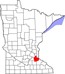 | |
| Townships | ||
| Unincorporated communities | ||
| Ghost towns | ||
| Indian reservation | ||
| Footnotes | ‡This populated place also has portions in an adjacent county or counties | |