Coates, Minnesota
| Coates, Minnesota | |
|---|---|
| City | |
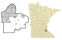 Location of the city of Coates within Dakota County, Minnesota | |
| Coordinates: 44°42′54″N 93°2′6″W / 44.71500°N 93.03500°W | |
| Country | United States |
| State | Minnesota |
| County | Dakota |
| Village | 1953 |
| Government | |
| • Type | City |
| • Mayor | Craig Franzmeier |
| • Clerk and Treasurer | Sherri Leflay |
| Area[1] | |
| • Total | 1.41 sq mi (3.65 km2) |
| • Land | 1.41 sq mi (3.65 km2) |
| • Water | 0 sq mi (0 km2) |
| Elevation | 912 ft (278 m) |
| Population (2010)[2] | |
| • Total | 161 |
| • Estimate (2012[3]) | 162 |
| • Density | 114.2/sq mi (44.1/km2) |
| Time zone | Central (CST) (UTC-6) |
| • Summer (DST) | CDT (UTC-5) |
| Area code(s) | 651 |
| FIPS code | 27-12376[4] |
| GNIS feature ID | 0641366[5] |
| Website | Official website |
Coates is a city in the U.S. state of Minnesota located west of the Upper Mississippi River on the exurban fringe in central Dakota County.
U.S. Highway 52 connects north to the city of Saint Paul, while County Road 46 draws east–west to nearby suburban cities. The population was 161 at the 2010 census.[6] It is named for Civil War Captain Henry C. Coates who served in the 1st Minnesota Volunteer Infantry.
Major employers are in trucking, moving and recycling services. The city is popular with Twin Citians for the House of Coates, a burger joint since 1962. St. Agatha's Catholic Church serves as city hall.
Originally a rural post office hub in the 1900s, the U.S. Postal Service now designates addresses as part of nearby larger Rosemount. The city of Coates incorporated in 1953 at the northwest corner of Vermillion Township, and was named for early settler G. A. Coates.[7]
Geography
According to the United States Census Bureau, the city has a total area of 1.41 square miles (3.65 km2), all of it land.[1]
Demographics
| Historical population | |||
|---|---|---|---|
| Census | Pop. | %± | |
| 1960 | 202 | — | |
| 1970 | 212 | 5.0% | |
| 1980 | 207 | −2.4% | |
| 1990 | 186 | −10.1% | |
| 2000 | 163 | −12.4% | |
| 2010 | 161 | −1.2% | |
| Est. 2015 | 163 | [8] | 1.2% |
Coordinates: 44°43′02″N 93°02′05″W / 44.71722°N 93.03472°W
2010 census
As of the census[2] of 2010, there were 161 people, 66 households, and 41 families residing in the city. The population density was 114.2 inhabitants per square mile (44.1/km2). There were 71 housing units at an average density of 50.4 per square mile (19.5/km2). The racial makeup of the city was 96.3% White, 2.5% Asian, and 1.2% from two or more races. Hispanic or Latino of any race were 2.5% of the population.
There were 66 households of which 30.3% had children under the age of 18 living with them, 47.0% were married couples living together, 10.6% had a female householder with no husband present, 4.5% had a male householder with no wife present, and 37.9% were non-families. 28.8% of all households were made up of individuals and 1.5% had someone living alone who was 65 years of age or older. The average household size was 2.44 and the average family size was 2.95.
The median age in the city was 36.2 years. 23% of residents were under the age of 18; 9.4% were between the ages of 18 and 24; 29.3% were from 25 to 44; 28.6% were from 45 to 64; and 9.9% were 65 years of age or older. The gender makeup of the city was 56.5% male and 43.5% female.
2000 census
As of the census[4] of 2000, there were 163 people, 64 households, and 36 families residing in the city. The population density was 116.9 people per square mile (45.3/km²). There were 66 housing units at an average density of 47.3 per square mile (18.3/km²). The racial makeup of the city was 94.48% White, 0.61% Native American, 4.29% Asian, and 0.61% from two or more races.
There were 64 households out of which 29.7% had children under the age of 18 living with them, 45.3% were married couples living together, 9.4% had a female householder with no husband present, and 42.2% were non-families. 29.7% of all households were made up of individuals and 7.8% had someone living alone who was 65 years of age or older. The average household size was 2.55 and the average family size was 3.38.
In the city the population was spread out with 26.4% under the age of 18, 13.5% from 18 to 24, 30.7% from 25 to 44, 23.3% from 45 to 64, and 6.1% who were 65 years of age or older. The median age was 33 years. For every 100 females there were 123.3 males. For every 100 females age 18 and over, there were 126.4 males.
The median income for a household in the city was $48,958, and the median income for a family was $57,500. Males had a median income of $30,000 versus $27,083 for females. The per capita income for the city was $20,348. About 5.3% of families and 7.9% of the population were below the poverty line, including none of those under the age of eighteen or sixty five or over.
References
- 1 2 "US Gazetteer files 2010". United States Census Bureau. Archived from the original on 2012-06-26. Retrieved 2012-11-13.
- 1 2 "American FactFinder". United States Census Bureau. Retrieved 2012-11-13.
- ↑ "Population Estimates". United States Census Bureau. Archived from the original on 2013-06-17. Retrieved 2013-05-28.
- 1 2 "American FactFinder". United States Census Bureau. Archived from the original on 2013-09-11. Retrieved 2008-01-31.
- ↑ "US Board on Geographic Names". United States Geological Survey. 2007-10-25. Retrieved 2008-01-31.
- ↑ "2010 Census Redistricting Data (Public Law 94-171) Summary File". American FactFinder. United States Census Bureau. Archived from the original on 21 July 2011. Retrieved 27 April 2011.
- ↑ Warren Upham (2001). Minnesota place names: a geographical encyclopedia. Minnesota Historical Society Press.
- ↑ "Annual Estimates of the Resident Population for Incorporated Places: April 1, 2010 to July 1, 2015". Retrieved July 2, 2016.
- ↑ "Census of Population and Housing". Census.gov. Archived from the original on May 11, 2015. Retrieved June 4, 2015.
Municipalities and communities of Dakota County, Minnesota, United States | ||
|---|---|---|
| Cities | 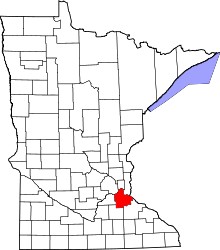 | |
| Townships | ||
| Unincorporated communities | ||
| Ghost towns | ||
| Indian reservation | ||
| Footnotes | ‡This populated place also has portions in an adjacent county or counties | |